Brúarfoss
| Brúarfoss | ||
|---|---|---|
|
The Brúarfoss |
||
| Coordinates | 64 ° 15 '52.2 " N , 20 ° 30' 59.4" W | |
|
|
||
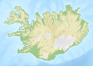
| place | Southurland , Iceland | |
| height | 5 m | |
| Number of fall levels | 2 | |
| flow | Brúará → Hvítá | |
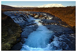
The Brúarfoss ( Eng . "Bridge Waterfall") is a waterfall in the south of Iceland .
The Brúará falls here in two stages by a total of 5 m. Below the waterfall there is a footbridge over the river. It is located about 3 km north of Laugarvatnsvegurs ![]() . Between the Brúarfoss and the road there are still the Miðfoss and the Hlauptungufoss.
. Between the Brúarfoss and the road there are still the Miðfoss and the Hlauptungufoss.
legend
Near the Brúarfoss, around 3 km north of today's bridge, there is said to have been a natural stone arch over the river that gave it its name. In 1602, according to a legend, on the orders of the Skálholt estate manager, the arch was destroyed to cut off the path to the village for beggars. A little later, the land manager is said to have drowned himself in the Brúará.
See also
Individual evidence
- ↑ Bruarfoss (Laugarvatn). Retrieved March 12, 2019 .
- ↑ Jens Willhardt, Christine Sadler: Iceland. 3rd updated and revised edition. Michael Müller, Erlangen 2003, ISBN 3-89953-115-9 , pp. 287f.

