
Southurland
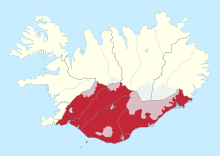
Suðurland ( dt. Südland ) is one of the eight regions of Iceland . It is located in the south of the country. Its administrative center is Selfoss in the municipality of Árborg . On December 1, 2008, 24,176 inhabitants lived in an area of 24,690 km² (population density: 0.979 inhabitants / km²).
Division into districts and municipalities
Suðurland is divided into three districts and two independent municipalities.
| Code no. | Independent municipality | Residents (January 1, 2019) |
Area [km²] |
Administrative headquarters |
|---|---|---|---|---|
| 8000 | Vestmannaeyjabær | 4301 | 17th | Vestmannaeyjar |
| 8200 | Sveitarfélagið Árborg | 9486 | 158 | Selfoss |
| Code no. | circle | Residents (January 1, 2019) |
Area [km²] |
Administrative headquarters |
| 8500 | Vestur-Skaftafellssýsla | 954 | 7,701 | Vík í Mýrdal |
| 8600 | Rangárvallasýsla | 3,459 | 7,971 | Hvolsvöllur |
| 8700 | Árnessýsla | 7,460 | 8,287 | Selfoss |
Division into parishes
Suðurland is divided into 14 municipalities (as of January 1, 2019).
| According to no. | local community | Residents (January 1, 2019) |
Area [km²] |
bigger places | |
|---|---|---|---|---|---|
| District-free municipalities | |||||
| 8000 | Vestmannaeyjabær | 4301 | 17th | Heimaey | |
| 8200 | Sveitarfélagið Árborg | 9486 | 158 | Selfoss, Eyrarbakki, Stokkseyri | |
| Vestur-Skaftafellssýsla | |||||
| 8508 | Mýrdalshreppur | 695 | 755 | Vík í Mýrdal | |
| 8509 | Skaftárhreppur | 583 | 6,946 | Kirkjubæjarklaustur | |
| Rangárvallasýsla | |||||
| 8610 | Ásahreppur | 248 | 2,942 | ||
| 8613 | Rangárþing eystra | 1924 | 1,841 | Hvolsvöllur , Skógar | |
| 8614 | Rangárþing ytra | 1636 | 3,188 | Hella | |
| Árnessýsla | |||||
| 8710 | Hrunamannahreppur | 786 | 1,205 | ||
| 8716 | Hveragerðisbær | 2628 | 8th | Hveragerdi | |
| 8717 | Sveitarfélagið Ölfus | 2153 | 738 | Þorlákshöfn | |
| 8719 | Grímsnes- og Grafningshreppur | 493 | 900 | ||
| 8720 | Skeiða- og Gnupverjahreppur | 626 | 2,402 | ||
| 8721 | Bláskógabyggð | 1121 | 3,300 | Laugarvatn, Skálholt | |
| 8722 | Flóahreppur | 667 | 290 | ||
Web links
Commons : Suðurland - Collection of images, videos and audio files
- www.sudurland.is (Icelandic)
Regions in Iceland
Coordinates: 64 ° 6 ′ N , 19 ° 24 ′ W