Croker Island (Northern Territory)
| Croker Island | ||
|---|---|---|
|
Satellite image of Croker Island with the Cobourg Peninsula |
||
| Waters | Arafura lake | |
| Geographical location | 11 ° 8 ′ S , 132 ° 33 ′ E | |
|
|
||
| length | 43 km | |
| width | 15 km | |
| surface | 331.5 km² | |
| Highest elevation | 15 m | |
| Residents | 300 <1 inh / km² |
|
| main place | Minjilang | |
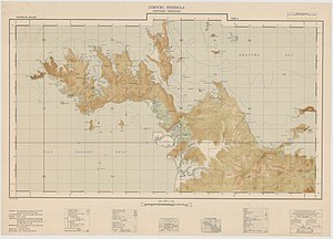
| Topographic map sheet of the Cobourg Peninsula , with CROKER ISLAND in the north. The island's capital, Minjilang, is marked there with the word MISSION BUILDINGS . | ||
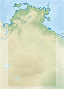
Croker Island is an island in the Arafura Sea off the coast of the Northern Territory in Australia , 200 km northeast of Darwin . It is separated from the Cobourg Peninsula to the west by Bowen Strait , which at its narrowest point is 2.5 km wide and 8.5 km long. In the north and east lies the Arafurasee, in the south and southeast lies Mountnorris Bay . Croker Island measures 43 km from Point David (in the south, also Inngirnatj ) to Cape Croker (in the north), up to 15 km wide, with a land area of 331.5 km². The highest point on the island is only 15 m above sea level. The only significant settlement on Croker Island is the Aboriginal community of Minjilang , located on Mission Bay on the east coast.


