
Northern Territory
| flag | coat of arms |
|---|---|

|

|
| ( Details ) | ( Details ) |
| Basic data | |
| Capital : | Darwin |
| Area : | 1,349,130 km² |
| Residents : | 246,700 (Dec 2017) |
| Population density : | 0.18 inhabitants per km² |
| ISO 3166-2 : | AU-NT |
| The highest point: | Mount Zeil 1,531 m |
| Official Website: | www.nt.gov.au |
| politics | |
| Administrator : | John Hardy |
| Chief Minister : | Michael Gunner |
| Parliament seats: | 2 ( House of Representatives ) 2 ( Senate ) |
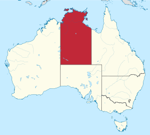
| map | |
  |
|
The Northern Territory [ 'nɔːðən ˈtɛɹɪtɹɪ ] (abbreviation NT , German Northern Territory ) is an Australian federal territory , i. H. an administrative unit which, in contrast to the member states such as Western Australia or South Australia, has no statehood. However, the territory has been granted a large degree of self-government by federal law, whereby its status has in fact been brought into line with that of the member states; however, any law in the territory can be repealed by the federal parliament, as has happened with a law ( Rights of the Terminally Ill Act ) that allowed active euthanasia . The territory is extremely sparsely populated with around 243,800 inhabitants. The population is very multicultural; a non-English mother tongue is spoken in 24.1% of households.
Almost 80% of the territory's population live in the three largest cities of Darwin , Palmerston and Alice Springs .
geography
The Northern Territory is bordered to the west by Western Australia (along 129 degrees east), to the south by South Australia (26 degrees south) and to the east by Queensland (138 degrees east). In the north it is bordered by the Timor Sea , the Arafura Sea and the Gulf of Carpentaria .
The coast of the mainland is approx. 5500 kilometers long and is strongly divided by bays and river mouths; swamp areas alternate with sandy beaches, and there are occasional steep sections. The Northern Territory includes some islands, including Groote Eylandt , Melville Island , Bathurst Island and the Wessel Islands . This doubles the length of the entire coastline to almost 11,000 kilometers.
The coastal area is followed by an extensive flatland, which is characterized by plateaus (e.g. Arnhem Land ) and tabular lands (e.g. Barkly Tableland ). It is only in the south that island mountains characterize the landscape, which predominantly run in an east-west direction. In the MacDonnell Ranges there is also Mount Zeil , at 1,531 meters the highest point in the Northern Territory. Large parts of the south are covered by dunes (e.g. Simpson Desert ).
The total area is 1,349,130 km², which is roughly four times the area of Germany. In addition to Darwin (120,000 inhabitants), Palmerston (28,030), Alice Springs (27,481), Litchfield (18,277), Katherine (9912), Tennant Creek (5634) and Nhulunbuy (3719) are among the larger cities.
The Northern Territory is divided into 17 Local Government Areas , see Local Government Areas in the Northern Territory .
climate
In the interior there is an arid desert climate, the coastal region in the north, however, is from the hot and humid monsoon and severe tropical cyclones ( cyclones ) determined.
The maximum temperatures in the tropical north of the country can reach around 34 ° C from November to April. This is also the time when the humidity is highest and heavy monsoon rains can sometimes be expected, so that unpaved roads to tourist destinations are temporarily impassable. In the remaining months the temperatures drop a little and the humidity is also lower.
Central Australia has a dry climate, with maximum temperatures in the Australian summer months of up to 58 ° C, which can drop to 20 ° C in the remaining months, especially in June and July. In the nights between April and September the temperatures can cool down to a few degrees Celsius.
history


Aborigines have lived in the Northern Territory for around 40,000 years , both in the tropical areas of the north and in the arid areas of the center. Coastal people had been involved in extensive, seasonal trade with people of Indonesia for at least five centuries .
After first sightings by Europeans in the 17th century, the British tried in the 19th century to establish a settlement on the north coast.
On his first expedition from 1844 to 1845, Ludwig Leichhardt made the first crossing from Queensland to Port Essington in the Northern Territory. John McDouall Stuart was the first to reach the coast of the Northern Territory - more precisely Adam Bay at the mouth of the Adelaide River on the Van Diemen Gulf - by land from Adelaide . A distance of around 2000 miles.
Under South Australian administration from 1863 to 1911
At that time the governments of Queensland and South Australia tried to get the territory of New South Wales transferred. Queensland refrained from this request. In 1863 it was finally transferred to South Australia subject to revocation at any time. At the instigation of McDouall Stuart, the area south of the 16th parallel to the 26th parallel, i. H. the border with South Australia, in homage to the rare grace blessed Princess of Wales and later Queen of England and Empress of India, Alexandra , Alexandra Land . It covered an area of around one million square kilometers. This term was occasionally used for the entire northern territory, but was forgotten after the transfer of the northern territory to the Australian federal government in 1911.
In 1864, the government of South Australia commissioned former Prime Minister Boyle Finniss to research the area around the mouth of the Adelaide River for a possible settlement. He had a settlement built in Escape Cliffs and explored the area around what is now Darwin with Frederick Henry Litchfield . On January 5, 1869, Palmerston was founded on the site of Darwin with 135 settlers , named after the British Prime Minister Lord Palmerston . The area was part of colonial New South Wales from 1825 to 1863 , with a brief interruption as part of the briefly existing colony of North Australia between February and December 1846. From 1863 it belonged to South Australia, under whose administration the overland telegraph line was established (1870 to 1872).
In 1883, the government under Prime Minister John Cox Bray requested the full and permanent surrender of the northern territory to South Australia, but this was refused because the possibility of the territory to be declared a separate colony was reserved.
Between 1883 and 1889 a railway line was also built between Darwin and Pine Creek . Cattle breeding developed into an important industry, so that around 1911 the area of what is now the Northern Territory was not only home to 513,000 cattle, but also the Victoria River Downs, which was then the largest cattle farm in the world. In addition, mining began in the 1870s, as gold was found at Grove Hill (1872), Pine Creek, Brocks Creek and Burrundi, and copper was also found at Daly River .
South Australia had high hopes for the economic development of the area and dreamed of planting sugar cane, tobacco, cotton and even coffee. Barren soils, little water and inexorable sunshine let none of this come of anything. By 1879 only a thousand Europeans had settled in Alexandra Land, and they did not even contribute to the tax revenue of South Australia.
Overall, the Northern Territory remained a grant deal for South Australia. Shortly after the Australian colonies had united to form the Commonwealth of Australia in 1901, the government of the now federal state of South Australia asked to hand over the entire northern territory to the Australian Federation. In 1911, the federal government finally took over administration of the territory.
At the beginning of 1903, the Northern Territory was estimated to have 3884 inhabitants. Of these, only 880 were Europeans, two thousand were Chinese and hundreds were Japanese and Malays. The natives were not counted then. In 1902 the territory had a migration loss of almost 200 people. Even if the lack of cheap labor was seen as one of the main reasons for the lack of economic development in the territory, a mass influx of Asiatics was rejected.
On January 1, 1911, the Australian Confederation took over administration of the territory. In that year, the territory had 3,271 inhabitants, 2,673 men and 598 women, not counting natives. Since 1890, the territory sent two MPs to the South Australian Parliament. A representation in the Australian parliament was not initially planned.
Federal territory from 1911
Towards the end of 1912, the thought grew that the name "Northern Territory" was not satisfactory. The names "Centralia", "Territoria" and - analogous to Queensland - "Kingsland" (after George V ) were proposed, the last of which enjoyed the greatest support. The renaming efforts petered out, however.
In 1922 the territory was granted a seat for the federal parliament for the first time by the "Northern Territory Representation Act 1922"; from 2001 a further seat was granted. Since 1975, the territory has had two Senate representatives who also represent the Australian territories in the Indian Ocean, Christmas Island and the Cocos (Keeling) Islands .
For a brief period from 1927 to 1931, the Northern Territory was divided into North Australia and Central Australia along the 20th parallel south .
During the time of the Holocaust , parts of the NT were considered in the Kimberley Plan as a possible Jewish homeland to save Jews from Europe and to colonize northern Australia in the process, which was not pursued further. During World War II , most of the top end was under military rule due to a feared Japanese invasion. When the war ended, control was returned to the Commonwealth. This was the only time an Australian state or territory has been under military control.
The Aborigines had previously suffered from poor wages and lack of land rights. In February 1973, the Aboriginal Land Rights Commission was set up, a royal commission that examined land rights in the Northern Territory from 1973 to 1974. She proposed the establishment of a Central Land Council and a Northern Land Council , which should represent the views of the Aborigines. The government under Gough Whitlam drafted an implementation law in 1975, which was passed by the government under Malcolm Fraser as the Aboriginal Land Rights (Northern Territory) Act 1976 . This law laid the foundation for Aboriginal people to be able to claim land rights based on their traditional habitation for the first time. It came into force on the following Australia Day , January 26, 1977.
Responsible government was granted to the Territory in 1978 , with a legislative assembly under the leadership of a Chief Minister . The Northern Territory Administrator is the indirect representative of the Queen, the formal head of state of Australia, in the Northern Territory.
Through the Rights of the Terminally Ill Act of 1995, the Northern Territory was briefly one of the few places in the world where euthanasia was legal. However, the corresponding law was repealed in 1997 by a federal law, which means that it is de jure still in force, but de facto ineffective, as it may not be applied.
In 1998 a referendum was held on the future status of the Northern Territory. The conversion to a federal state was rejected with a narrow majority of 51.3 percent and the status as a territory was initially retained. In July 2015, however, the Council of Australian Governments (an assembly of representatives of the federal government, the governments of the states and the mainland territories and the municipalities) passed a unanimous resolution , according to which the Northern Territory was to become the seventh state in Australia on July 1, 2018.
The history of the tropical areas of the Northern Territory and especially that of the capital Darwin is also determined by the frequent cyclones . Particularly violent storms occurred in 1897, 1937 and 1974 ( Cyclone Tracy ).
population

Only 245,854 of Australia's nearly 25.2 million inhabitants lived in the Northern Territory in December 2018, which corresponds to approximately one percent of the country's population. Most of the residents are concentrated in the capital Darwin, its satellite town Palmerston and Alice Springs inland, which is known as the “center of the outback”. The rest of the population is spread over townships throughout the territory, particularly along the Stuart Highway, which crosses the territory in a north-south direction, as well as some extensive farms.
The Northern Territory has the largest Aboriginal share in Australia with 29 percent (average: 2.4 percent). The largest tribes are the Pitjantjatjara near Uluru , the Arrernte around Alice Springs, the Luritja between these two, the Warlpiri further north and the Yolngu in eastern Arnhem Land .


|
Statistical Division / District |
Population at the end of 2018 |
|---|---|
| Greater Darwin | 148,564 |
| - Darwin city | 28,420 |
| - Darwin suburbs | 57,083 |
| - Palmerston | 37,841 |
| - Litchfield | 25,220 |
| Katherine | 20,839 |
| Barkly | 6.115 |
| Alice Springs | 39,388 |
| East Arnhem | 14,519 |
| Daly-Tiwi-West Arnhem | 17,902 |
economy

Economic activity in the Northern Territory is limited not only by the arid climate , but also by the small population of around 243,800 inhabitants. That's only 1% of the Australian population. The fact that the Northern Territory nevertheless makes up about one sixth of the land area of Australia has only a minor economic impact: a considerable part of the country has no inhabitants at all. In macroeconomic terms, the Northern Territory therefore plays only a minor role in the Australian economy.
The export-oriented meat cattle breeding is of the greatest importance . Natural resources such as uranium , bauxite and gold are mined and energy sources such as crude oil and natural gas are extracted. With the help of its Northern Territory Geological Survey , the territory seeks further raw material development investments. The processing industry (food, textile and mechanical engineering) plays a minor role.
Tourism is an important factor in the economy, especially at the world-famous tourism icons in the Ulu r u-Kata-Tju t a National Park (“ Ayers Rock ” and “ Olgas ”). The “capital of the outback ”, Alice Springs , and the Kings Canyon in the south and the Kakadu and Litchfield National Park in the north are also important destinations for international tourism.
traffic
Street

.jpg)
The main highway is the Stuart Highway , which connects Darwin in the north via Katherine and Tennant Creek with Alice Springs in the center. From there, the paved road continues to Adelaide on the south coast of the continent and thus represents the most important north-south connection in Australia, over which a large part of the goods traffic is handled by road trains .
The Barkly Highway , which branches off from the Stuart Highway, is the main road connection between the Northern Territory and Queensland , the corresponding connection with Western Australia is provided by the Victoria Highway .
Other major roads are: Arnhem Highway , Buchanan Highway , Buntine Highway , Carpentaria Highway , Kakadu Highway , Lasseter Highway , Plenty Highway , Roper Highway , Sandover Highway , Savannah Way , Tablelands Highway .
railroad
At the beginning of 2004 the Central Australian Railway , which until then ended in Alice Springs from South Australia , was extended to Darwin . In addition to the road trains , the railways are now also helping to develop the region. This makes it easier for Australian exports to reach the most important port in Asia, Darwin. Passenger traffic is offered on the route by the largely tourist train The Ghan .
Air traffic
The Darwin International Airport is the only international airport of the territory. Smaller airports for domestic flights from Australia include Alice Springs Airport , Connellan Airport (Ayers Rock), Katherine Airport and Tennant Creek Airport . There are also many runways for small planes.
Universities
- Charles Darwin University (CDU), Darwin
See also
Web links
- Portal of the Government of the Northern Territory (Engl.)
- Northern Territory, Outstation Service Delivery Map
- Darwin City Council (Engl.)
- Official tourism information site
- Northern Territory Photo Gallery
Individual evidence
- ↑ 3101.0 - Australian Demographic Statistics, Dec 2014 , accessed June 28, 2015.
- ↑ a b Australian Government - Geoscience Australia: Place names search - Mount Zeil ( page no longer available , search in web archives ) Info: The link was automatically marked as defective. Please check the link according to the instructions and then remove this notice. . Retrieved December 5, 2013.
- ↑ a b Geoscience Australia : Border Lengths - States and Territories . Retrieved March 6, 2016.
- ↑ Australian Bureau of Statistics : National Regional Profile: Northern Territory ( page no longer available , search in web archives ) Info: The link was automatically marked as defective. Please check the link according to the instructions and then remove this notice. . Retrieved October 25, 2010.
- ↑ Our White Elephant , The Advertiser , September 3, 1903, p. 4
- ^ The Territory: Federal Policy Criticized , The Advertiser . November 14, 1912.
- ^ House of Representatives , Sydney Morning Herald . November 14, 1912.
- ↑ Territoria or Kingsland! , The Register . April 16, 1914.
- ^ Kingsland: New name for the Northern Territory , The Advertiser. April 22, 1913.
- ^ Sarah Whyte: Northern Territory could become Australia's seventh state by 2018 . In: The Sydney Morning Herald . July 23, 2015. Retrieved February 26, 2016.
- ^ National Archives of Australia : Cyclones and the Northern Territory - Fact sheet 90 . Retrieved December 5, 2013.
- ↑ Northern Territory population , Northern Terroitory Government (as of July 1, 2019)
States:
New South Wales |
Queensland |
South Australia |
Tasmania |
Victoria |
Western Australia
Territories:
Australian Capital Territory |
Jervis Bay Territory |
Northern Territory
Outskirts:
Ashmore and Cartier Islands |
Australian Antarctic Territory |
Heard and McDonald Islands |
Coconut Islands |
Coral Sea Islands |
Norfolk Island |
Christmas Island