Gulf of Carpentaria
| Gulf of Carpentaria Carpentaria Golf |
||
|---|---|---|
|
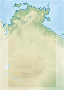
Location of the Gulf of Carpentaria |
||
| Waters | Arafura Lake ( Pacific Ocean ) | |
| Land mass | Australia | |
| Geographical location | 15 ° S , 138 ° E | |
|
|
||
| width | 590 km | |
| depth | 700 km | |
| surface | 300,000 km² | |
| Greatest water depth | 82 m | |
| Medium water depth | 61 m | |
| Islands | Groote Eylandt , Sir Edward Pellew Islands , Wellesley Islands | |
| Tributaries | Norman River , Nicholson River , Mitchell River | |
The Gulf of Carpentaria is a large, flat bay that cuts concisely into the coast of northern Australia and is bordered to the east by the Torres Strait . North of the bay is the Arafurasee , the strait between Australia and New Guinea , which is formed by an imaginary line around 590 kilometers long between Cape Arnhem, the easternmost point of Arnhem Land (a little south of Bremer Island ), and Slade Point, a promontory in the north of the Cape York Peninsula , about 50 kilometers southwest of Cape York is delimited. The gulf is part of the Australasian Mediterranean and therefore part of the Pacific Ocean .
geography
At its widest point, the Gulf of Carpentaria is 675 kilometers wide. The extension in north-south direction is around 700 kilometers. The area of the gulf is around 300,000 km². On average, the gulf is between 55 and 66 meters deep. Its deepest point is just 82 meters below the sea surface. The waters near the coast are mostly very shallow and characterized by shallows. The currents in the Gulf are mainly shaped by the tides and the prevailing winds. In terms of geological time, the Gulf is still young, because it was still dry land during the last Ice Age .
The land that surrounds the gulf is generally flat and low. In particular, the east coast along the Cape York Peninsula is flat and quite straight. The west coast along the Arnhem Land at the top end of the Northern Territory and further south is a little hilly and has several bays and islands. With an area of 2,260 km², the Groote Eylandt in front of Arnhem Land is the largest island in the Gulf. There are various small islets between Groote Eylandt and Arnhem Land. At the southern end of the gulf are the 22 Wellesley Islands . Mornington Island is the largest island in this group with 1002 km². The approximately 50 islands of the Sir Edward Pellew Islands lie off the southwest shore. One of them is about the national park ( Barranyi- (North-Iceland) -Nationalpark stated) North Iceland .
The Gulf of Carpentaria is hardly developed along its entire coast. The largest place on the bay is Weipa . The mining town with around 3,000 inhabitants is about 250 kilometers south of Cape York. The port is the transshipment point for the bauxite mines in the area and home to a small fishing fleet that mainly catches shrimp . Around 1000 people live on Mornington Island. The region south of the Gulf - that is, northwest Queensland and the adjacent areas in the Northern Territory - is commonly referred to as the Gulf Country . The southern tip of the bay is hardly accessible due to swamps and mangroves . Settlements such as Burketown or Normanton are located on rivers around 30 kilometers from the coast. Karumba with around 500 inhabitants at the mouth of the Norman River is the only place in this area directly on the coast. Important rivers in this region are the Nicholson River , its tributary Gregory River , Leichhardt River , Flinders River , Norman River, and Gilbert River . Major estuary rivers on the east bank are the Mitchell River , Holroyd Rier , States River , Wenlock River, and Archer River . The Roper River is one of the larger tributaries in Arnhem Land .
climate
The climate is subtropical, hot and humid. There are two seasons, the dry season from April to November and the rainy season from December to March. Both are characterized by the monsoon , dry, often strong southeast wind in winter, rain-bringing northwest wind in summer. Most of the rainfall is concentrated in two to three months. Cyclones happen regularly. Many coastal areas are flooded during the rainy season. There are no mountains in the entire area around the Gulf. Therefore, precipitation is not concentrated on the coastal areas, but slowly decreases towards the interior.
Morning glory clouds are a common weather phenomenon over the south of the Gulf from August to November . These rolling clouds are several hundred kilometers long, but only one to two kilometers wide and high. They move forward at speeds of up to 60 km / h and emerge over the Cape York Peninsula.
fauna and Flora
The waters and coasts of the Gulf of Carpentaria are still often natural and hardly influenced by humans. Fauna and flora in and outside the water are shaped by the subtropical climate. With around 17,000 animals, the Gulf is home to one of the largest populations of dugongs . A species similar to the White Seahorse is still unknown.
history

Mornington Island has been inhabited by Aborigines for about 10,000 years . Other stretches of coastline and islands have been shown to have been settled by Aboriginal tribes for a long time . Many Aboriginal tribes still exist today, even if they often consist of fewer than 100 people.
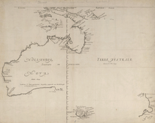
The first European explorer to visit this region was the Dutch captain Willem Janszoon in 1606. He was to explore new trading centers in Southeast Asia with his ship Duyfken on behalf of the Dutch East India Company . He followed the coast of New Guinea , had to move south and landed in Australia without being aware of his discovery. His compatriot Jan Carstensz followed in 1623 and named the east bank of the Gulf Carpentaria , after Pieter de Carpentier , the then Governor General of the Dutch East Indies . In 1644 Abel Tasman explored the coast of northern Australia.
The region was mapped and explored further by Matthew Flinders in 1802 and 1803. In 1844, Captain John Lort Stokes followed on the HMS Beagle Flinders' route. He drove up the Albert River for dozens of kilometers and was impressed by the vast grassland in the hinterland. In 1845 Ludwig Leichhardt explored the south coast of the Gulf. Edmund Kennedy , who was supposed to find a land route from Sydney to the Gulf of Carpentaria between 1845 and 1848 , never reached the Gulf and, like so many other explorers in Australia, died during an expedition.
Robert O'Hara Burke , William John Wills , John King and Charley Gray reached the mangroves at the mouth of the Flinders River on February 9, 1861 , coming overland from Melbourne . The water was salty and they could see the tides. However, the mangrove swamps along the coast prevented them from seeing the sea. Nevertheless, the expedition by Burke and Wills is considered to be the first south-north crossing of Australia - but the men, with the exception of King, were not supposed to return. Frederick Walker opened up vast areas of the Gulf in his search for Burke and Wills.
Several cattle ranches were established in the Gulf Country in the 1860s. The first settlement was Burketown on the Albert River in 1865 . The small town was almost completely destroyed by a cyclone and floods on March 5, 1887 and, despite successful exports of beef to Batavia and Singapore, developed only very slowly. Various missionary stations were set up around the Gulf and on the islands inhabited by Aborigines.
See also
Web links
Individual evidence
- ↑ a b c d North Coast of Australia - Gulf of Carpentaria (PDF; 1.2 MB) US National Imagery and Mapping Agency (NIMA)
- ↑ Gesa Gottschalk: The Enigmatic Coast , in: GEO Epoch No. 36: Australien , Gruner + Jahr, Hamburg 2009, ISBN 978-3-570-19877-3
- ^ A b The Gulf of Carpentaria: Discovery and Exploration. In: Burke Shire Council. Retrieved December 25, 2015 .
- ↑ a b Sydney Morning Herald: Burketown. Retrieved May 8, 2009 .


