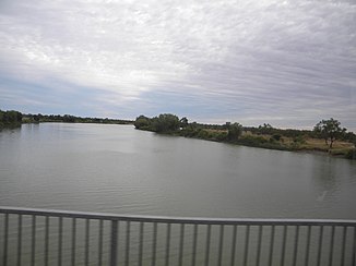
Norman River
| Norman River | ||
|
The Norman River in 2013 |
||
| Data | ||
| location | Queensland ( Australia ) | |
| River system | Norman River | |
| Drain over | Norman River → Gulf of Carpentaria | |
| source | Gregory Range ( Great Dividing Range ) 19 ° 29 ′ 51 ″ S , 143 ° 28 ′ 55 ″ E |
|
| Source height | 449 m | |
| muzzle |
Gulf of Carpentaria near Karumba Coordinates: 17 ° 28 ′ 0 ″ S , 140 ° 49 ′ 0 ″ E 17 ° 28 ′ 0 ″ S , 140 ° 49 ′ 0 ″ E |
|
| Mouth height | 0 m | |
| Height difference | 449 m | |
| Bottom slope | 1.1 ‰ | |
| length | 420 km | |
| Catchment area | 48,950 km² | |
| Left tributaries | Spear Creek, Brown Creek, Sawtell Creek, Four Mile Creek, Alligator Creek | |
| Right tributaries | Jacky Creek, Cartridge Creek, Borah Creek, W Creek, Plum Tree Creek, Clara River , Yappar River , Jumble Hole Creek, Halfway Creek, Clarina Creek, Twenty Mile Creek, Carron River , Wills Creek, Fools Lagoon Creek | |
| Flowing lakes | 2 water holes | |
| Reservoirs flowed through | Glenore Weir 17 ° 51 '42 " S , 141 ° 7' 39" O | |
| Medium-sized cities | Normanton | |
| Small towns | Glenore, Clarina, Karumba | |
| Communities | Bellfield, Victoria Vale, Woodstock, Vena Park | |
| Ports | Karumba | |
The Norman River is a river in the north of the Australian state of Queensland .
geography
River course
The river has its source on the southwest slopes of the Gregory Range about 140 km south of Georgetown . From there it flows first to the west and turns in its middle reaches to the northwest. 30 km off the coast it flows through the city of Normanton and finally flows after 420 km with mostly a slight gradient at Karumba into the Gulf of Carpentaria .
The catchment area is bounded in the north by the Gilbert River , in the southwest by the Flinders River . The sizes vary between 48,950 km² and 50,445 km². The annual runoff of 2.346 million m³ corresponds to 9.5% of the water runoff into the Gulf of Carpentaria.
The largest reservoir in the catchment area is Belmore Lake / Belmore Creek Dam (location) with a capacity of 2.5 million m³. It is used to supply the town of Croydon with water .
The Norman River reached the highest measured water level in Normanton at 8.8 meters during the record flood of 1974. It should be noted that the systematic recording of water levels was only started from this point in time. Major floods occurred in 1991 and 2009.
Tributaries with mouth heights
- Jacky Creek - 285 m
- Cartridge Creek - 256 m
- Borah Creek - 236 m
- W Creek - 49 m
- Plum Tree Creek - 33 m
- Spear Creek (Norman_River) - 31 m
- Clara River - 25 m
- Yappar River - 18 m
- Jumble Hole Creek - 16 m
- Brown Creek - 8 m
- Sawtell Creek - 7 m
- Four Mile Creek - 7 m
- Alligator Creek - 6 m
- Halfway Creek - 5 m
- Clarina Creek - 5 m
- Twenty Mile Creek - 3 meters
- Carron River - 2 m
- Wills Creek - 0 m
- Fools Lagoon Creek - 0 m
Flowing lakes
- Crocodile Waterhole - 12 m
- The Rocky Waterhole - 12 m
climate
At the Glenore Weir station, an annual mean (1969 to 2000) rainfall of 764 mm was measured. Near the coast it is around 900 mm, in the interior around 400 mm annually.
The nearby Normanton has (1908 to 2001) mean monthly maximum temperatures in the range between 29.1 ° C (July) and 36.8 ° C (November) and minimum temperatures between 15.1 ° C (July) and 25.3 ° C ( December). The mean afternoon temperature is over 30 ° C for 10 months of the year.
fauna
The fauna includes at least 26 (proven in 2006), but probably approx. 48 fish species, including the pied rainbow fish ( Melanotaenia splendida inornata ), the Australian freshwater herring ( Nematalosa erebi ), Macleay's glass perch ( Ambassis macleayi ) and Leiopotherapon unicolor .
Individual evidence
- ↑ a b c d Map of Norman River, QLD . Bonzle.com
- ^ A b Steve Parish: Australian Touring Atlas . Steve Parish Publishing, Archerfield QLD 2007. ISBN 978-1-74193-232-4 . P. 12 + 13
- ↑ a b c Survey of Freshwater Fish and Fish Habitats of the Norman River ( PDF; 1.6 MB) Australian Center for Tropical Freshwater Research, James Cook University, Townsville. Archived from the original on March 25, 2012. Info: The archive link was automatically inserted and not yet checked. Please check the original and archive link according to the instructions and then remove this notice. Retrieved April 9, 2011.
- ↑ a b c 2000-2002 National Land and Water Resources Audit (English) ( Memento of the original from June 2, 2011 in the Internet Archive ) Info: The archive link was inserted automatically and has not yet been checked. Please check the original and archive link according to the instructions and then remove this notice.
- ↑ Archived copy ( memento of the original from October 2, 2009 in the Internet Archive ) Info: The archive link was inserted automatically and has not yet been checked. Please check the original and archive link according to the instructions and then remove this notice.
- ↑ Flood warning system of the Bureau of Meteorology (engl.)
- ↑ Climate data Normanton Post Office (Engl.)
