Karumba
| Karumba | |||||||||
|---|---|---|---|---|---|---|---|---|---|

|
|||||||||
|
|||||||||
|
|||||||||
|
|||||||||
|
|||||||||
|
|
|||||||||
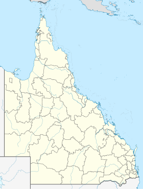
Karumba is a small Australian town in northwest Queensland at the mouth of the Norman River in the Gulf of Carpentaria . With around 500 inhabitants, Karumba is the second largest settlement in the local administrative area (LGA) Carpentaria Shire .
The main source of income for the place is fishing and port operations.
history
In 1872 a telegraph station was built in the urban area of today's Karumba. The resulting settlement was called Norman Mouth because of its location at the mouth of the Norman River . After an interim name change to Kimberley in 1876, the place was given the name Karumba, derived from an Aboriginal language .
Karumba first became more important in 1937, when Short Empire flying boats made stopovers on the Norman River on their way from London to Sydney .
During the Second World War there was a base of the Australian Air Force in Karumba , where flying boats of the type Catalina were stationed.
Since the 1950s, Karumba has developed into an important fishing location and has also become popular with recreational anglers.
economy
Karumba's main sources of income are fishing, livestock farming, mining and tourism. In 2007/2008 almost 1,000,000 tons of zinc and 60,000 tons of lead were exported via the port. During the same period, 12,659 head of live cattle also left the port.
traffic
Karumba is the only place on the Gulf of Carpentaria that can be reached via an asphalt road. The distance to the next larger town, Normanton , is about 73 km.
There is a bus connection from Karumba via Normanton to Cairns , which is operated several times a week (as of August 2011). The journey time is around 11 hours.
There is an airfield near Karumba (IATA: KRB, ICAO: YKMB). The nearest airport with regular flight connections is at Normanton.
Web links
- Carpentaria Shire Council (English)
- Karumba Progress Association (English)
- Karumba State School (English)
Individual evidence
- ↑ Australian Bureau of Statistics : Karumba (L) ( English ) In: 2016 Census QuickStats . June 27, 2017. Retrieved April 14, 2020.
- ↑ Carpentaria Shire ( Memento from January 15, 2015 in the Internet Archive )
- ↑ Karumba History ( engl. ) Archived from the original on 10 October 2013. Information: The archive link is automatically inserted and not yet tested. Please check the original and archive link according to the instructions and then remove this notice. Retrieved August 11, 2013.
- ↑ Economy ( engl. ) Archived from the original on 29 July 2013. Information: The archive link is automatically inserted and not yet tested. Please check the original and archive link according to the instructions and then remove this notice. Retrieved August 11, 2013.
- ↑ Trans North Bus & Coach Service ( Engl. ) Accessed on August 11, 2013.
