Dobrin country
Coordinates: 52 ° 58 ′ 1.2 ″ N , 19 ° 19 ′ 58.8 ″ E
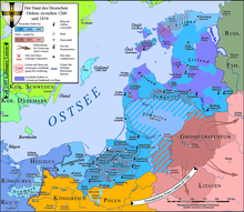
The Dobriner Land is a Polish landscape on the east bank of the Vistula . It connects to the Kulmerland south of the Drewenz and includes the Powiat Lipnowski and the Powiat Rypiński . The name is derived from the town of Dobrin on the Vistula . It belonged to Kuyavia .
history
In July 1343, the Polish King Casimir the Great received the Dobriner Land and Kujawien from the Teutonic Order in the Peace of Kalisch and promised in return that no more claims would be made to Pomeranian , Kulmerland and Michelauer Land in the future .
Web links
Footnotes
- ^ Gotthold Rhode : Brief history of Poland . Scientific Book Society, Darmstadt 1965, p. 71.

