Duiker Island
| Duiker Island | ||
|---|---|---|
| Fur seals on Duiker Island | ||
| Waters | South Atlantic | |
| Geographical location | 34 ° 3 ′ 31 ″ S , 18 ° 19 ′ 37 ″ E | |
|
|
||
| length | 95 m | |
| width | 77 m | |
| surface | 0.4 ha | |
| Residents | uninhabited | |
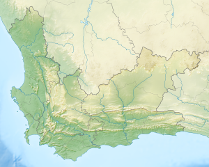
Duiker Island or Afrikaans Duikereiland (word meaning diving island ), with the name variant Seal Island (word meaning seal island ), is a small rocky island west of Hout Bay near Cape Town , South Africa . It is located near the town of Hout Bay within the Cape Town metropolitan area . The island measures 95 by 77 meters, or 0.4 hectares in area, and is known for its fauna (birds and fur seals ), and is therefore often visited by tourists and photographers by boat via Mariner's Wharf in Hout Bay harbor.
On October 13, 2012, a boat capsized near the island. Two men were killed while the three women survived in a bubble under the capsized boat.
Individual evidence
- ↑ 3 Women Survive in Air Pockets Under Capsized Boat by Bazi Kanani ( ABC News , October 15, 2012)
- ↑ Cape Town boat capsizes: Peter Hyett dies in Hout Bay ( BBC News , October 15, 2012)
Web links
Commons : Duiker Island - collection of images, videos and audio files

