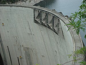
El Cajón Dam (Honduras)
| El Cajón dam | |||
|---|---|---|---|
| The dam with the overflow | |||
|
|||
|
|
|||
| Coordinates | 15 ° 2 ′ 0 ″ N , 87 ° 45 ′ 0 ″ W | ||
| Data on the structure | |||
| Lock type: | Arch dam | ||
| Construction time: | 1979-1984 | ||
| Height of the barrier structure : | 234 m | ||
| Building volume: | 0.16 million m³ | ||
| Crown length: | 382 m | ||
| Power plant output: | 300 MW | ||
| Operator: | Empresa Nacional de Energía Eléctrica | ||
| Data on the reservoir | |||
| Water surface | 109.745 km² | ||
| Storage space | 7085 million m³ | ||
| Design flood : | 5 900 m³ / s | ||
The El Cajon Dam is the largest dam in Honduras . It is also known under the name "Represa Hidroeléctrica Francisco Morazán".
The dam has a 234 m high arch dam as a barrier structure. It dams the Rio Comayagua in northwest Honduras. The reservoir has a storage space of 7085 million cubic meters (other information: 4200, 5650 or 6500 million m³) and a water surface of 109.7 km². That is a little more than Lago de Yojoa (90 km²), which is located southwest of the reservoir and is the largest natural lake in Honduras.
The main tributaries into the reservoir are the Rio Sulaco and the Rio Humuya. The outflow is the Rio Comayagua, which flows into the Caribbean Sea via the Río Ulúa .
The dam was completed in 1984. It is used for hydropower generation, irrigation, flood protection and recreation. The hydropower plant generates 300 megawatts, which is 60% of Honduras' electricity needs. The operator is the company Empresa Nacional de Energía Eléctrica (ENEE) .
During Hurricane Mitch in 1998, the reservoir had an extremely large inflow of an estimated 9800 m³ / s, which is regarded as 70% of the maximum possible inflow ( PMF ) of 14,000 m³ / s (PMF = probable maximum flood). The flood was absorbed in the reservoir and there was only a discharge of 1,200 m³ / s. The flood discharge is designed for a peak discharge of 5,900 m³ / s. This capacity is achieved through a combination of overflows with and without closures. A year later there was also a flood in which the dam proved its worth. This time 1,000 m³ / s flowed off.
In the 1980s, part of the catchment area was declared Panacoma National Park.
See also:
- List of the largest dams on earth
- List of the largest reservoirs on earth
- List of the largest hydroelectric plants in the world
- List of dams in the world
Web links
- Page 23: Honduras: El Cajon Dam (PDF file; 325 kB)

