Lake Yojoa
| Lake Yojoa | ||
|---|---|---|

|
||
| Lake Yojoa | ||
| Geographical location | Honduras | |
| Drain | → Río Yure → Río Humuya → Río Comayaqua → Río Ulúa | |
| Data | ||
| Coordinates | 14 ° 53 ′ N , 87 ° 59 ′ W | |
|
|
||
| Altitude above sea level | 632 m | |
| surface | 90 km² | |
|
particularities |
largest inland lake in Honduras' |
|

|
||
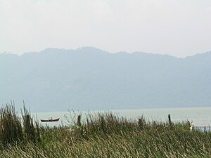
The Lago de Yojoa is the largest inland lake in Honduras , it borders on the Department of Santa Bárbara .
In contrast to its neighboring countries, Honduras only has smaller inland lakes, the largest of which, Lago de Yojoa, stands out due to its richness in species of fish and birds. Up to 750 species of birds breed and nest on the banks and in the vicinity; the lake is a popular local excursion and travel destination. Parts of the area around the lake are used for agriculture through the cultivation of pineapples , coffee and citrus fruits, and for forestry through pine cultures .
On the shores of the lake is Los Naranjos , an archaeological dig site, with hiking trails through the wet forest and viewing platforms for bird watching. There is a hydroelectric power station at the outflow of the lake .
geography
The lake is located 61.2 km from San Pedro Sula and has an area of 90 km². It lies at an altitude of 632 m above sea level and is surrounded by mountains up to 2600 m high. The south-north extension is 17.7 km, the west-east extension 9.21 km. The lake is located in one of the wettest zones in the country with an average rainfall of 3200 mm / year and an average temperature of around 22 ° C. Two national parks border the lake: Cerro Azul Meambar on the south coast and Santa Bárbara on the north coast. To the south are the Cataratas de Pulhapanzak .
environmental issues
The existence of the Lago de Yojoa is threatened by clearing and mining operations in the surrounding mountains, and its level drops year after year. That is why the Exo-Lago Foundation was set up to save the lake and its ecosystem in collaboration with fishermen and farmers.
