Gorg blue
| Gorg blue | |||||
|---|---|---|---|---|---|
| View of the Gorg Blau from the north-west bank | |||||
|
|||||
|
|
|||||
| Coordinates | 39 ° 48 '13 " N , 2 ° 49' 9" E | ||||
| Data on the structure | |||||
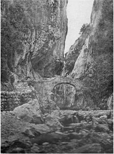
| Area of the lake in 1904, before flooding | |||||
Gorg Blau is a reservoir on the Spanish Mediterranean island of Mallorca .
location
The reservoir is located in the Serra de Tramuntana mountains in the north-west of the island in the municipality of Escorca . To the west of the lake rises the largest mountain on the island, the Puig Major . To the southwest lies the Cúber , another reservoir, to which there is a connection via the Torrent de Gorg Blau . The Ma-10 road runs from Pollença to Sóller on the west bank of the lake .
history
The reservoir was created in the late 1960s / early 1970s. In the flooded area was the prehistoric mountain sanctuary Almallutx , which was abandoned in 1969 and dates from the 6th to the 1st century before the beginning of our era. Three horizontal pillars of the facility were secured and re-erected on the current shore of the lake.
The reservoir with its capacity of 7.36 million m³ is primarily used to supply the municipality of Palma with drinking water . However, due to the sharp increase in water demand, the amount of reservoirs is no longer sufficient today. Together with the water in the Cúber, which has a capacity of 4.64 million m³, the water supplies would only be sufficient for 58 summer days to cover the water demand.
Web links
Individual evidence
- ^ Susanne Lipps, Oliver Breda: Mallorca. Dumont, Ostfildern 2007, ISBN 978-3-7701-7634-2 , p. 191 f.
- ↑ a b Ciclo integral del agua - Captación. In: Homepage of the water supplier EMAYA. Retrieved October 10, 2018 (European Spanish).
- ^ A b Joan-Antoni Adrover i Mascaró: 600 questions about Mallorca. Campos, 2010, ISBN 978-84-614-1808-4 , p. 93.


