Metadata information system
The metadata information system in geomatics ( GeoMIS ) is an information system that provides metadata on geodata , geospatial services and geospatial applications. The operator of a GeoMIS acts as an intermediary and makes this available in a structured manner. A GeoMIS can therefore also be called a search engine for a spatial data infrastructure .
A publish-find-bind relationship exists between the three people intermediary, provider and customer .
- The provider publishes his data through the agent.
- The customer finds interesting information for him from the agent.
- The customer turns to the provider to use the offer.
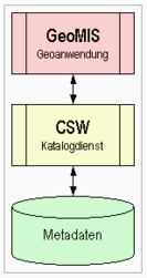
From a technical point of view, GeoMIS usually accesses several Web Catalog Services (CSW) with an attached meta database. There are two types of data storage in Germany today. The Federal GeoMIS outputs the current results of all connected catalogs. The future GeoMIS of the GDI Berlin / Brandenburg uses the Operation Harvest of the CSW and integrates the data from the connected catalogs into its own relational database in advance , which enables faster presentation of results.
See also
Web links
Germany ( GDI-DE ):
Switzerland ( GDI-CH ):

