
Gunung Mulu National Park
|
Gunung Mulu National Park
|
||
 |
||
| location | Sarawak | |
| surface | 52,864 ha | |
| WDPA ID | 787 | |
| Geographical location | 3 ° 57 ' N , 114 ° 47' E | |
|
||
| Setup date | 1974 | |

| Gunung Mulu National Park | |
|---|---|
|
UNESCO world heritage |
|
| National territory: | Malaysia |
| Type: | nature |
| Criteria : | (vii) (viii) (ix) (x) |
| Surface: | 52,864 ha |
| Reference No .: | 1013 |
| UNESCO region : | Asia and Pacific |
| History of enrollment | |
| Enrollment: | 2000 (session 24) |

The Gunung Mulu National Park is a protected area on Borneo . It was designated in 1974 and added to the UNESCO natural heritage list in 2000 . The national park was named after the Gunung Mulu mountain . It is on the territory of Sarawak , a state of Malaysia . Two thirds of all known amphibian species in Borneo live in this national park .
In the area there is a karst landscape with a huge cave system, which is home to numerous bats . Another attraction form at an altitude of about 1200 m located Pinnacles , a crenellated limestone formation.
The National Park can be reached by turboprop aircraft from Miri and Kuching .
gallery
A selection of photos from Gunung Mulu National Park:

Wooden plank path through the jungle

Limestone cave
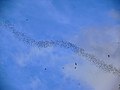
Swarm of bats leaves the cave system

bat

Millipede ( Zephroniidae )

Millipede Trachelomegalus modestior

Frog Hylarana glandulosa

Orchid species Coelogyne swaniana
.jpg)
.jpg)
_out_of_Deer_Cave_(6761236185).jpg)


_(8409211384).jpg)
_(6760585131).jpg)
_(15326654290).jpg)
_(15495986192).jpg)
Web links
Individual evidence
- ↑ Gunung Mulu National Park. UNESCO World Heritage Center, accessed June 12, 2017 .
- ↑ Borneo amphibians. WWF, accessed September 29, 2016 .

Heritage: Malacca and George Town (2008) | Archaeological Sites in the Lenggong Valley (2012)
Natural heritage: Kinabalu Park (2000) | Gunung Mulu National Park (2000)