
Hans Meyer Mountains
| Hans Meyer Mountains | ||
|---|---|---|
| Highest peak | Mount Taron ( 2379 m ) | |
| location | New Ireland | |
|
||
| Coordinates | 4 ° 25 ′ S , 152 ° 58 ′ E | |

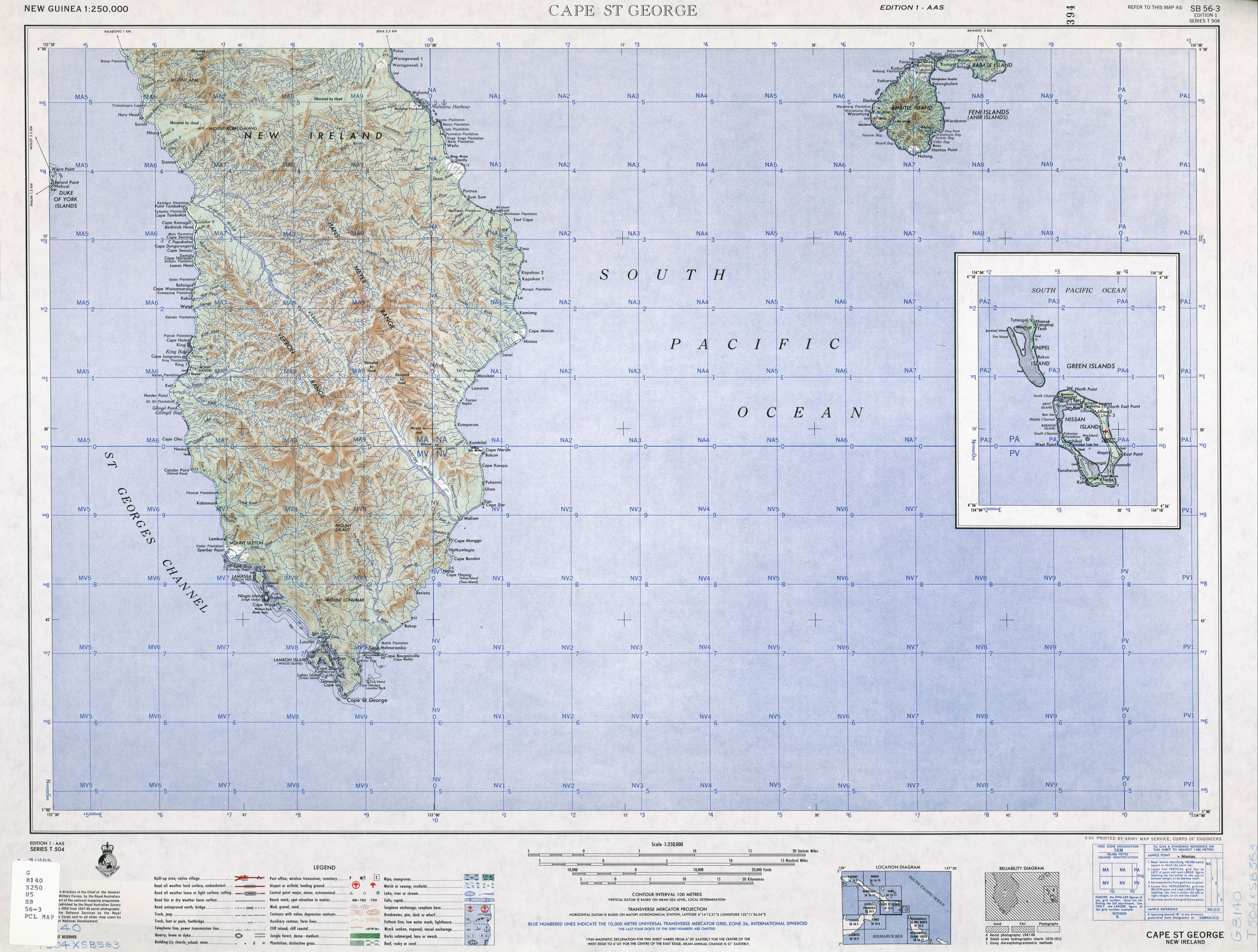
The Hans Meyer Mountains are a mountain range in the southern part of the island of New Ireland , Papua New Guinea . The highest point of the Hans Meyer Mountains is Mount Taron with a height of 2379 m. The Mount Taron is the highest mountain in New Ireland. Located on the broader southern part of New Ireland, the mountain range of the Hans Meyer Mountains, separated by the Weitin Valley from the Verron Mountains (Hahl Mountains) in the west, runs parallel to this from north to south. The rainy area is drained by numerous, mostly short rivers, the most important rivers are the Kamdaru River and the Weitin River .
The island of New Ireland is dominated by the landscape of oil palm and coconut palm plantations . Only in the valleys of the Hans Meyer Mountains are there still contiguous tropical rainforests , which are home to a large number of rare species of flora and fauna with high biodiversity .
The Hans Meyer Mountains were named after the German explorer , zoologist and first climber of Kilimanjaro Hans Meyer .
literature
- Heiner Wesemann: Papua New Guinea, Culture - Landscape . In: DuMont documents . DuMont Buchverlag, Cologne 1985, ISBN 3-7701-1322-5 , p. 298 .
Web links
- University of Texas at Austin: US Army Map Service, Topographic Map Portfolio of New Guinea, TK250, Sheet SB 56-3, Edition 1964 (jpg, English; 4.4 MB)
- CJ Müller: A New Species of Cethosia and a New Subspecies of Delias (Lepidoptera: Nymphalidae and Pieridae) from New Ireland, Papua New Guinea. Records of the Australian Museum, vol. 51 169–177 here p. 176 , ISSN 0067-1975 (PDF, English; 18 kB)