Hestvatn
| Hestvatn | ||
|---|---|---|

|
||
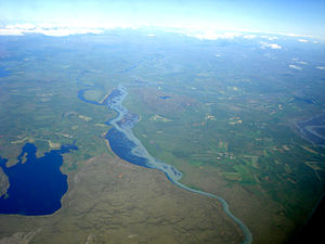
| Hestvatn (left), Hvítá in the center of the picture | ||
| Geographical location | Iceland | |
| Drain | Hestlækur → Hvítá | |
| Islands | Lambhagi | |
| Location close to the shore | Sólheimar | |
| Data | ||
| Coordinates | 64 ° 1 '12 " N , 20 ° 42' 36" W | |
|
|
||
| surface | 6.8 km² | |
| Maximum depth | 61.5 m | |
The Hestvatn is a lake in the Suðurland region in southwest Iceland . It is located in the municipality of Grímsnes og Grafningur .
geography
In the north of the lake, which has a size of 6.8 km², is the island of Lambhagi. The Hestvatn is connected to the Hvítá via the Hestlækur , which flows around the lake to the east and south. The greatest depth of the lake is 61.5 m. The lake is surrounded by gently rolling hills to the east, where the Hestfjall (317 m) rises . The next larger town is the eco-village of Sólheimar , northeast of the lake.
