Holoogberg
| Holoogberg | ||
|---|---|---|
|
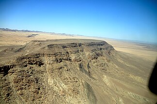
The Holoogberg in southern Namibia, looking south- |
||
| Highest peak | 1286 m | |
| location |
ǁKaras , Namibia |
|
|
|
||
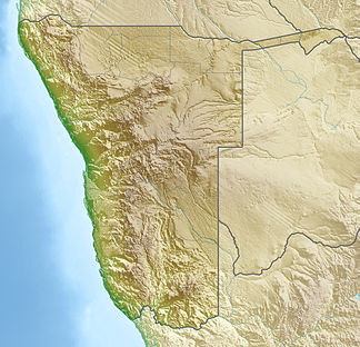
| Coordinates | 27 ° 33 ′ S , 17 ° 56 ′ E | |
| surface | 10 km² | |
The Holoogberg is a free-standing massif in southern Namibia . The massif has an area of around ten square kilometers and is 1224 m high. The main road C12 and the Windhoek – Nakop railway to South Africa run on its north-eastern edge . The Holoog stop is on the railway line . The Holoogberg borders the Gondwana Canyon Nature Park.
The “ Gondwana Roadhouse ” is located twelve kilometers west of the Holoogberg . The Fish River Canyon is located 33 km west of the Holoogberg.
Web links
Commons : Holoogberg - collection of images, videos and audio files
Individual evidence
- ↑ Namibia Travel Map . Kunth-Verlag, Munich 2017, ISBN 978-3-95504-578-4 .
- ↑ Holoogberg on Mapcarta
- ^ Gondwana Canyon Park. Info-Namibia.com Retrieved November 16, 2018.

