
Namibia


.svg)

Namibia (officially: Republic of Namibia ; German pronunciation: [ naˈmiːbi̯a ]; English Republic of Namibia ) is a state in southern Africa between Angola , Botswana , Zambia , South Africa and the Atlantic Ocean . A border line up to 100 meters long - and thus the only quadrangle in the world - with Zimbabwe is controversial.
The arid landscape was originally settled by the San ("Bushmen") and Damara peoples . Since about the 14th century hiked Bantu one during the Bantu migration into the country. The area of what is now Namibia became a German “protected area” in 1884 and remained a German colony called Deutsch-Südwestafrika until the end of the First World War . In the years 1904 to 1908, the German colonial power violently suppressed the Herero and Nama uprising and thus committed genocide. In 1920 the League of Nations placed Namibia under a South African mandate - effectively as a South African colony - which introduced its own laws, such as those on apartheid , in Namibia.
Namibia gained independence from South Africa in the course of the Namibian Liberation Struggle on March 21, 1990 - with the exception of Walvis Bay and the Penguin Islands , which were under South African control until 1994 . March 21st has been the country's national holiday since then . The capital and largest city of Namibia is Windhoek . The country has been a member of the United Nations (UNO), the Southern African Development Community (SADC), the Customs Union of Southern Africa (SACU), the African Union (AU) and the Commonwealth of Nations since 1990 ( Resolution 652 ) .
Due to the large area covered by the Namib Desert, Namibia is only sparsely populated. The country has about 2.1 million inhabitants. 18 percent of the population live below the Namibian poverty line (as of November 2016), compared to 28.7 percent in 2009. 10 percent (as of October 2016) of the population suffer from HIV / AIDS .
Namibia has a stable parliamentary democracy. The Namibian economy is heavily influenced by agriculture , tourism and mining ( uranium , gold , silver and base metals ). On the Human Development Index , Namibia ranked 130th out of 189 countries in 2019.
etymology
The name of the state is derived from the Namib desert , which occupies the entire coastal area of the country. It was chosen as a neutral designation during independence so as not to disadvantage any of the many Namibian peoples. Mburumba Kerina is considered to be the creator of the name Namibia .
On June 12, 1968, the name Namibia was recognized by the General Assembly of the United Nations .
geography
Namibia lies between 17.87 ° and 29.9808 ° south latitude and 12 ° and 25 ° east longitude.

Namibia is bordered in the east to Botswana by the Kalahari , in the south to South Africa by the Oranje - also known as the Orange River - in the west by the South Atlantic and in the north to Angola by the Kunene and Okavango . In the north-east there is also an approximately 450 km long and up to 50 km wide finger of land between the countries bordering Angola and Zambia to the north and Botswana to the south - the Caprivi Strip , which is bordered in the eastern area by the Zambezi and the lower reaches of the Kwando .
In addition to the border rivers mentioned, there are numerous other rivers , but not a single one of them has water all year round. Outside of the rainy season there are only dried out river beds ( riviers ).
The entire national territory of Namibia covers around 824,292 square kilometers . The landscape of Namibia is essentially characterized by two deserts, in the west by the Namib, which extends from the South African province of North Cape to far into Angola, and in the east by the Kalahari . Between the two deserts lies the inland highlands, which are an average of 1700 meters high and around the capital Windhoek , which also crosses the 2000 meter mark. One of the most striking mountains is the Etjo , the highest mountain, however, is the approximately 2600 meter high Königstein in the Brandberg massif , near the coast, about 200 kilometers north of the coastal town of Swakopmund . In the east, the inland highlands gradually merge into the Kalahari highlands, which are around 1200 meters high and covered by dry vegetation.
Time zone
Namibia has been using the same time all year round as South Africa ( UTC + 2 ) since September 3, 2017 - as it did between 1990 and 1994 .
geology
The area of today's Namibia is considered to be one of the oldest parts of the earth's crust . Long before the formation of the supercontinent Gondwana , two shelves formed in what is now Africa more than two billion years ago : the Congo craton and the Kalahari craton. The latter covers large parts of today's Namibia. Through various tectonic processes , a huge, contiguous mainland area was created around 550 million years ago, which comprised today's (sub) continents of Africa , South America , Australia, India and the Antarctic : Gondwana.
About 150 million years ago this supercontinent gradually began to break up and drift apart into the continents known today. The special climatic conditions in South West Africa, which lasted for millions of years, meant that many geological structures, processes and phenomena were particularly well preserved and can therefore still be observed today. Ultimately, this also includes the Namib, which can therefore be considered the oldest desert in the world.

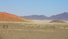
NamibRand Nature Reserve - Wolwedans
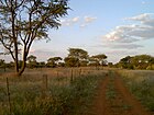
Farm path near Omaruru
Namib desert


climate

The average climate in Namibia is hot and dry. The largely arid climate is subtropical and continental . There are big differences between the individual parts of the country:
In the Namib west of the demolition stage, precipitation is extremely rare. A warm, strong wind blows all year round. Even in winter, temperatures often reach 25 ° C and more. In the hottest summer months of December and January, temperatures are usually well above 30 ° C, while in the coldest months, July and August, they can drop to freezing point at night, but then rise again to around 25 ° C during the day. In the mornings and evenings, temperature jumps of more than 20 ° C within a few hours can be expected, especially in winter. In the inland highlands , due to the high altitude, there can even be frost at night and, in very rare years, snowfall. During the day it is not quite as hot there as in the desert. The situation in the Kalahari is similar to that in the Namib. The precipitation is a little more frequent, but still rare, as is typical of the desert.
The area between the Namib and the Atlantic Ocean is one of the regions in the world with the best climate for astronomical observations . The astro camps set up there are therefore visited by many astronomical friends, especially for the purposes of sky photography.
The climate of the Atlantic coast, in turn, is determined by the cold Benguela Current. This cools the prevailing southwest wind strongly, which prevents the formation of (rain) clouds due to condensation and regularly creates a dense, persistent fog near the ground. In summer it is pleasantly cool and in the winter months it is sometimes very cold during the day. The water temperature rarely exceeds 15 ° C.
The Caprivi Strip, on the other hand, is characterized by mostly safe precipitation in the rainy season. These have created an extensive river system and a subtropical savanna forest. In contrast to other parts of the country, the humidity here is relatively high.
In the central highlands, which occupy most of Namibia, summer rains prevail, which means that although irregular but occasionally very heavy rains are to be expected between November and April; the extreme south, on the other hand, lies in the winter rain area, so that - if at all - rainfall occurs mainly in the months of June and July. Despite the irregularity of the rainfall in terms of frequency and productivity, it increases significantly from the south with less than 50 mm per year in the north-east with up to 600 mm per year, which does not exclude regional dry periods of several years.

Due to the special climatic conditions, agricultural use of the land is only possible to a limited extent: in the highlands mainly cattle breeding (in the north more cattle, in the south more sheep and goats), in the relatively rainy north also arable farming. A special feature of the Namib are the dunes in the area of Sossusvlei . With a height of well over 400 meters, the star dunes are among the highest in the world. The attraction of this dune landscape lies not only in its height, but above all in its play of colors, which depends on the moisture content and the position of the sun.
population
_de.svg)
Namibia is extremely sparsely populated. After Mongolia , Namibia is the most sparsely populated independent state on earth. The population is concentrated in a few cities and the fertile north of the country. Around 44 percent of the population live in the Omusati , Oshana , Ohangwena and Oshikoto regions . A third live in central Namibia, where more than 300,000 people live in Windhoek alone. Only seven percent of the population live in the south of the country; the west and the Namib Desert, with the exception of the port cities, are almost deserted. About 57 percent of the population live in rural areas.
The number of civil war refugees from Angola peaked in 2001 at around 32,000; many were repatriated after the civil war ended. However, the border is relatively permeable, especially at Oshikango , so that it is crossed in both directions by some 10,000 people each year, some of whom remain in Namibia for longer or permanently. The migration in the opposite direction is less.
development
Namibia has a total of around 2.32 million inhabitants (as of 2016), with a growing trend (1991: around 1.4 million inhabitants). In the years between 1970 and 1990 the population more than doubled, and in the following ten years it increased by around 30 percent. In the decade 2001 to 2011, it increased by only 15 percent.
health

A Namibian woman gives birth to an average of 3.4 children in her lifetime. The current annual population growth is around 1.9 percent (as of 2016). About 11 percent (as of 2013) of the population are infected with HIV / AIDS . In the early 2000s, the HIV rate was around 20 percent. In 2015, 4.1% of newborns were infected with the virus from their mother; 13 years earlier it was a third.
As a result, the average life expectancy at birth fell significantly. In 1990 it was around 62 years and in 2005 it was only 52 years. In the period from 2010 to 2015, thanks to the progress made in the fight against the AIDS epidemic, it was 61.8 years again (men: 59.1 years, women: 64.3 years).
Namibia has one of the best medical systems on the African continent. In 2007 there were 37 doctors per 100,000 inhabitants in Namibia and thus one of the best doctor-to-population ratios in Africa.
languages

Today's Namibians are a mixture of different, but partly related, peoples who mostly resettled in the area through several migrations between the 16th and 18th centuries. This diversity of the population is also reflected in the languages spoken. With the Bantu languages , the Khoisan languages (e.g. the Haiǁom ) and the Indo-European languages, there are three large language groups with over 30 individual languages or dialects.
The Bantu languages spoken in Namibia are Oshivambo , Otjiherero , RuKwangali , SiLozi and Setswana . The Khoisan languages include Khoekhoegowab and the San languages such as ǃKung and Khoe. By the Europeans and Bastern Indo-European languages introduced as Afrikaans and German are indeed spoken only by a small part of the population as a first language, but especially among farm workers and other language whites still very common lingua franca .
48.9% of the Namibian population (2011 census) stated that they speak Oshivambo as their mother tongue, 11.3% Khoekhoegowab, 10.4% Afrikaans, 8.6% Otjiherero and 8.5% Kavango languages . A large part of the population speaks Afrikaans as a second language. Of the white population, 60% speak Afrikaans, 32% German and 7% English .
From 1884 to 1915 German was the official language in German South West Africa . From 1916 to 1920 German was the accepted colloquial language. From 1920 on, English and Afrikaans were the only official languages in South West Africa . From 1984 until the country became independent from South Africa in 1990, de jure Afrikaans, German and English were official languages with equal status. In order to finally put an end to apartheid and foreign rule, but above all in order not to benefit any of the existing population groups and thus endanger the integrity of the country, the "neutral" world language English was made the only official language. In addition to the official language English, a number of other languages enjoy a preferred position as so-called national languages .
German is the mother tongue of 0.9% (around 20,000) of the population and the second language of the majority of the white population and a small part of the black population (around 80,000). In everyday life, German is an important lingua franca, especially in business and tourism.
Although only 3.4% of the population speak English as their first language at home, the proportion of those who can speak English fluently has increased dramatically in the years since independence. This is mainly due to the consistent use of English in schools, offices and the media. However, due to the low proportion of native speakers, the English spoken in Namibia differs from Oxford English in various peculiarities. With regard to this, a pidgin- like mixed language has emerged over the years, especially among the country's black African population , which is often referred to as Namlish .
religion
As a result of proselytizing during the colonial era , around 87 percent of Namibians are Christians, which puts the country well above the African average. Of these, 50 percent are Lutherans , 20 percent Catholics , 5 percent are members of the Dutch Reformed Church and 5 percent are Anglicans . The remaining Christians spread to other smaller churches such as Baptists , Adventists , New Apostolic Christians and from the United States coming African Methodist Episcopal Church .
The remaining 13 percent of the population, especially the San, Himba and Caprivians, are followers of traditional religions . The Islam plays a minor role in Namibia, the number of Muslims in Namibia is estimated at a few thousand. The largest Muslim religious building in the country is the Quba Mosque in the capital. Only about seven families (as of November 2015) across the country follow Judaism ; the Windhoek synagogue is the only one active in the country.
history
The arid regions of South West Africa have been the habitat and home of the San and Damara peoples for thousands of years . Portuguese navigators first discovered the country for Europe in the 15th century. However, due to the inhospitable conditions in the coastal regions, there was no significant settlement for a long time. In the course of numerous African migrations, beginning in the 17th century, Herero , Nama , Orlam and Ovambo tribes invaded the country. It was not until the 19th century that European settlers began to immigrate heavily. These came mainly from Portugal, England and the German-speaking area.
Until 1884/85 the country, with the exception of Walvis Bay , which remained under British influence, came under the rule of the German Empire and became a colony of German South West Africa. The first German officials arrived in May 1885, among them Reich Commissioner Heinrich Ernst Göring . With the help of local missionaries, he concluded a protective alliance with the Herero. The Herero were promised protection from the Nama under Hendrik Witbooi ; In return, they had to undertake to grant the Germans free trade and not to sell any land without German consent. When it became clear that the German administration was unable to provide such protection, the Herero terminated the agreement and expelled the officials under Göring. As a result, around 20 soldiers were dispatched under Curt von François , which was little more than a symbolic presence. Curt von François acted with these soldiers with ruthless severity against the Herero and turned them against him within a very short time. As a result, the " protection troops " had to be continuously strengthened.
In 1894 the German Reichstag deposed Curt von François and appointed Theodor Leutwein governor of German South West Africa. Leutwein had only a very limited military budget and therefore tried to consolidate German rule as cheaply as possible and with little use of his own military resources by persuading various local leaders to work together. In 1897 rinderpest decimated the Herero's large livestock. The white settlers were much less affected because they could vaccinate their cattle. The Herero lost the basics of their autonomous and self-sufficient way of life with the herds of cattle and increasingly had to step into wage labor with the whites.
The aim of many white settlers was to buy land from the Hererochiefs. Therefore, they often sold the Herero for several years on credit European consumer goods. Much later, they presented the bills and collected the debts that had to be paid with cattle and land. It also happened that merchants simply threw goods in the villages that the Herero had no interest in and later insisted on payment. These approaches led to conflicts between the representatives of German colonial rule and the peoples of the colony. Between 1904 and 1908 the Herero and Nama uprising and tens of thousands of Herero and Nama were destroyed.
During the First World War , the country was captured by the British troops of South Africa and handed over to administration by the League of Nations as a mandate area of the Union of South Africa at the end of the war . This kept the country occupied until it gained independence on March 21, 1990, despite intensive international efforts and two decades of armed struggle against the South West African People's Organization (SWAPO), founded in 1960 .
Discovery and settlement
The area of what is now Namibia was first populated probably before 2000 (to 2500) years by the San who immigrated from Central or even North Africa . Although rock engravings have been found in Namibia that indicate a settlement significantly older than 2000 years, the rock paintings in Twyfelfontein are probably over 10,000 years old, but they cannot be assigned to the San with the necessary certainty. Some of their rock paintings, which can be clearly identified, are well over 1000 years old and were only discovered in the 19th and 20th centuries. Century completely set.
In the course of the African north-south migration between the 17th and 18th centuries, first the cattle-breeding Herero , who belong to the Bantu tribes, came from Bechuanaland (today's Botswana ) , then in the 19th century the Nama from the Cape Province and then from the same direction the Africans to Namibia. They all waged an extermination campaign against the San and pushed them east into the Kalahari Desert, where they were reduced to a wild boar economy . The San still live there today - more tolerated than welcome by the governments of South Africa, Botswana and Namibia, as they have so far stubbornly opposed all "civilization efforts".
Settlement by German immigrants began a good one hundred to one hundred and fifty years after the first immigrants of the black tribes living there today and two hundred years after the settlement by Dutch, the so-called Boers or Afrikaans , in the Cape and the surrounding area and the founding of Cape Town in 1652, or almost 400 Years after the discovery by the Portuguese ( Bartolomeu Diaz , 1488) and the later establishment of a colony. The latter, however, did not last due to increasing difficulties with the Khoi Khoi and was given up after a punitive expedition by the Portuguese viceroy, which never returned with his person, and was later replaced by the Dutch.
German colonial period until 1915

After the German businessman Franz Adolf Eduard Lüderitz had succeeded in acquiring large tracts of land through contracts with local tribal leaders (" Lüderitz Bay "), the country from the Orange to the Kunene was declared a "protected area" of German South West Africa in 1884 and then a German colony . The news of fabulous diamond discoveries literally triggered a “gold rush mood” in the imperial German Empire. In Lüderitz Bay you could pick up the cliff gravel, as the diamonds were called, in the sand of the beach and in the hinterland in the dunes of the desert. In the course of this, the diamond mining town of Kolmannskuppe was founded ten kilometers inland from Lüderitz . The resulting influx of traders and farmers and their land grabbing met with increasing resistance from the local Herero and Nama. The harsh behavior of the settlers met with resistance, especially from the Herero.
The Herero's economic situation, which deteriorated dramatically at the end of the 19th century, forced them to sell more land and finally to work with German settlers. Persistent conflicts between the settlers and the local population could not be resolved by the captain of the Herero Samuel Maharero and the governor of German-South Africa Theodor Leutwein . The result was a German colonial war against the Herero and Nama, which lasted from 1904 to 1908 and grew into a war of extermination that cost the lives of an estimated 60,000 to 70,000 men, women and children.
The Herero War
In January 1904 there was a Herero and Nama uprising led by Samuel Maharero. With a total of around 15,000 men under Lieutenant General Lothar von Trotha , the Herero uprising was suppressed by August 1904 in the Battle of Waterberg . Most of the Herero then fled to the almost waterless Omaheke desert. Von Trotha had this cordoned off and the refugees chased away from the few watering holes available there, so that thousands of Herero along with their families and herds of cattle died of thirst. Von Trotha had those who were hunted into the desert informed in the so-called extermination order: “The Herero are no longer German subjects. […] Every Herero within the German border is shot with or without a rifle, with or without cattle, I no longer take up women or children, drive them back to their people or have them shot at. [...] and the shooting at women and children is to be understood in such a way that they are shot over to force them to run. I assume with certainty that this decree will lead to no more male prisoners being taken, but will not degenerate into atrocities against women and children. ”The survivors were expropriated, imprisoned in concentration camps and forced to work. The abuse, inadequate nutrition and poor hygienic conditions in these camps resulted in the deaths of half of all prisoners in this second phase of the Herero genocide.
The Nama uprising
Following the Herero War, the Witbooi rose in the south of the country in October 1904 - an Orlam tribe that had fought on the German side during the Herero War. The Fransman-Nama joined this uprising; after the surrender of the Witbooi in 1905, the Nama continued the guerrilla fight under Simon Kooper and Jakobus Morenga until 1908, which gave this uprising the name Nama uprising .
First World War
The news of the outbreak of the First World War reached German South West Africa on August 2nd via the Nauen - Kamina radio link and the large radio station still under construction in Windhoek . After the outbreak of war became known, Governor Theodor Seitz ordered the general mobilization of the troops on August 7, 1914 . There were various skirmishes with the Union troops of South Africa , but also clashes with the Portuguese in Angola . Some Boer associations from South Africa that had fought against their government were partly smashed and withdrew across the Orange River to join the German troops. At the beginning of the war, German troops managed to inflict heavy losses on the South Africans, but they lost ground and eventually had to surrender.
On July 9, 1915, the commander of the Schutztruppe , Lieutenant Colonel Franke, as well as the imperial governor Seitz and the commander- general of the South African Union Louis Botha signed an armistice treaty that amounted to a surrender.
South African administration
German South West Africa was occupied by South Africa during the First World War and, by resolution of the League of Nations, was assigned to the South African Union as a mandate area in 1920 . In the years that followed, the South African administration succeeded in sustainably reducing the formerly strong German influence and in “South Africanizing” Namibia - including the expansion of apartheid policy to include the mandate area. Namibia's white voters were guaranteed representation in the South African parliament from 1947 to 1977. After the Second World War , South Africa's behavior sparked numerous, albeit unsuccessful, attempts by the UN to withdraw its former League of Nations mandate from South Africa; This was requested before the UN General Assembly, as South Africa did not fulfill its information obligations about the area to the body. It was only after the International Court of Justice in The Hague in 1971 declared the South African administration illegal that South Africa was ready in 1972 to give South West Africa independence after a reasonable transition period.
But South Africa's behavior had also met with increasing resistance in South West Africa itself, supported by the international community. The decision of the International Court of Justice gave this resistance the desired legitimacy, which ultimately even led to the independence movement South West African People's Organization (SWAPO) , which was largely supported by the Ovambo and operated with presumed financial support from the Soviet Union, was granted sole power of representation for Namibia by the UN in 1973 . In 1978, under great pressure, South Africa enabled elections to a constituent assembly in which black Africans were also allowed to vote. The main opposition group, which had a very strong women's wing, boycotted the elections.
The propagandistic fear of apartheid politicians in South Africa that they might get a communist or socialist neighboring state justified a decade-long asymmetric war against domestic and foreign opponents of apartheid and liberation movements in Namibia and Angola . On September 6, 1978, Pieter Willem Botha took advantage of Prime Minister Vorster's illness-related absence to act as Minister of Defense at the National Party congress in Bloemfontein before a 7,500-strong UN task force took over the area of South West Africa and established it this way to warn of the " Marxist enemy power" by SWAPO, which could lead to a "Marxist state" on the borders with South Africa.
The war ended in 1988 with the armistice between South Africa and Angola and the subsequent preparation of elections in Namibia. Most of the more than 60,000 refugees who had lived in SWAPO camps in Angola , Zambia and Tanzania from 1963 to 1989 were repatriated after 1990. They were accompanied by many Angolan civil war refugees.
In the elections of November 7, 1989, women and men had the general right to vote and stand as a candidate. With that the right to vote for women was achieved.
independence

On March 21, 1990, Namibia received its independence after more than 100 years of foreign control . Universal suffrage for adults became part of the constitution. After independence, the SWAPO leader Sam Nujoma ruled the country for three terms as president, elected by a clear majority. The democratic opposition parties, including the Democratic Gymnasium Alliance (DTA), remained at odds with one another and played a subordinate role in Namibia's political life. A further term of office was not possible according to the Namibian constitution, so that in 2004 the previous Minister for Land Affairs, Hifikepunye Pohamba - also Ovambo and a SWAPO member - was elected second president. On March 21, 2005, he was sworn in in Windhoek in the presence of several African presidents. After two terms in office, Hage Geingob took over the power as president through the clearest election result in independent Namibia.
Law
An independent Namibian legal culture has not yet developed. For historical reasons, Namibian law essentially consists of the law adopted from South Africa , i.e. H. the Roman-Dutch law as a mixed system between common law and Roman law .
Constitutional law
The National Assembly is the legislative body, which means that laws can only be passed by it. The National Council only has an advisory role in order to give sufficient attention to the concerns of the individual regions. The highest court in Namibia is the Supreme Court , whose judges are appointed by the President.
politics

Namibia has been a republic with a semi-presidential system of government since 1990 . The vote on this took place in 1989, which can also be seen as the beginning of independence. The head of state is the president , who is elected every five years. The Namibian government consists of a Prime Minister who is appointed by the President along with the Cabinet. The parliament of Namibia consists of two chambers. One chamber is the National Council with 42 seats (26 seats until 2013). Each of the 14 administrative regions (13 until August 8, 2013) sends three representatives every five years (two until August 2013). The other chamber is the National Assembly with 104 (until August 2013 78) seats, 96 of which are elected by general election and eight are elected by the President. The term of office is five years.
In the 2019 Democracy Index of the British magazine The Economist, Namibia ranks 65th out of 167 countries and is therefore considered an " incomplete democracy ". In the country report Freedom in the World 2017 by the US non-governmental organization Freedom House , the country's political system is rated as “free”.
At regional and local level, traditional leaders in Namibia are given certain rights. The Namibian constitution was also one of the first in the world to include environmental protection as a priority national goal, which has since been coordinated by the Ministry of Environment and Tourism .
Foreign policy
According to President Hage Geingob, the country's foreign policy is guided by “having no enemies and only friends”. The country tries to have balanced diplomatic relations and, due to its own history, feels obliged to multilateral cooperation. The most important foreign policy point of reference for Namibia is its large neighbor South Africa, which is by far the country's most important trading partner. With South Africa as well as Botswana, Lesotho and Swaziland Namibia is connected by the Customs Union of Southern Africa (Southern African Customs Union, SACU). The Namibian dollar is pegged to the South African rand at a ratio of 1: 1 . The country is also a member state of the African Union , Southern African Development Community (SADC), which aims to deepen the integration of southern Africa. In addition to regional cooperation, member relationships in the Commonwealth of Nations and relationships with the European Union , the People's Republic of China , the United States and North Korea are important.
Germany maintains extremely close relations with Namibia due to their shared colonial history (1884–1915) and the resulting special responsibility of Germany and the German-speaking minority in the country. In the last two decades, Germany has provided development aid in Namibia amounting to around 1 billion euros (highest German output per capita in Africa). The special German-Namibian relationship was expressed in numerous other high-ranking political contacts at government level. These include u. a. the visits by Federal Chancellor Kohl (1995) and Federal President Herzog (1998) to Namibia as well as the visits to Germany by President Nujoma (1996 and 2002) and President Pohamba (2005). Federal President a. D. Köhler represented the Federal Republic of Germany at the celebrations on the occasion of the 25th anniversary of Namibia's independence and the inauguration of the new President Geingob in 2015. Every year almost 100,000 German tourists visit the country, which is why the Germans are the largest non-African tourist group and for the country are of great economic importance.
defense
The Namibian Defense Force (NDF) was founded after Namibia's independence in 1990. The Constitution of Namibia (Chapter 15) defines the main features of the NDF as “defender of the territory and national interests”. The armed forces can therefore be legally deployed at home and abroad. The main task is to secure the sovereignty and territorial independence of Namibia by protecting against foreign attackers. In addition, the NDF can be used to support civilian tasks, for example in the event of natural disasters, but also to protect government buildings.
Namibia spent almost 3.4 percent of its economic output or 434 million US dollars on its armed forces in 2017.
Administrative division


Namibia is divided into fourteen regions . Each region is supported by a Regional Council (regional council) rules, and depending on the size of the region on in six to twelve constituencies (constituencies) divided. There are a total of 121 constituencies .
The municipalities are divided into municipalities (as of May 2015: 17), cities, villages and settlements. In 2016, 47.6% of the population lived in cities or urban areas. Windhoek , the capital of Namibia, is by far the most populous and economically most important city in Namibia. The largest cities are (as of 2011 census):
- Windhoek : 325,858 inhabitants
- Rundu : 63,431 inhabitants
- Walvis Bay : 63,431 inhabitants
- Swakopmund : 44,725 inhabitants
- Oshakati : 36,541 inhabitants
- Rehoboth : 28,843 inhabitants
- Katima Mulilo : 28,362 inhabitants
- Otjiwarongo : 28,249 inhabitants
economy
.jpg)
Namibia has a largely market- oriented economic system. The main industries are mining , fishing and processing, and agriculture and tourism .
The agriculture plays an important role traditional. In addition to subsistence farming , Namibia also exports large quantities of meat and animal products. Agriculture is the country's largest employer alongside the state.
Namibia is a member of the Southern African Customs Union (SACU) (Namibia, Lesotho , Swaziland , South Africa and Botswana ), whose accounting units de facto also require a currency union .
Although the country is one of the richer countries in Africa, unemployment is high in Namibia (34.1 percent in 2018). Due to the low wages on the one hand and the very imperfect taxation of income on the other, only just under 134,000 Namibian residents paid taxes in 2007. According to the Gini coefficient, Namibia ranks last in the world and therefore has the most unequal distribution of income. Corruption, especially in public procurement an obstacle for foreign investors represent. Namibia is 2011, the rise in the group of "upper middle income countries" (countries with higher medium income) of the United Nations succeeded.
In addition, fishing and tourism are playing an increasingly important role. In this respect, the manufacturing industry in Namibia is only weak, so that a large part of the consumer goods and machines have to be imported.
In the Global Competitiveness Index , which measures a country's competitiveness, Namibia ranks 89th out of 137 countries (as of 2017/18). In 2017, the country ranks 78th out of 180 countries in the index for economic freedom .
Mining and industry


Around 12 percent of the gross domestic product (GDP; as of 2012) of Namibia is generated by mining . Namibia's raw materials are primarily uranium and diamonds , and large amounts of copper , gold , lead and tin are also mined. The restricted diamond area around Lüderitz is famous . The largest uranium mine in the world is the Rössing mine northeast of Swakopmund. There is a significant copper deposit near Tsumeb , and the formerly world's largest tin mine was located in Uis .
tourism

The size of the country, its diverse landscapes and its abundance of animals had already made Southwest Africa an interesting travel area in the 1950s - initially above all for the neighboring South African tourists, who found untouched nature and seemingly endless expanse here. In addition, Namibia was then under South African administration, so that there were no entry or residence barriers for the South Africans who were isolated at the time.
Tourism contributed 11 percent to GDP in 2011 , making it the country's second most important industry. More than 11 billion Namibian dollars were turned over .
State budget
The national budget in 2014/2015 includes expenditure of almost 58 billion Namibian dollars , the equivalent of around 5.2 billion US dollars . The budget deficit was around 4.4 percent of gross domestic product (GDP) in 2012/13 .
The national debt was around 20 percent of GDP in 2012.
Infrastructure
communication
Namibia has a modern telecommunication system . In December 2016, there were 2.66 million active SIM cards , i.e. more than one per inhabitant, according to the Namibian communications regulator . In addition, there were almost 188,000 landline connections in the country , which was roughly the same as in June 2013.
rail

The basic structure of the rail network of the state-owned transport company TransNamib dates back to the German colonial era and was initially determined primarily by military needs. It has now been expanded to a length of 2626 kilometers and connects important economic centers in Namibia. The construction of new routes and the renovation of existing ones has continued since 2011. Rail transport plays a role primarily in freight transport; In contrast, it is almost insignificant in passenger transport.
Street

The Namibian road network is well developed and opens up all of the country's inhabited areas. It is around 45,000 kilometers long, around 80 percent of which are unpaved slopes, mostly with a gravel base layer, which are maintained with a grader on a regular basis or as required . Only the national roads, some main roads and the most important inner-city roads (about 6,700 kilometers) are paved. In Namibia, as in all neighboring countries with the exception of Angola, there is left-hand traffic . With up to 700 road deaths per year, Namibia has the highest number of deaths in the world in relation to the number of inhabitants.
Air traffic

Namibia is well integrated into the regional flight network and has its own national airline, Air Namibia . There are direct flight connections to Europe. International airports have the state capital Windhoek with the Hosea Kutako International Airport , which is about 45 kilometers east of the city, and the port city of Walvis Bay ( Walvis Bay Airport ). In addition, every major town in Namibia and many farms have their own landing pads . There are numerous charter flight companies in Namibia .
shipping
The two deep-water ports in Namibia are in Walvis Bay and Lüderitz. Three more ports are under construction or in planning.
Culture
Cultural and natural monuments
The nationwide inclusion of cultural and natural monuments was completed in 2003. It records geological structures, paleontological and archaeological sites (including the petroglyphs and rock paintings of Twyfelfontein ), habitats and plant formations such as the baobab trees of Tsandi and Ombalantu or the camel thorn forest near Rehoboth as well as historical sites, including the padrões of the Portuguese sailors on the coast, tombs ( including the grave of Jonker Afrikaner ) and cemeteries, secular buildings , sacred buildings and industrial monuments.
public holidays
There are twelve public holidays in Namibia . If a public holiday falls on a Sunday, the following Monday is also a public holiday.
The Herero Day is the last weekend of August in the Namibian town of Okahandja taking place day to commemorate the battle of Waterberg . It is not a public holiday, but is perceived as such by the Herero .
media
Despite the small population and the multitude of languages, Namibia has numerous newspapers. The largest daily newspaper in the country is the English language The Namibian , which also contains texts on Oshivambo . The second largest daily newspaper is the Namibian Sun (also in English), followed by the Afrikaans-speaking republic . The English-speaking New Era is state-sponsored . The Allgemeine Zeitung appears in German and is the oldest newspaper in the country. "Die Republikein", "Allgemeine Zeitung" and "Namibian Sun" belong to Namibia Media Holdings (NMH).
The Namibian Broadcasting Corporation (nbc) is the public broadcaster in Namibia with three television programs (as of July 2014) and numerous radio programs in nine languages. 70 percent of the population are reached by digital signals (as of June 2015). There are also various private radio stations and four private television stations with One Africa Television , TBN Namibia , THISTV and EDU TV . Satellite television is made possible primarily by the South African service DStv and for German speakers by Deukom and Satelio .
In 2019, Namibia ranks 23rd in the list of press freedom of Reporters Without Borders (2018: 26th place) and is number one of all African countries.
literature
The Namibian Helmut Kangulohi Angula wrote an autobiographical novel, also translated into German, about the time of the SWAPO's struggle for independence (“Two thousand days of Haimbodi ya Haufiku”). Joseph Diescho deals with similar topics . The author Rachel Valentina Nghiwete , who published her autobiography Valentina: The exile child in 2010 , was born in a refugee camp in Angola .
Giselher Hoffmann , descendant of German settlers, and Lisa Kuntze , who was born in Dresden, wrote novels and short stories in German.
kitchen
education


The preschool education sector in Namibia is largely privately sponsored. There are kindergartens and preschools in the cities, and in rural areas, preschool education is often organized informally. Farm schools are sometimes set up on farms because of the great distances to the nearest villages . Primary and secondary education in Namibia is free.
The secondary education sector (schools, vocational schools and high schools) is managed by the Ministry of Education . A comprehensive system of vocational schools does not yet exist in Namibia. There are vocational training centers (VTC) for individual trades (bricklayer, plumber, car mechanic, tailor) , and the Namibia University of Science and Technology also offers training courses similar to vocational schools ( e.g. hotelier, land surveyor, accountant). Most professions, however, are taught informally through apprenticeship training, with no curriculum, grades or formal qualifications.
There are two state-sponsored educational institutions in Windhoek for young people with disabilities, the Dagbreek School for the mentally handicapped and the Ehafo Trust, a vocational training institution for people with disabilities of all kinds.
The tertiary education sector is dominated by the three tertiary educational institutions, the University of Namibia (UNAM), the Namibia University of Science and Technology (NUST) and the International University of Management . The course is subject to a fee; for talented students, scholarships are granted by private and public authorities.
In Namibia, the mean school attendance for over 25s increased from 5.6 years in 1990 to 6.7 years in 2015. It is one of the longest in Africa. The compulsory education in Namibia is 7 years.
The literacy rate in 2015 was 81.8% of the adult population (women: 84.5%, men: 79.2%). This made Namibia one of the few countries in Africa where the rate was higher for women than for men.
National parks
There are numerous national parks in Namibia , such as wildlife parks or nature reserves. In 2013, 138,163.7 km² were under state protection. Some of the parks are a UNESCO World Heritage Site, such as the Sossusvlei National Park , in which the orange color of the sand, which is more than 5 million years old, changes depending on the incidence of light. The national parks include the Skeleton Coast , the Namib-Naukluft National Park and the Etosha National Park .
Sports

The most popular sports in Namibia are rugby and soccer, as well as cricket . Inline hockey and fistball are widespread among German Namibians, and especially jukskei among those who speak Africa . National sports have been rugby, football and netball since August 2018 .
The national rugby federation Namibia Rugby Union was founded in March 1990, the year of independence, and joined the IRB in the same year . He is also a member of the CAR . The national team is one of the best in Africa and often qualifies for the World Cup as one of two African teams. She is also two-time African champion and two-time vice-African champion.
The national football association Namibia Football Association was also founded in 1990. In 1992 the NFA joined FIFA and CAF . In the top division, the Namibia Premier League , 16 teams compete against each other. The national team belongs to the midfield in Africa and was able to qualify for the African Championship in 1998 and 2008 . In 2014, Namibia hosted the women's African championship .
One of the world's most famous Namibian athletes is Frank Fredericks , a track and field athlete over 100 and 200 meter distances and multiple medalist at the Olympic Games . In addition, Collin Benjamin gained greater fame as a long-time player at Hamburger SV in Germany.
The Icestocksport Association of Namibia was founded in 2004 and participated in the World Cup in the same year and in 2008. The association became African champions in 2005 and 2007.
In addition, Namibia has a national fistball team and hosted the 1995 fistball world championship and in January 2009 the U18 fistball world championship. In addition, in 2008 Namibia hosted the World Archery Championships according to IFAA guidelines.
See also
literature
- Wendula Dahle , Wolfgang Leyerer: Namibia . Edition Temmen , Bremen 2001, ISBN 3-86108-861-4 (travel guide).
- Klaus Dierks : Chronology of Namibian History . 2nd Edition. Klaus Hess Verlag, Göttingen 2003, ISBN 3-933117-52-6 .
- Johannes Haape: Namibia (= Apa Guide). Langenscheidt Fachverlag, Munich 1995, ISBN 3-8268-1398-7 (travel guide).
- Rolf Hennig : Wildland South West Africa. Landbuch-Verlag, Hannover 1978, ISBN 3-7842-0187-3 .
- Klaus Hüser u. a .: Namibia. Landscape studies in pictures . Klaus Hess Verlag, Göttingen / Windhoek 2001, ISBN 3-933117-14-3 (= Edition Namibia; Vol. 5).
- Thomas Keil: Postcolonial German Literature in Namibia (1920-2000) . Dissertation, University of Stuttgart, 2003 ( full text ).
- Henning Melber : Understanding Namibia. The Trials of Independence . Hurst & Co., London 2014, ISBN 978-1-84904-411-0 .
- Henning Melber: Namibia. Limits to Post-Colonial Emancipation . Brandes and Apsel, Frankfurt am Main 2003, ISBN 3-86099-784-X .
- Toubab Pippa (Ed.): From the wickedness in the heart of the people. Hendrik Witbooi and the black and white history of Namibia . Löhrbach 2004, ISBN 3-922708-31-5 .
- Nick Santcross, Gordon Baker, Sebastian Ballard: Namibia Handbook . 3. Edition. Footprint, Bath (England) 2001, ISBN 1-900949-91-1 (travel guide in English, standard work).
- Beate Tito: On farms in the southwest . Landbuch-Verlag, Hannover 1980, ISBN 3-7842-0236-5 .
- Johannes Paul : German South West Africa (PDF; 4.3 MB). In: Carl Petersen, Otto Scheel, Paul Hermann Ruth, Hans Schwalm (eds.): Concise dictionary of border and foreign German. Ferdinand Hirt Verlag, Breslau 1936, Volume II, pp. 262-278.
- Heinrich Vedder: The old South West Africa: South West Africa's history until Maharero's death in 1890 . Berlin 1934 (reprint: SWA Wissenschaftliche Gesellschaft, Windhoek 1985, ISBN 0-949995-33-9 and other editions).
- Namibia. Facts and dates. Konrad-Adenauer-Stiftung e. V., Windhoek 2009.
- Namibia . Special issue of the magazine: Die Erde. 133rd year 2002, issue 2.
- Nicole Grünert: Namibia's fascinating geology . Klaus Hess Verlag, Göttingen 2003, ISBN 99916-747-7-2 .
Web links
- Government of Namibia (English)
- Official website of the Embassy of the Republic of Namibia in Germany
- Country information from the Federal Foreign Office on Namibia
- Database of cataloged literature on the social, political and economic situation in Namibia
- Political science literature on Namibia in the Annotated Bibliography of Political Science
- Historical photographs of the German Colonial Society , the Sam Cohen Library / Namibia and other historical literature
- Namibia Library by Dr. Klaus Dierks
- German-Namibian Development Company e. V.
- Website of the German-Namibian Society
- Dominant soils in Namibia (University of Cologne)
Individual evidence
- ↑ CIA Factbook Namibia , accessed July 31, 2017
- ^ World Economic Outlook of the International Monetary Fund
- ↑ United Nations Development Program ( UNDP )
- ^ Namibia Inter-Censal Demographic and Labor Force Survey. Namibia Statistics Agency, November 24, 2016.
- ↑ Human Development Report 2019 (English; PDF: 1.7 MB, 40 pages ) on hdr.undp.org
- ↑ The Man Who Named Namibia- Mburumba Kerina. The Namibian, September 9, 2014 .
- ↑ 12 June 1968: South West Africa renamed to 'Namibia'. The Namibian, June 12, 2020.
- ↑ UNHCR Yearbook: Namibia (pdf) ( Memento of August 24, 2006 in the Internet Archive )
- ↑ a b c d The World Factbook: Namibia , accessed on September 16, 2015.
- ↑ Mother-to-child HIV transmissions decline. The Namibian, April 4, 2017.
- ↑ WDI Online, World Bank , visited at 5 February of 2008.
- ↑ World Population Prospects - Population Division - United Nations. Retrieved July 21, 2017 .
- ^ Country Health Profile Namibia 2006. Who.int, 2006 accessed on April 15, 2012.
- ↑ Biodiversity.org
- ^ JF Maho: Few people, many tongues. The languages of Namibia. Gamsberg MacMillan, Windhoek 1998, ISBN 99916-0-086-8 .
- ↑ a b Namibia 2011 Population and Housing Census Main Report (PDF), p. 68, accessed on October 1, 2017.
- ↑ Frequently asked questions at www.deutschinnamibia.org .
- ↑ Country information Namibia .
- ^ Windhoek synagogue might shut down. The Namibian, November 4, 2015, p. 3.
- ↑ Horst Drechsler: South West Africa under German colonial rule. The struggle of the Herero and Nama against German imperialism (1894–1915). Akademie-Verlag, Berlin 1966.
- ^ A b Dominik J. Schaller: Colonial War, Genocide and Forced Labor in German South West Africa. In: Dominik J. Schaller u. a .: Dispossessed, expelled, murdered - contributions to genocide research. Chronos, Zurich 2004.
- ↑ Jan-Bart Gewald: The Great General of the Kaiser. In: Botswana Notes and Records . Volume 26, p. 74.
- ↑ From the “sandbox” to the communication network The history of the development of the post and telegraph system in the colony of German South West Africa (1884–1915). Dissertation, Uni Halle, December 2004. p. 249
- ^ Wilfried Westphal: History of the German colonies . Gondrom, Bindlach 1991, ISBN 3-8112-0905-1 , p. 306.
- ^ A b c June Hannam, Mitzi Auchterlonie, Katherine Holden: International Encyclopedia of Women's Suffrage. ABC-Clio, Santa Barbara, Denver, Oxford 2000, ISBN 1-57607-064-6 , p. 9.
- ^ Ernesto Che Guevara: Selected works in separate editions. Volume 4: Writings on Internationalism. P. 157, p. Footnote 72.
- ^ SAIRR : Survey of Race Relations in South Africa 1978 . Johannesburg 1979, p. 525.
- ^ CA Williams: Exile History: An Ethnography of the SWAPO Camps and the Namibian Nation. Dissertation, Univ. of Michigan 2009 [1] .
- ^ Mart Martin: The Almanac of Women and Minorities in World Politics. Westview Press Boulder, Colorado, 2000, p. 270.
- ↑ Democracy-Index 2019 Overview chart with comparative values to previous years , on economist.com
- ↑ Namibia. Retrieved January 3, 2018 .
- ^ The Constitution of The Republic of Namibia .
- ↑ Foreign Office: Foreign Office - Foreign Policy . In: Foreign Office DE . ( Auswaertiges-amt.de [accessed on May 20, 2018]).
- ↑ International Model United Nations Association: Namibia . at www.imuna.org (English)
- ↑ Foreign Office: Foreign Office - Relations with Germany . In: Foreign Office DE . ( Auswaertiges-amt.de [accessed on May 20, 2018]).
- ↑ Military expenditure by country as percentage of gross domestic product 2001-2017. (PDF) SIPRI, accessed on July 17, 2018 .
- ^ Military expenditure by country in US $ 2001-2017. (PDF) SIPRI, accessed on July 17, 2018 .
- ↑ [2]
- ↑ Key Highlights of the 2018 Labor Force - Indicators. Namibia Statistics Agency , March 2019 (PDF).
- ^ Only half of Namibia's taxpayers pay tax. The Namibian, March 8, 2007, accessed November 10, 2014.
- ↑ Corruption in Namibia at www.business-anti-corruption.com , accessed on July 14, 2015.
- ↑ [3] .
- ↑ [4] .
- ↑ Chamber of Mines Annual Review 2011–2012, Chamber of Mines of Namibia, p. 2 ( Memento of October 29, 2013 in the Internet Archive ) (PDF; 5.3 MB) accessed on October 24, 2013.
- ↑ Total Government debt now nearly N $ 26 billion. The Namibian, September 7, 2012. Retrieved November 11, 2014.
- ↑ Stats Newsletter December 2016. CRAN, March 7, 2017.
- ^ Andreas Vogt : National monuments in Namibia. An inventory of the proclaimed national monuments in the Republic of Namibia . Gamsberg Macmillan, Windhoek 2006, ISBN 99916-0752-8 .
- ^ Andreas Rothe: Media System and News Selection in Namibia. 2010.
- ↑ Official website of THISTV ( Memento of 29 May 2015, Internet Archive ) (English).
- ↑ reporter-ohne-grenzen.de: Ranking list of press freedom
- ↑ Human Development Data (1990–2015) | Human Development Reports. Retrieved August 2, 2018 .
- ^ The World Factbook - Central Intelligence Agency. Accessed July 31, 2017 .
- ↑ Namibia National Parks. Retrieved June 7, 2017 .
- ↑ Cabinet approves categorization of sports codes. Namibia Press Agency, August 2, 2018.

Member States of the United Nations
Egypt (also in Asia) |
Algeria |
Angola |
Equatorial Guinea |
Ethiopia |
Benin |
Botswana |
Burkina Faso |
Burundi |
Djibouti |
Ivory Coast |
Eritrea |
Eswatini | Gabon | Gambia | Ghana | Guinea | Guinea-Bissau | Cameroon | Cape Verde | Kenya | Comoros | Democratic Republic of the Congo | Republic of the Congo | Lesotho | Liberia | Libya | Madagascar | Malawi | Mali | Morocco | Mauritania | Mauritius | Mozambique | Namibia | Niger | Nigeria | Rwanda | Zambia | São Tomé and Príncipe | Senegal | Seychelles | Sierra Leone | Zimbabwe | Somalia | South Africa | Sudan | South Sudan | Tanzania | Togo | Chad | Tunisia | Uganda | Central African Republic
Dependent areas
Îles Éparses |
Canary Islands |
Madeira |
Mayotte |
Plazas de soberanía (with Ceuta and Melilla ) |
Réunion |
St. Helena, Ascension and Tristan da Cunha
Disputed Areas
Sahara Arab Democratic Republic |
Somaliland

Member States:
Egypt |
Algeria |
Angola |
Equatorial Guinea |
Ethiopia |
Benin |
Botswana |
Burkina Faso |
Burundi |
Djibouti |
Ivory Coast |
Eritrea |
Gabon |
Gambia |
Ghana |
Guinea |
Guinea-Bissau |
Cameroon |
Cape Verde |
Kenya |
Comoros |
Congo, Democratic Republic |
Congo, Republic of |
Lesotho |
Liberia |
Libya |
Madagascar |
Malawi |
Mali |
Morocco |
Mauritania |
Mauritius |
Mozambique |
Namibia |
Niger |
Nigeria |
Rwanda |
Zambia |
São Tomé and Príncipe |
Senegal |
Seychelles |
Sierra Leone |
Zimbabwe |
Somalia |
South Africa |
Sudan |
South Sudan |
Swaziland |
Tanzania |
Togo |
Chad |
Tunisia |
Uganda |
Central African Republic
Internationally not recognized members:
Democratic Arab Republic of the Sahara
Current Member States:
Antigua and Barbuda |
Australia |
Bahamas |
Bangladesh |
Barbados |
Belize |
Botswana |
Brunei |
Dominica |
Fiji |
Gambia |
Ghana |
Grenada |
Guyana |
India |
Jamaica |
Cameroon |
Canada |
Kenya |
Kiribati |
Lesotho |
Malawi |
Malaysia |
Malta |
Mauritius |
Mozambique |
Namibia |
Nauru |
New Zealand |
Nigeria |
Pakistan |
Papua New Guinea |
Rwanda |
Solomon Islands |
Zambia |
Samoa |
Seychelles |
Sierra Leone |
Singapore |
Sri Lanka |
St. Kitts and Nevis |
St. Lucia |
St. Vincent and the Grenadines |
South Africa |
Swaziland |
Tanzania |
Tonga |
Trinidad and Tobago |
Tuvalu |
Uganda |
Vanuatu |
United Kingdom |
Cyprus
Former Member States:
Dominion Newfoundland |
Federation of Malaya |
Ireland |
Sultanate of Zanzibar |
Tanganyika |
Zimbabwe
Members
Angola |
Equatorial Guinea |
Brazil |
Guinea-Bissau |
Cape Verde |
Mozambique |
East Timor |
Portugal |
Sao Tome and Principe
Observer
Andorra |
Argentina |
Chile |
France |
Georgia |
Italy |
Japan |
Luxembourg |
Macau ( candidate ) |
Mauritius |
Namibia |
Senegal |
Serbia |
Slovakia |
Czech Republic |
Turkey |
Hungary |
Uruguay |
United Kingdom
Coordinates: 23 ° S , 17 ° E