
Comoros
| Udzima wa Komori (Comorian) الاتحاد القمري (Arabic) Union des Comores (French) |
|||||
|
al-Ittiḥād al-Qumurī (Arabic) |
|||||
| Union of Comoros | |||||
|
|||||
|
Motto : وحدة ، تضامن ، تنمية / waḥda, taḍāmun, tanmiya ( Arabic ) Unité - Solidarité - Développement ( French ) "Unity, solidarity, development" |
|||||
| Official language | Comorian , Arabic and French | ||||
| Capital | Moroni | ||||
| Form of government | Islamic Federal Republic | ||||
| Government system | Presidential system | ||||
| Head of state , also head of government | President Azali Assoumani | ||||
| surface | 2,236 km² | ||||
| population | 794,678 (July 2016) | ||||
| Population density | 355 ( 24th ) inhabitants per km² | ||||
| Population development | +1.71% (2016) | ||||
gross domestic product
|
2016 | ||||
| Human Development Index | 0.497 ( 160th ) (2016) | ||||
| currency | Comoros Franc (KMF) | ||||
| independence | July 6, 1975 (from France ) | ||||
| National anthem |
Udzima wa ya Masiwa |
||||
| National holiday | July 6th | ||||
| Time zone | UTC + 3 | ||||
| License Plate | COM | ||||
| ISO 3166 | KM , COM, 174 | ||||
| Internet TLD | .km | ||||
| Telephone code | +269 | ||||
 .svg) |
|||||


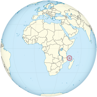
The Comoros ( Arabic جزر القمر Juzur al-Qamar , Comoros قمر Komori , French Comores [ kɔˈmɔːʀ ]), officially the Union of Comoros since 2001 , form a federal island state in the Indian Ocean at the northern exit of the Mozambique Strait between Mozambique and Madagascar . They comprise three of the four main islands of the Comoros Archipelago . These are Grande Comore (Njazidja), Anjouan (Nzwani), Mohéli (Mwali) and some smaller islands. The fourth main island of Mayotte (Mahoré) is an overseas department of France and is also claimed by the Union.
The Comoros gained independence from France in 1975 and since then has seen an eventful history with coups and secessionist efforts. Its estimated 795,000 inhabitants are of mixed, predominantly East African and Arab ancestry, and the majority are Muslim . The country's name is from the Arabic Juzur al-Qamar (جزر القمر) derived, which means "lunar islands".
geography
Natural space
The Comoros archipelago rises on an underwater ridge. All islands are of volcanic origin and have a mountainous relief . Volcanic mountains with deeply furrowed slopes, plateaus, chains of hills and mostly only narrow coastal strips characterize the landscape. The coasts of the islands are mostly rocky and lined with coral reefs . In the center of the main island of Grande Comore is the active volcano Karthala, 2361 meters high . The last major eruption occurred in 1977, when a whole village was overrun by the lava. In early 2005 there was a minor eruption that proceeded without an explosion or lava leak. Only ash covered a considerable part of the volcano after the eruption. At the end of May 2006, the volcano covered the capital Moroni with a cloud of dust and smoke, which led to local evacuations.
climate
The tropical- maritime climate shows only slight temperature fluctuations over the year. The average temperature of the coolest months (July / August) is 22 ° C, that of the warmest months (February / March) is 27 ° C. The dry south-east trade wind prevails between May and October, and the rain-bringing north-west monsoon from November to April . The wettest month is January. Depending on the altitude, between 1000 and 4000 mm of annual precipitation is recorded. In the hot season, tropical cyclones move over the islands more often.

Flora and fauna
The original vegetation - dense tropical rainforest with valuable wood species - has been strongly pushed back and is almost only preserved in higher elevations. Plantations and savannahs shape the landscape today. Coconut palms , bananas and mango trees are the most common in the lowlands . The coasts are partly overgrown by mangroves . The land fauna is relatively poor in species and is similar to that of Madagascar . There are rare bird and turtle species as well as a wet-nosed monkey , the Mongozmaki , that can only be found here . The coastal waters including the coral reefs, on the other hand, are rich in all kinds of aquatic animals. The coelacanth is a specialty ; In 1938, a member of this genus, previously only known as fossils, was caught off the Comoros for the first time .
Most important cities
The largest cities are (as of January 1, 2005) Moroni (42,872 inh.), Mutsamudu (23,594 inh .), Fomboni (14,966 inh .), Domoni (14,509 inh.) And Tsémbehou (11,552 inh .).
.jpg)
population

Anjouan is the most densely populated island in the archipelago. In 2004 64% of the population lived in rural areas and life expectancy was 63 years. A good 42% of the population was younger than 15 years. In the period from 1994 to 2004, the population grew by 2.8%. The official languages are Comorian (related to Swahili ), Arabic and French . The Comorians (97% of the total population) are descended from Arabs , Madagascans , Bantu , Indians , Shirazi and Indo-Melanesians . Several hundred Europeans also live on the islands. Population growth and high unemployment lead to emigration, especially to Mayotte and Madagascar .
The Comoros are among the poorest countries in the world .
Religions
The state religion of the country is Sunni Islam of the Shafiite school of law. About 99% of the population belong to it. There is also in the Comoros a small minority of Indian Ismailites ( Shiah ) and a Catholic - charitable mission activity ; approx. 1% of the population professes Christianity .
education
After independence and the departure of French teachers, the education system was of poor quality with moderately trained teachers. Since the educational reform in 1975 there has been compulsory education for eight years, including the two-year Koran school for preschool children. The illiteracy rate is estimated at 50%.
health
Social care and health care have significant gaps. Malnutrition is one of the reasons for the high infant mortality rate (2004: 5.2%). Malaria is common. In 2004 there were 15 doctors for every 100,000 people in the country. In the same year, the fertility rate was 4.7 children per woman. The life expectancy of women is around 67 and that of men 62 years.
history
prehistory
It is not known exactly when or where the earliest inhabitants of the archipelago came from; Archaeologists have found traces of a 6th century settlement on Anjouan. It is believed that Austronesian immigrants who came by sea from Indonesia in the 1st millennium AD and landed on Madagascar also settled in the Comoros. In addition, Bantu came from East Africa (especially Mozambique ).
Islamization
Arabs and Persians also visited the islands; From the 15th century onwards they settled more and more on the four main islands, introduced Islam , founded sultanates mainly in the coastal area and pushed the old population into the interior of the islands. In the 16th century, the Comoros was a regional trading center exporting rice, spices, ambergris and slaves to East African and Middle Eastern port cities.
Dominance of Arab sultanates
The first European visitors were Portuguese, who landed on Grande Comore in 1505. The Comoros first appeared on a Portuguese map in 1527. For a long time, however, the Europeans were unable to exert a formative influence. The branches founded by the Portuguese , Dutch and French in the 16th century were soon closed. The Arab - Islamic influence remained dominant until the middle of the 19th century . The Shirazi - Sultans tended to acquire more lands, they often but were of native workers also imported from East Africa slaves farming. In 1865, an estimated 40% of the population were slaves. From the late 18th century, the Sakalava from Madagascar carried out slave hunts in the Comoros and almost depopulated Mayotte; these raids ended after the Merina conquered the kingdoms of the Sakalava. After that, groups of Sakalava and Betsimisaraka settled on Mayotte and Mohéli.
French protected area (from 1841), then overseas territory (from 1946)
The rivalry between France and Great Britain for the islands in the western Indian Ocean began in the first half of the 19th century . France prevailed in the Comoros region, taking Mayotte into its possession in 1841 ; In 1886 the remaining three islands came under French protectorate . In 1912 the last sultan abdicated and the Comoros came under colonial administration with the main town Dzaoudzi on Mayotte. Slavery was abolished under colonial rule ; the economy was geared towards the cultivation of vanilla , ylang-ylang and other products, with the profits from this being hardly reinvested in the Comoros.
During the Second World War , the islands that had declared themselves for the Vichy government of Marshal Philippe Pétain were temporarily occupied by British troops . In 1946 the Comoros, which were no longer administered from Madagascar, were given the status of a French overseas territory with administrative autonomy . According to the Loi Lamine Guèye of 1946, all citizens had the right to vote in elections to the French parliament and also in local elections. This introduced a limited right to vote for women . The right to stand as a candidate was not specifically mentioned in the law, but it was not excluded either. There was a two-class suffrage, which favored the French-born citizens.
On June 23, 1956, the loi-cadre Defferre was introduced. In this way, France guaranteed the right to vote and the transition to full internal autonomy, which, however, was not finally granted until January 1968. In a referendum in 1958, the voters decided with a clear majority to remain with France. The two established political parties in the 1960s - the Parti Vert led by Saïd Mohamed Cheikh and the Parti Blanc under Prince Saïd Ibrahim Ben Ali - were both pro-French, conservative, and dominated by the descendants of the sultans.
The independence movement Mouvement de la Liberation Nationale des Comores (Molinaco) was founded by Comorians in Tanzania in 1962 and began in 1967 to expand its influence on the Comoros themselves. The widespread feeling of being neglected by France, combined with the independence of the nearby Tanganyika and Zanzibar and the beginning independence struggles in Mozambique, increased support for independence, especially among younger Comorians. Under the government of Ahmed Abdallah , in office since 1972, another referendum on independence was held in 1974 , in which around 95% were in favor of independence, but in Mayotte around 63% voted to remain with France.
Independence (since 1975)
.svg)
On July 6th 1975 the independence of the Comoros was unilaterally declared. Universal suffrage was confirmed.
On the following August 3, a coalition of six parties overthrew Abdallah; Who was behind the coup and in particular to what extent France played a role is still unknown today. A new government under Ali Soilih took power.
In 1975 Paris approached the mercenary Bob Denard to replace the President of the Comoros Ahmed Abdallah with Ali Soilih. Denard came to the Comoros with about ten mercenaries, where supporters of Soilih joined them. There was only one brief shootout, Abdallah was exiled to Paris and the Comoros was ruled by a new President Ali Soilih.
Between 1975 and 2008 there were 20 different armed coups and secessionist movements in the Comoros.
Political system
Constitution and Presidency
According to the 2001 constitution, the Comoros are a federal republic and Islam is the state religion . The head of state and government is the president, who is directly elected for four years, whereby, according to the principle of rotation, only the population of a single island can vote each time. Only candidates from the island of Anjouan were allowed to run in the 2006 presidential elections, after Grande Comore had appointed the president in 2002. On May 14th, the moderate Islamist Ahmed Abdallah Mohamed Sambi emerged as the winner . The Sunni entrepreneur, also known as “ Ayatollah ” on the Comoros because of his theological studies in Iran , prevailed with 58% of the votes against Ibrahim Halidi (28%), who was supported by the previous president . After his election, Sambi vehemently denied wanting to turn the Comoros into an Islamic state. In 2016, the former coup leader Azali Assoumani won the presidential election.
In a constitutional referendum on July 31, 2018, according to the electoral commission, 92.74 percent voted yes with a turnout of 63.9 percent. According to this, the previous rotation of the presidential office every five years between residents of the three main islands Grande Comore (Njazidja) , Anjouan (Nzwani) and Mohéli (Mwali) is to be abolished and the president should be able to rule for two five-year terms regardless of origin. The opposition had called for an election boycott. She fears that the constitutional amendment should consolidate and extend the power of President Azali Assoumani.
In the 2019 Democracy Index of the British magazine The Economist, the Comoros ranked 131st out of 167 countries and are considered an "authoritarian regime".
Union Assembly
The legislature rests with the Union Assembly with 33 members, 18 of whom are elected every five years, while the remaining 15 seats are reserved for members of the regional parliaments. A multi-party system has existed since 1990. The 2004 elections were won by the Camp of the Autonomous Islands (CdIA) with 12 seats and the Convention for the Renewal of the Comoros (CRC) with 6 seats. In 2009 the CdIA won the elections again. All residents aged 18 and over have the right to vote. The highest judicial authority is the Supreme Court, which is sent equally from all islands. The Comoros are a member of the United Nations , the African Union , the Arab League , the Organization for Islamic Cooperation and the Community of Sahel-Saharan States (CEN-SAD).
military
With the Armée nationale de développement, the country has an army of 800 soldiers with a police-like character. The country has military support from France , which has small naval and foreign legion units stationed on Mayotte . South Africa provides military aid .
Media freedom
In the 2017 press freedom ranking published by Reporters Without Borders , Comoros ranked 44th out of 180 countries. Journalists' arrests are rare. However, waste of money, corruption and criticism of the army are prohibited topics.
Administrative division

The Federal Republic of the Comoros is divided since the administrative reform of 28 July 2011 in three existing autonomous islands with 16 prefectures (prefectures). In the prefectures there are 54 communities (communes) , which consist of several villages and towns or one town.
Autonomous Islands
The following table shows the three autonomous islands:
| Surname | Capital | Residents | surface | Population density | flag |
|---|---|---|---|---|---|
| Grande Comore | Moroni | 345,000 | 1,012.9 km² | 341 inhabitants / km² |
|
| Anjouan | Mutsamudu | 240,000 | 424 km² | 566 inhabitants / km² |
|
| Mohéli | Fomboni | 40,000 | 290 km² | 138 inhabitants / km² |
|
Prefectures
There are a total of 16 prefectures on all three autonomous islands.
Economy and Infrastructure
The economically underdeveloped island state is highly dependent on foreign support. The main source of funding for the national budget is budget support from France . The Comoros are one of the least developed countries in the world as defined by the United Nations .
Economic sectors
The Agriculture , including fishing, hunting and forestry was formed in 2001 for 73% of the population's livelihood and introduced in 2004 with 41% the largest share of GDP . Small self-catering businesses mainly grow cassava , corn , yams , sweet potatoes , bananas and rice . Vanilla , cloves , pepper , cocoa , sisal and coconut trees grow on plantations that are mostly owned by French shareholders . The Comoros are also a major producer of ylang ylang oil .
The main sources of energy for the population are firewood and agricultural waste. Commercial energy generation is mainly based on imported petroleum . The industry is hardly developed; small farms supply the domestic market, some process agricultural products for export. The main exports in 2003 were vanilla (78%), cloves (13%) and ylang-ylang (6%), of which 39% went to France, 20% to the United States and 7% to Germany in 2000 . 20% petroleum products, 18% food, 13% vehicles and 5% cement were imported, namely 37% from France, 14% from Pakistan , 11% from Kenya and 9% from South Africa .
The entire road network covers around 900 km, of which around 500 km are paved. Grande Comore and Anjouan have circular coastal roads. There are ship and air connections between the islands. The main port is Mutsamudu on Anjouan. There is an international airport on Grande Comore. The so far insignificant tourism is promoted with French and South African support. Most of the guests come from France. The level of education is low and thus favors the subsistence economy , resulting in high unemployment of around 20% in (1996).
State budget
The state budget included expenditures in 2016 of the equivalent of 186 million US dollars in income equivalent to 165 million US dollars. This results in a budget deficit of 3.3% of GDP .
In 2006, the share of government expenditure in GDP was as follows:
Sports
The most popular sport in the Comoros is football . The association was admitted to FIFA on September 12, 2005 together with East Timor . In 1979 the national team played their first friendly game, which was lost 6-1 to Réunion . The first official game since joining FIFA was a game against Yemen in 2006, lost 2-0. The first win (1-0) came in 1990 in a new game against Réunion.
See also
literature
- Christina Westenberger: Comoros . Travel manual. 2nd, revised edition. Stein, Kronshagen 1998, ISBN 3-89392-221-0 (first edition: 1995).
- Katrin Schrickel: Comoros . in: Wolfgang Gieler (Ed.), Handbook of Foreigners and Immigration Policy . Lit, Hamburg 2003, ISBN 3-8258-6444-8 .
Old descriptions
- Complete manual of the latest earth description: Complete and latest earth description of the southern half of Africa: with an introduction to the statistics of the countries, part 6, p.783ff
Web links
swell
Individual evidence
- ↑ CIA - The World Factbook : Overview of the Comoros
- ↑ [1]
- ↑ [2] (PDF) International Monetary Fund
- ↑ [3] United Nations Development Program ( UNDP ),
- ^ Abdourahim Said Bakar: Small Island Systems: A Case Study of the Comoro Islands. In: Comparative Education. 24 (2, Special Number (11)), 1988, pp. 181-191. doi: 10.1080 / 0305006880240203 .
- ↑ a b c afro.who.int ( Memento from January 7, 2010 in the Internet Archive )
- ^ Franz Ansperger: Politics in Black Africa: The modern political movements in Africa with French characteristics. Springer Fachmedien Wiesbaden GmbH Wiesbaden, 1961, p. 73.
- ↑ a b - New Parline: the IPU's Open Data Platform (beta). In: data.ipu.org. June 23, 1956, accessed September 30, 2018 .
- ^ Anti-French protests in Comoros BBC News of March 27, 2008
- ^ Comoros: President wants to abolish federalism. In: Deutsche Welle . July 31, 2018, accessed July 31, 2018 .
- ↑ Democracy-Index 2019 Overview chart with comparative values to previous years , on economist.com
- ↑ a b Reporters Without Borders eV: Comoros. Retrieved January 16, 2018 .
- ↑ a b c d The World Factbook
- ^ Index mundi
- ^ The Europe World Year 2004. p. 1253.
- ↑ The Fischer World Almanac 2010: Figures Data Facts. Fischer, Frankfurt 2009, ISBN 978-3-596-72910-4 .

Member States of the United Nations
Egypt (also in Asia) |
Algeria |
Angola |
Equatorial Guinea |
Ethiopia |
Benin |
Botswana |
Burkina Faso |
Burundi |
Djibouti |
Ivory Coast |
Eritrea |
Eswatini | Gabon | Gambia | Ghana | Guinea | Guinea-Bissau | Cameroon | Cape Verde | Kenya | Comoros | Democratic Republic of the Congo | Republic of the Congo | Lesotho | Liberia | Libya | Madagascar | Malawi | Mali | Morocco | Mauritania | Mauritius | Mozambique | Namibia | Niger | Nigeria | Rwanda | Zambia | São Tomé and Príncipe | Senegal | Seychelles | Sierra Leone | Zimbabwe | Somalia | South Africa | Sudan | South Sudan | Tanzania | Togo | Chad | Tunisia | Uganda | Central African Republic
Dependent areas
Îles Éparses |
Canary Islands |
Madeira |
Mayotte |
Plazas de soberanía (with Ceuta and Melilla ) |
Réunion |
St. Helena, Ascension and Tristan da Cunha
Disputed Areas
Sahara Arab Democratic Republic |
Somaliland

Member States:
Egypt |
Algeria |
Angola |
Equatorial Guinea |
Ethiopia |
Benin |
Botswana |
Burkina Faso |
Burundi |
Djibouti |
Ivory Coast |
Eritrea |
Gabon |
Gambia |
Ghana |
Guinea |
Guinea-Bissau |
Cameroon |
Cape Verde |
Kenya |
Comoros |
Congo, Democratic Republic |
Congo, Republic of |
Lesotho |
Liberia |
Libya |
Madagascar |
Malawi |
Mali |
Morocco |
Mauritania |
Mauritius |
Mozambique |
Namibia |
Niger |
Nigeria |
Rwanda |
Zambia |
São Tomé and Príncipe |
Senegal |
Seychelles |
Sierra Leone |
Zimbabwe |
Somalia |
South Africa |
Sudan |
South Sudan |
Swaziland |
Tanzania |
Togo |
Chad |
Tunisia |
Uganda |
Central African Republic
Internationally not recognized members:
Democratic Arab Republic of the Sahara
Coordinates: 12 ° S , 44 ° E