
Caprivi Strip


The Caprivi Strip or Caprivi Strip , officially from 1939 Caprivi Strip ( english Caprivi Strip , historic Eastern Caprivi Strip ) is an ear-shaped bulge in the northeast of the territory of Namibia . The demarcation and naming after Leo von Caprivi go back to the colonial prehistory of the country as German South West Africa .
The area is bordered by the Okavango , Kwando and Zambezi rivers . It extends from longitude 21 ° east and beyond longitude 25 ° east and has a west-east extension of around 500 kilometers at a maximum width of 100 kilometers. Administratively, the Caprivi Strip belongs to the Namibian regions of Zambezi (until August 2013 Caprivi ) and the constituency of Mukwe in the Kavango-East region .
Controversial terms
Some sources, including government agencies in Namibia, have been using the name Zambezi Strip ( Zambezi Strip ) since 2013 . According to the official map of the 2013 changes and the Official Gazette, no geographical names have been changed, only administrative names (ie name of the region).
history
The origin of the territory goes back to the treaty between Germany and England on the colonies and Heligoland of July 1, 1890 ("Helgoland-Sansibar Treaty"). In this, the German Reich waived future claims to Witu and Zanzibar . In return, the island of Helgoland fell to Germany, and its colony German South West Africa was given access to the Zambezi. Behind this was the strategy of creating a territorial connection between the South West African possessions and German East Africa . On the English side, too, there were considerations about a more appropriate consolidation of colonial possessions: In the race for Africa, Cecil Rhodes campaigned for the Cape-Cairo Plan , which required British-controlled territory from South Africa to Egypt. Accordingly, Northern Rhodesia was taken into British possession in 1891 , which thwarted the German plans.
The contract negotiations were led by Chancellor Caprivi. The Caprivi Strip was named after him on the initiative of the governor of German South West Africa, Theodor Leutwein ; Initially, “Deutsches Barotseland” and “Deutsches Sambesiland” were also in use.
In mid-November 1908, Captain Kurt Streitwolf (from 1909 to 1911 first imperial resident of the Caprivi Strip in Schuckmannsburg ) set off on an expedition through the Caprivi Strip on behalf of Governor Bruno von Schuckmann , which reached the area at the end of January 1909. Streitwolf came to the conclusion that “this malaria-infested Caprivi Strip” should be exchanged for something valuable - for example, Walvis Bay. It was not until January 27, 1909, that the Caprivi Strip was administratively incorporated into German South West Africa. With him it came under South African military administration during the First World War in 1915 .
From 1919 to 1990 South West Africa was administered by South Africa , initially as a League of Nations mandate South West Africa , from 1966 against the objection of the UN . From 1970 the South African apartheid regime developed the homelands Kavangoland and Ostcaprivi in the Caprivi Strip .
After Namibia's independence in 1990, the regions of Namibia were reorganized. The Caprivi Strip was divided between the regions of Caprivi and Kavango from 1994 to 2013 . In 2013 the Caprivi region was renamed the Zambezi ; the western part of the Caprivi Strip now belongs to the Kavango-East region .
Borderline

In a treaty between the German Empire and Portugal dated December 31, 1886, the northern border of the protected area German South West Africa was established from the mouth of the Kunene into the Atlantic to the Zambezi , which largely followed the natural border lines along the rivers in the north .
The southern border of the Caprivi Strip as far as the Zambezi was agreed in the Helgoland-Zanzibar Treaty as follows (original quote): “... the above-mentioned longitude (21st degree east longitude) runs up to its meeting with 18th degree south latitude then in an easterly direction along these latitudes until it reaches the Tschobefluß, and then continues in the Thalweg of the main course of this river to its confluence with the Zambese, where it ends. It is agreed that this provision should give Germany free access to the Zambese from its protected area by means of a strip of land which is at no point less than 20 English miles wide. The area reserved for Great Britain to exercise its influence is bounded in the west and north-west by the line previously indicated. Lake N'Gami is included in the same. The course of the proposed border is generally shown on the basis of a map which was officially made for the British Government in 1889. "
As was later determined, the definition of the boundary line made in this way on the 18th degree of latitude could not be used because the northern boundary previously defined with Portugal was already partly south of it. In order to avoid an overlap, the supplementary regulation of the treaty with Great Britain had to be stopped, according to which the Caprivi Strip should have a width of at least 20 miles . The relevant southern border of the Caprivi Strip is therefore partly parallel to the northern border with Angola .
administration
Until Namibia's independence in 1990, the Caprivi Strip often had a special legal status, which is why numerous laws from the South African period in South West Africa also explicitly applied to (or not for) the Eastern Caprivi Strip , from 1939 Caprivi Strip .
The tip was administered from 1922 to 1929 by the British High Commissioner in South Africa, as part of the administration of Bechuanaland ( Botswana ). The administrator of South West Africa was then responsible for the administration until 1939 . Until 1951, the administration of the tip fell under the South African Department of Bantu Administration and Development . In 1951, the governor-general of South Africa was actually commissioned with the administration. From then on, no laws for South West Africa or South Africa were expressly applicable to the Caprivi Strip. Walvis Bay and the Rehoboth area occupied similar special positions .
Secessionist aspirations

In the 1980s, the Caprivi Liberation Movement was formed . It culminated in the Caprivi conflict in 1999. The United Democratic Party - Caprivi Freedom campaigned from exile in Copenhagen for the independence of the Caprivi Strip in its historical geographical expansion.
On October 7, 2002, the Itengese people declared their home region as the Free State of Caprivi Strip, independent of Namibia. However, this was not recognized by the central government and the Zambezi region is still part of Namibia. The government-in-exile of the Caprivi African National Union (CANU) adopted a flag that is based on the flag of the former homeland.
gallery
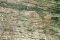
Dunes in the Caprivi Strip, satellite image (2012)

Main road through the Caprivi Strip (2011)

Military escort for a truck convoy through the Caprivi Strip (2002)


See also
Wachan Corridor - Comparable stretch of land in northeastern Afghanistan
literature
- Maria Fisch: The Caprivi Strip during the German period 1890-1914 (History, cultural traditions and innovations in Southern Africa vol. 2), Cologne 1996, ISBN 3-89645-050-6 .
- This: The South African military administration (1915–1920) and the early mandate period (1920–1936) in the Kavango region / Namibia (History, Cultural Traditions and Innovations in Southern Africa vol. 21), Cologne 2004, ISBN 978-3- 89645-360-0 .
- this: The Mbukushu in Angola. A History of Migration, Flight and Royal Rainmaking (History, Cultural Traditions and Innovations in Southern Africa vol. 11), Cologne 2005, ISBN 978-3-89645-350-1 .
Web links
Individual evidence
- ↑ Tourism in Focus , in: Invest Namibia Journal , Namibia Investment Center, March 2018.
- ^ Baseline Report (Volume 1) for the Zambezi Integrated Regional Land-use Plan. Ministry of Lands and Resettlement, March 2015.
- ↑ Markus M. Haefliger: The “Caprivi Strip” will be abolished - Namibia is renaming an administrative region and is losing its historical memory . In: Neue Zürcher Zeitung . No. 184 . Zurich August 12, 2013, p. 5 .
- ↑ Caprivi is no more. The Namibian, August 9, 2013.
- ^ Proclamation. Government Gazette of the Republic of Namibia, August 9, 2013, No. 5261.
- ↑ a b Die Welt from December 25, 2010
- ^ GMO Bulkeley: The Mandated Territory of South-West Africa . In: Ellen Hellmann, Leah Abrahams (Ed.): Handbook on Race Relations in South Africa . Cape Town, London, New York, Oxford University Press, 1949. p. 747
- ^ SAIRR : A Survey of Race Relations in South Africa 1972 . Johannesburg 1973. p. 446.
- ↑ a b Moser, J .: Studies on the history of cartography in Namibia, p. 122 ff
- ↑ Quoting from Article III of the German version of the Treaty between Germany and England on the Colonies and Heligoland (July 1, 1890)
- ↑ Namlex Index to Laws of Namibia. Legal Assistance Center, 2010, S. History 5.
- ^ Flags of the World - Caprivi African National Union
Coordinates: 17 ° 54 ′ 0 ″ S , 23 ° 36 ′ 0 ″ E