
Zambezi (region)
|
||||
| Basic data | ||||
|---|---|---|---|---|
| Regional capital | Katima Mulilo | |||
| Biggest town | Katima Mulilo | |||
| motto | ||||
| ISO 3166-2 | NA-CA | |||
| website | www.caprivirc.gov.na | |||
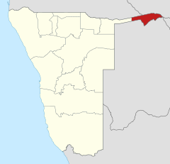
| Map of the region | ||||
  |
||||
| Inhabitants and geography | ||||
| population | 98,849 (2016) | |||
| Population density | 5.06 per km² | |||
| languages | English , Lozi | |||
| Geographic coordinates | 17 ° 49 ′ S , 23 ° 23 ′ E | |||
| surface | 19,532 km² | |||
| The highest point | - | |||
| Politics and administration | ||||
| Ruling party | SWAPO | |||
| Governor / in | Lawrence Sampofu | |||
| Distribution of seats in the regional council | SWAPO 8 | |||
| Constituencies | 8th | |||
| Last choice | 2015 | |||
| Next choice | 2020 | |||

.jpg)
Zambezi ( English Zambezi ; until August 8, 2013 Caprivi ) is one of the 14 administrative regions of Namibia .
The region includes a large portion of Caprivi (English Caprivi Strip ), an ear-shaped bulge of the territory in the northeast of the country, to the Sambesi ranges. The region therefore bore the name Caprivi until 2013, after Leo von Caprivi .
history
From 1918 to 1929 the Caprivi Strip was part of the British colony of Bechuanaland , today's Botswana . He was then reassigned to the mandate area of South West Africa, which had been under South African administration since 1920 . The apartheid regime established a semi-autonomous homeland in East Caprivi .
In 1990 Namibia gained independence and thus also power of disposal over the Caprivi Strip. In August 1999 armed clashes broke out in the provincial capital Katima Mulilo (possibly also supported by Botswana) between the secessionist movement "Caprivi Liberation Movement" (CLM) and the Namibian government . The aim of the smoldering conflict is the independence of the Caprivi from Namibia . The Caprivi was also a source of unrest due to the long civil war in Angola: after the official end of the fighting, dispersed units of the defeated UNITA flew through the region, plundering and terrorizing, and were persecuted there by both Angolan and Namibian troops . There were numerous raids, so that civil traffic came to a complete standstill or was only possible under military protection. Today the United Democratic Party - Caprivi Freedom is politically pursuing the achievement of greater autonomy for the Caprivi.
renaming
In July 2012, the Minister for Presidential Affairs introduced a proposal from the Namibian President to rename the Caprivi region to parliament. A name without colonial origins was to be found, the historical name Itenge was considered, among other things . On August 8, 2013, the name was changed to Zambezi.
geography

The administrative region of Zambezi borders the Cuando to the west of the Kavango-East region . Zambezi is bordered by Angola to the north, Zambia and Zimbabwe to the east, and Botswana to the south . It is the only region in Namibia that is almost exclusively in the tropics , it consists largely of flat marshland. Several year-round water-bearing rivers such as the Okavango , the Cuando and tributaries of the Zambezi run through the landscape, making it a particularly humid and therefore very game-rich region , especially during the rainy season from December to March.
population
Around four percent of the Namibian population live in the region. You belong u. a. the ethnic groups Mafwe , Lozi , Subia , San (Bushmen), Nyemba .
According to the 2011 census , 89.6 percent of the population of the SiLozi region speak as their main language. It is followed by the Kavango languages with 3.9 percent. Seven residents use German as their main language.
The Zambezi region has the highest AIDS rate in Namibia. Around one in four pregnant women is infected with HIV . Overall, 34 percent of the population living there are HIV positive. The medical infrastructure consists of a hospital in Katima Mulilo (220 beds) and Andara (100 beds), as well as 3 health centers and 29 clinics.
administration
.svg)
The Zambezi region is divided into eight constituencies :
- Judea Lyaboloma
- Kabbe North
- Kabbe south
- Katima Mulilo Land
- Katima Mulilo city
- Kongola
- Linyanti
- Sibbinda
There are also (as of December 2015) two local administrations in the region:
Economy and tourism
The Zambezi guarantees Namibia's access to the waters of the Okavango and is therefore important for the region's economy.
Large parts of the region are taken up by nature reserves and are therefore increasingly the target of tourist activities - a development that was promoted with the continuous asphalting of the national road B8 , which is now open all year round . It forms the starting point for trips to the Zambezi , the Victoria Falls and the Okavango Delta . The Liambezi Lake , the Caprivi National Park and the Mudumu National Park are also located here . The region is part of the planned Kavango-Zambezi Transfrontier Conservation Area .
Time zone
In the Zambezi, the statutory time regulation of Namibia applies with the exception that it does not switch to the otherwise usual winter time.
See also
Web links
- Zambezi Statistics Profile 2011 ; Namibia Statistics Agency , February 2014
Individual evidence
- ↑ Namibia Inter-censal Demographic Survey 2016 Report. Namibia Statistics Agency, November 21, 2017.
- ^ Media Briefing at State House by President Pohamba. Namibia Press Agency (Nampa), August 8, 2013
- ↑ Jan Poolman: Caprivi renaming raises hackles. The Namibian, July 30, 2012, accessed October 9, 2013 .
- ↑ President divides into two Kavango. New Era - Newspaper for a New Namibia (archived by allAfrica.com) , August 9, 2013, accessed on October 9, 2013 (English).
- ↑ 2011 Population and Housing Census Regional Profile, Zambezi Region. Namibia Statistics Agency, p. 40f. Retrieved June 11, 2020.
- ↑ New Scientist reported on July 14, 2007, p. 8 that in Caprivi "up to 48% of adults are HIV +" .
- ↑ Official election results of the regional and local elections 2015, ECN, December 4, 2015 ( Memento of December 10, 2015 in the Internet Archive ) (PDF; 150 kB)
