Bukalo
| Village Bukalo
|
|||
|---|---|---|---|
|
|||
| motto | |||
| Basic data | |||
|
Population Area Population Density |
|
||
|
State Region Constituency |
Namibia Zambezi Katima Mulilo Land |
||
| Establishment date | |||
|
License plate phone code |
KM (0) 66 |
||
| Website | |||
|
Geographical data
Geographic coordinates : 17 ° 42'15 "S, 24 ° 29'58" E Height : 750 m |
|||
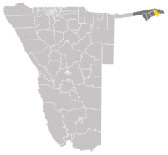
Bukalo is a village in the constituency of Katima Mulilo in the Zambezi region in the Caprivi Strip in Namibia . It is in close proximity to the Zambezi .
Bukalo is located between Katima Mulilo (23 kilometers away) and Ngoma (around 20 kilometers away) on the B8 national road .
It has schools, various supply facilities and a health center for the population of the surrounding area. The place is also known for the surrounding "Bukalo Forest" ( Afrikaans Bukalo Woud ).
status
Bukalo received in 1999 the status of a settlement (settlement) . Later it received the status of a village (Village) . 2013 Bukalo was for the city to some sources (Town) proclaimed, but both in 2015 in an official government announcement and claims to be from 2017 still a village.
Local politics
The following official final result was determined in the 2015 local elections .
| Political party | be right | Share of votes | Seats |
|---|---|---|---|
| SWAPO | 189 | 90.4% | 5 |
| DTA | 18th | 8.6% | 0 |
| NDP | 2 | 0.9% | 0 |
| All in all | 209 | 100% | 5 |
Individual evidence
- ^ Bukalo royal family in proclamation saga. The Namibian, January 26, 2015.
- ^ Government Gazette. Republic of Namibia, April 30, 2015, p. 3
- ↑ Official election result of the regional and local elections 2015, ECN, December 4, 2015 ( Memento of the original of December 10, 2015 in the Internet Archive ) Info: The archive link was inserted automatically and has not yet been checked. Please check the original and archive link according to the instructions and then remove this notice. (PDF; 150 kB)
Coordinates: 17 ° 42 ′ S , 24 ° 30 ′ E


