
Hardap
|
||||
| Basic data | ||||
|---|---|---|---|---|
| Regional capital | Mariental (Namibia) | |||
| Biggest town | Rehoboth | |||
| motto | Unity, Prosperity, Humanity | |||
| ISO 3166-2 | NA-HA | |||
| website | www.hardaprc.gov.na | |||
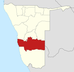
| Map of the region | ||||
  |
||||
| Inhabitants and geography | ||||
| population | 87,186 (2016) | |||
| Population density | 0.8 per km² | |||
| languages | Afrikaans , German , English , Khoekhoegowab | |||
| Geographic coordinates | 24 ° 34 ′ S , 17 ° 58 ′ E | |||
| surface | 109,888 km² | |||
| The highest point | 1,976 m ( Losberg ) | |||
| Politics and administration | ||||
| Ruling party | SWAPO | |||
| Governor / in | Solomon April | |||
| Distribution of seats in the regional council | SWAPO 7, UPM 1 | |||
| Constituencies | 8th | |||
| Last choice | 2015 | |||
| Next choice | 2020 | |||

Hardap ( Khoekhoegowab for "nipple" or "wart") is one of the 14 regions of Namibia . The name of the region comes from the Hardap Dam , the (as of June 2016) largest dam in Namibia . The regional capital is Mariental , which lies on the Fish River below the Hardap Dam; however, the largest city in the region is Rehoboth .
Hardap is one of the southern regions of the country and borders the ǁKaras region in the south and the Erongo , Khomas and Omaheke regions in the north . The region borders on the South Atlantic to the west and Botswana to the east .
geography

Hardap covers an area of around 110,000 square kilometers . The entire coast and large parts of the west of Hardaps are occupied by the Namib and are part of the Namib-Naukluft National Park , one of the largest nature reserves in Namibia . Sights like the Sossusvlei and the Sesriem Canyon are among the most important natural monuments in Namibia.
To the east of the Namib Desert, there are numerous mountain ranges such as the Tiras and Naukluft Mountains , which form parts of the Great Peripheral Step . The middle of Hardaps is crossed by the fish river and its tributaries from north to south . The east of Hardaps is characterized by the wide, mountainless Kalahari .
population
According to the 2011 census , 43.3 percent of the population of the Khoekhoegowab region speak as their main language. This is followed by Afrikaans with 41 percent and Oshivambo with 9.8 percent. 0.2 percent of the population use German as their main language.
Regional policy
In the 2015 regional council elections , SWAPO won seven of the eight regional council seats. One seat is taken by UPM .
Administrative division
.svg)
The Hardap region is divided into eight constituencies :
- Aranos
- Daweb
- Gibeon
- Mariental Land
- Mariental city
- Rehoboth land
- Rehoboth City (West) - UPM
- Rehoboth City (East)
There are also (as of December 2015) eight local administrations in the region:
Economy and population

Hardap is located in its core area on the main north-south axis between the Namibian capital Windhoek and the Karas regional capital Keetmanshoop and further to South Africa in the south. There is a well-developed railway connection and the B1 national road . Most of the towns, cities and businesses in the region lie along this axis. Due to the Hardap Dam near Marienthal , this area has an adequate water supply for irrigation agriculture . With the superfarm of the Namibia Dairies company , almost all of the milk and yoghurt comes from the region.
Hardap is also one of the regions in Namibia with the highest proportion of whites. Accordingly, there is hardly any other region in the country to find so many place and landscape names that are German or Afrikaans .
See also
Web links
Individual evidence
- ↑ Namibia Inter-censal Demographic Survey 2016 Report. Namibia Statistics Agency, November 21, 2017.
- ↑ Hardap Dam. I Dream Africa. Accessed January 30, 2018.
- ↑ http://www.namibia-tourism.com/
- ↑ Southern Region ( Memento from February 22, 2009 in the Internet Archive )
- ↑ 2011 Population and Housing Census Regional Profile, Hardap Region. Namibia Statistics Agency, p. 40f. Retrieved June 10, 2020.
- ↑ Official election result of the regional and local elections 2015, ECN, December 4, 2015 ( Memento of the original of December 10, 2015 in the Internet Archive ) Info: The archive link was inserted automatically and has not yet been checked. Please check the original and archive link according to the instructions and then remove this notice. (PDF; 150 kB)