
Limestone edge
| Village Limestone edge
|
|||
|---|---|---|---|
|
|||
.jpg) |
|||
| motto | - | ||
| Basic data | |||
|
Population Area Population Density |
|
||
|
State Region Constituency |
Namibia Hardap Rehoboth-Land |
||
| Establishment date | |||
|
License plate phone code |
|
||
| Website | |||
.svg) |
|||
|
Geographical data
Geographic coordinates : 24 ° 4'0 "S, 17 ° 35'0" E Height : |
|||


Kalkrand is a village in Namibia , around 100 kilometers southwest of the city of Rehoboth . Kalkrand is located in the Rehoboth-Land constituency at 1220 m , halfway between Rehoboth and Mariental . It is an important stop on the B1 national road as it is the only petrol station between the two cities. There is also a direct connection via the main road C21 to Maltahöhe, which is also around 100 km away .
The place and the surrounding area are characterized by agriculture.
Infrastructure
In addition to the gas station, the place has a clinic, several cafes, is a stop on the Windhoek – Nakop railway line and has a tourist center.
Educational institutions
- AA Denk Memorial School
- Gras Primary School
- Hoaganas AME Community Priv. School
- Kalkrand Primary School
- PJ Tsaitsaib Junior Secondary School
- St. Patrick's Primary School ( RKK Namibia )
Local politics
The following official final result was determined in the 2015 local elections .
| Political party | be right | Share of votes | Seats |
|---|---|---|---|
| SWAPO | 399 | 68.6% | 4th |
| RDP | 121 | 20.8% | 1 |
| APP | 36 | 6.2% | 0 |
| DTA | 26th | 4.5% | 0 |
| All in all | 582 | 100% | 5 |
gallery

Donkey cart in Kalkrand
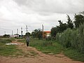
Path in Kalkrand


Web links
Individual evidence
- ↑ http://www.namibweb.com/kalkrand.htm
- ↑ Official election result of the regional and local elections 2015, ECN, December 4, 2015 ( Memento of the original of December 10, 2015 in the Internet Archive ) Info: The archive link was inserted automatically and has not yet been checked. Please check the original and archive link according to the instructions and then remove this notice. (PDF; 150 kB)
Coordinates: 24 ° 4 ′ 0 ″ S , 17 ° 35 ′ 0 ″ E