
Geography of Namibia


The geography of Namibia is essentially divided by three natural areas that run through the country from the Kunene River in the north to the Oranje River in the south: the coastal strip consisting of the Namib Desert and the Skeleton Coast , the Great Edge and the Inland Highlands ; The latter merges to the east into the Kalahari Basin .
Namibia is located in southern Africa between 17.5 ° and 29 ° south latitude and 12 ° and 25 ° east longitude and borders in the north on Angola , in the east on Zambia and Botswana , in the south on the Republic of South Africa and in the west on the South Atlantic . The entire national territory of Namibia covers around 824,292 km². The Kunene River in the northwest, the Okavango and Zambezi in the northeast and the Orange River in the south form natural borders . A special feature is the approximately 450 km long and up to 50 km wide Caprivi Strip , which not only occupies a special position in the national territory, but also has special geographical and climatic conditions.
Statistical data
| Data | |
|---|---|
| Geographic coordinates | 22 ° S , 17 ° E |
| Territory | 825,418 km² |
| territorial waters | 12 nm |
| Connection zone : 24 nm | |
| Exclusive economic zone : 200 nm | |
| State borders | 3824 km |
| see also Namibian border crossings | Angola 1376 km |
| Zambia 233 km | |
| Botswana 1360 km | |
| South Africa 855 km | |
| Coastline | 1572 km |
| Highest mountain | Koenigstein 2,573 m |
| Deepest depression | Atlantic 0 m |
| relief | Plains , plateaus , folded mountains , highlands |
| Forest and woodland | 22% |
| Land use and land consumption | 3.50% |
| see also Namibian Economy | Growing area 0.99% |
| Permanent culture 0.0% | |
| Irrigation cultivation 70 km² | |
| Natural resources |
Diamonds , copper , uranium , gold , lead , tin , lithium , cadmium , zinc , salt , vanadium , natural gas , wind power , fish |
| Environmental pollution | low water supplies and difficult water supply ; Desertification |
| Climate according to the effective climate classification | Desert climate , savanna climate , steppe climate , Etesia climate |
Natural spaces
Coastal strip
The Namibian coastal strip stretches from the mouth of the Oranje at Oranjemund to the mouth of the Kunene on the border with Angola . The main landscapes of the Namibian coast are the Diamond Restricted Area , the Namib Desert and the Skeleton Coast , all of which are very dry and arid areas due to the Benguela Current flowing here .
The barren coast has only a few islands, peninsulas or bays. Only notable exceptions are the Lüderitz in Lüderitz and Walvis Bay in Walvis Bay and the so-called Cold Bay at Cape Frio . The only islands are the Namibian Penguin Islands , a series of small islands of which Hollam's Vogel Island is the largest with 0.65 km².
Satellite image of Walvis Bay

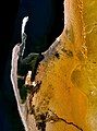
Bogenfels in the restricted diamond area

Colony of South African fur seals at Cape Cross

Dune 7, the highest sand dune in the world

.jpg)


The arid coastal strip stretches over a length of 2000 km, but only 80 to 130 km wide, from southern Angola to the South African province of North Cape and only rises slowly from sea level to around 600 m. In the north the coastal strip is predominantly stony, partly rocky, in the south predominantly sandy desert (especially south of the dry river Kuiseb ) with large shifting dunes up to 300 m high.
Large edge step
The Great Peripheral Step runs through Namibia from north to south as one of the three predominant landforms and separates the coastal plain from the inland highlands.
The part of the country to the west of the peripheral step , close to the coast, stretches as an approximately 2000 km long, but only 80 to 130 km wide strip from southern Angola to the South African province of North Cape and essentially corresponds to the area of the coastal plain. This coastal strip is mainly occupied by the Namib Desert and only rises slowly from the sea level to 600 m. In the north the coastal strip is predominantly stony, partly rocky (see Skeleton Coast ) and in the south predominantly sandy desert (especially south of the dry river Kuiseb ) with large shifting dunes up to over 300 m high.
The large marginal step joins the coastal strip to the east as a steep ascent, which leads up to a stratification level reaching up to over 2000 m above sea level . In the north, between the Kunene and Huab rivers, the Great Marginal Stage is formed by the Hartmann , Baynes and Joubert Mountains , and in the south by the Khomashochland , the Rantberge , the Naukluftberge as well as the Tsarisberg , Schwarzrand and Tirasberg . Broad and deep river valleys facing the coast cut through the Great Rim and open it to the Namib. In central Namibia, in the area of the 19th to 23rd parallel, the edge step is eroded and interrupted over several hundred kilometers: the so-called edge step gap . It is replaced by a sloping, continuously rising plain and the terrain rises continuously to the level of the inland highlands (compare also lunar landscape ). Outside the large marginal step are the Brandberg massif , the Erongo mountains and individual island mountains such as the Small and Large Spitzkoppe . From the Naukluft Mountains to the Oranje River , the Great Edge Step runs over 400 km in north-south direction as a layer step ( red edge) and on the edge of the diamond restricted area the granite mountains of the Great Edge Step rise from the wide plains of the Namib.
Hartmannberge with fairy circles in the foreground
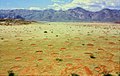
Kaokoland (August 2006)


Fish River Canyon
Inland highlands
Towards the east, the Great Marginal Step gradually descends into the mountainous lands of the Randschwelle and the central inner-African highlands and merges into the sand-filled Kalahari Basin, which belongs to the central basin landscape of southern Africa. In the north, the inland highlands are criss-crossed by wide valleys and are relatively fertile. In terms of mountains, the Waterberg and the Otaviberge should be mentioned. In the center of Namibia, between the Namib deserts in the west and the Kalahari in the east, lies the average 1700 m high Khomashochland and the up to 2400 m high Auas Mountains and Eros Mountains. The capital of Namibia is located in the Windhoek Basin at around 1600 m. In the south of Namibia, the highlands are mostly flat and the landscape is only structured by a few deep valleys. Exceptions are the Great Karas Mountains and individual mountain massifs of volcanic origin, such as the Brukkaros .

Fish River Canyon satellite image


Etosha pan
Caprivi
The flat Caprivi lies between the Okavango and Zambezi rivers and is the only region of Namibia with a subtropical and tropical climate. The Linyanti constituency in particular has been affected by the floods of the Cuando . The three national parks Mudumu , Mamili and Caprivi National Park are located in Caprivi .
Kalahari
Water regions

The water regions in Namibia are divided by the catchment areas of the rivers in Namibia . The Oranje Water Region and Kalahari Fish River Water Region in southern Namibia and the Kunene, Oshana, Okavango and Zambezi water regions in northern Namibia form the most important water resources in Namibia. The fish river is dammed near Mariental by means of the Hardap dam , the largest dam in Namibia . Other significant dams are the Naute Dam at Keetmanshoop and the Oanob Dam at Rehoboth .
The Namib water region in central Namibia (with the Kuiseb and Swakop rivers ) and the North Kalahari water region (with the Nossob and Omatako rivers ) only carry water sporadically and are important for the region's drinking water supply - the Swakoppforte Dam and the dam are important dams Von Bach dam , both near Okahandja .
Nature reserves

Nature conservation is very important in Namibia and is enshrined in the country's constitution. The environmental policy of Namibia focuses on the preservation of biodiversity and biodiversity and overall ecological balance between humans, animals and plants; the individual directorates of the Ministry of Environment and Tourism set up for this purpose serve to protect and preserve the country's natural resources .
See also
- List of mountains in Namibia
- List of mountain passes in Namibia
- List of mountains in Namibia
- List of rivers in Namibia
- List of dams in Namibia
- List of lakes in Namibia
- List of localities in Namibia
literature
- Steffen Niemann: Water supply and water use in Namibia . Institute for Africa customer , Hamburg 2000, ISBN 978-3-928049-68-9 .
- Klaus Hüser: Namibia: A landscape in pictures . Hess Verlag, Göttingen 2001, ISBN 978-3-933117-14-4 .
Web links
- Digital Atlas of Namibia from the University of Cologne
- Faculty of Agriculture and Natural Resources at the University of Namibia
- Geological Survey of Namibia , Ministry of Mines and Energy
- Namibia online travel guide: geography
Individual evidence
- ↑ Archive link ( Memento of the original from August 21, 2008 in the Internet Archive ) Info: The archive link was inserted automatically and has not yet been checked. Please check the original and archive link according to the instructions and then remove this notice.
- ↑ http://www.iiasa.ac.at/Research/POP/pde/briefs/na-geo.html International Institute for Applied Systems Analysis ( IIASA )
- ↑ CIA World Factbook: Namibia (English)
- ↑ Archive link ( Memento of the original from April 23, 2011 in the Internet Archive ) Info: The archive link was inserted automatically and has not yet been checked. Please check the original and archive link according to the instructions and then remove this notice.
- ^ The Ugab Terraces in West Namibia Research project of the University of Heidelberg
- ↑ Land use comparison Namibia, Christina Wolkenhauer, Institute for General Botany, Department of Biology, Hamburg 2003 ( Memento of the original from October 4, 2009 in the Internet Archive ) Info: The archive link was inserted automatically and has not yet been checked. Please check the original and archive link according to the instructions and then remove this notice.
- ↑ Archive link ( Memento of the original dated August 10, 2009 in the Internet Archive ) Info: The archive link was inserted automatically and has not yet been checked. Please check the original and archive link according to the instructions and then remove this notice. Nature conservation in the Basic Law, Namibian Embassy in Berlin
54 African member states of the United Nations :
Egypt |
Algeria |
Angola |
Equatorial Guinea |
Ethiopia |
Benin |
Botswana |
Burkina Faso |
Burundi |
Djibouti |
Ivory Coast |
Eritrea |
Gabon |
Gambia |
Ghana |
Guinea |
Guinea-Bissau |
Cameroon |
Cape Verde |
Kenya |
Comoros |
Democratic Republic of the Congo |
Republic of the Congo |
Lesotho |
Liberia |
Libya |
Madagascar |
Malawi |
Mali |
Morocco |
Mauritania |
Mauritius |
Mozambique |
Namibia |
Niger |
Nigeria |
Rwanda |
Zambia |
São Tomé and Príncipe |
Senegal |
Seychelles |
Sierra Leone |
Zimbabwe |
Somalia |
South Africa |
Sudan |
South Sudan |
Swaziland |
Tanzania |
Togo |
Chad |
Tunisia |
Uganda |
Central African Republic
Other areas:
Ceuta and Melilla |
Canary Islands |
Mayotte |
Reunion
Disputed areas:
Puntland |
Somaliland |
Western Sahara
Geography of the States of:
Asia |
Europe |
North America |
Oceania |
South America