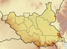
Geography of South Sudan
The geography of South Sudan is predominantly characterized by floodplain and marshland, with the Sudd representing the largest contiguous marsh landscape. In the north, the savannah landscape determines the picture, which borders on the rainforest zone from the middle . The country is part of the greater Sudan landscape .
The height division is from the basin landscape of the Nile determined and its mountain ranges. The western edge of the basin is represented by the North Equatorial Sill and the Central African Sill , which also form the watershed between the Nile and Congo systems . In the east the terrain begins to rise towards the Ethiopian highlands, and in the south on the border to Uganda the Imatong Mountains rise up with the highest mountain in South Sudan, the Kinyeti .
climate
The climate in South Sudan is, generally speaking, tropical to randtropisch . As in all tropical climates, there is also a rainy season here . South Sudan, especially Bahr al-Ghazal and the Sudd, are characterized by a humid, tropical climate in summer. The winter half of the year is hot in this region, with daytime temperatures around 36 ° C to occasionally 40 ° C. At night it cools down to 20 ° C. The summer months are characterized by a rainy season of up to eight months, which pushes temperatures to 30–33 ° C. During the nights it stays warm (21-23 ° C). This time is humid due to the high humidity (70–80%). The heavy rains usually take place from the end of April to the beginning of October, with the peak in July and August, when it can rain up to 18 days a month. The total amount of precipitation is between 700 and 1100 mm.
Hydrology
South Sudan is only determined by the hydrology of the Nile (excluding the Ilemi triangle ). The border with the Central African Republic is practically congruent with the catchment area border with the Congo . Here is also the region with the most rainfall in the otherwise arid country. The evaporation is so high that endorheic depressions such as the Ambadi , the Abu Shanab or the Maleit Lake have formed between the Sudd and the swamps of the Bahr al-Ghazal system .
There are three distinctive hydrological variables to be mentioned:
- The catchment area of the Bahr al-Ghazal, which is the largest sub-basin of the Nile in terms of area, but contributes little water to the Nile due to the high level of evaporation.
- The Sudd , which is one of the largest wetlands in the world.
- The Sobat catchment area, comes from Ethiopia and contributes about 10% of the water to the Nile at the mouth.
See also
Web links
- Andrew Nam Odero / FAO : Livelihood Characterization of South Sudan: The use of physiographic and agro-climatic layers. (PDF file; 807 kB)


