Geography of sudan
The geography of Sudan is characterized by the gradual transition from a practically precipitation-free desert region of the Nubian and Libyan deserts in the north and in the center and a savannah landscape in the south . The country is part of the greater Sudan landscape and the Sahel zone .
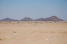
The height division is from the basin landscape of the Nile determined and its mountain ranges. In the northeast rises the mountains of the Jibal al-Bahr al-ahmar on the Red Sea , which reaches a height of 2259 m. In the west rises a basalt mountain range on the Marra plateau , the highest point of which is Mount Marra at 3,088 m and forms the geographical border with the Chad Basin . In the south rise the Nuba Mountains , which are between 500 m and 1325 m high. In the north, the country merges into the Sahara on both sides of the Nile , with the part west of the Nile known as the Libyan Desert and the part east of the Nile as the Nubian Desert . In the region around Khartoum , where the White Nile and Blue Nile flow together to form the actual Nile, wide, flat clay plains spread out.
climate
The climate in Sudan is, generally speaking, tropical to randtropisch . Roughly, it can be said that it is always warm to hot in Sudan, and that precipitation increases from north to south. As in all tropical climates, there is also a rainy season here , although it is only worth mentioning in the extreme south.
A more detailed description of the climate can in any case be based on four main climatic areas in Sudan. In the far north and in the entire north-west, for example, you will find an ever-dry desert climate that is shaped by the Sahara. The center of the country is divided into a dry and hot area and a moderately hot and humid area. Another different climatic area is the coastal strip along the Red Sea. Only in the extreme south are there sometimes more humid tropical zones.
Always dry desert climate
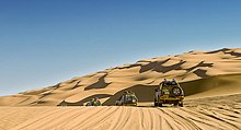
The north and northwest of Sudan borders the Sahara and is divided into two main sections of the desert: the Nubian Desert and the foothills of the Libyan Desert . This region is characterized by mild winters and hot summers, whereby the daytime temperatures in summer can exceed 50 ° C, while in the winter half of the year the nights are often very cool. All year round, there are considerable temperature fluctuations between day and night, which can be up to 30 ° C, for example when the thermometer falls to almost 0 ° C at night in February and then rises to 25 ° C and more during the day. The winters are generally quite pleasant, with temperatures averaging 6 to 12 ° C at night and 20-27 ° C during the day. From mid-April, however, the long, hot and dust-dry summer begins, which lasts until mid-October. The average values for this are 20–26 ° C at night and 37–43 ° C during the day. The humidity is low to moderate at 30–40% in winter and very low (10–25%) in summer, which makes the heat somewhat more bearable. In addition, the area is practically without any rain. It can happen that not a drop of rain falls for years. The number of days with some precipitation usually fluctuates between 0 and 4 mm per year. Another characteristic of this region are the sometimes severe dust and sand storms, known as habub , which occur especially in spring and autumn . This climate refers to cities like Wadi Halfa , Abu Hamad , Kerma and Bir al-Altrun .
Dry hot area
The center of the country from the Jazira Plain in the south to the Butana region in the east is characterized by a dry, hot climate that is no longer exclusively desert. It is hot here all year round, but there is one special feature: the climate diagrams show a two-wave curve: in winter you have to reckon with average day and night temperatures of around 16 and 31 ° C. After a rapid rise in temperature in March, spring becomes the hottest period with 40–43 ° C during the day (peak values around 47 ° C) and around 27 ° C at night. This is followed by a noticeable drop in temperature in midsummer, when the foothills of the rainy season in the south are noticeable, while in autumn the daily values climb again to 40 ° C. In the nights it is still warm with around 25 ° C before it gets a little cooler in November. The air humidity is low all year round (10–30%) and only increases slightly in July and August. The precipitation is kept within limits and mostly reaches just under 200 mm, which corresponds to about 15 rainy days a year, which are almost exclusively limited to the summer. Early summer and autumn are the time of dust and sand storms (habub). This climate applies to the capital Khartoum , Atbara , Kassala and similar.
Moderately hot and humid area
Not far from the area described above is the southwest of Sudan, which extends from Kurdufan in the center to Darfur in the west. Its climate is very similar to that of the neighboring north-eastern center, with the exception of slightly more moderate temperatures and noticeably higher rainfall. Winters are warm (14 ° C at night, 30 ° C during the day), spring is the hottest time (20–24 and 36–40 ° C), followed by summer with occasional rain at 31–33 ° C during the day. The nights stay warm at this time (22 ° C). Autumn usually records a slight increase in temperature to 36 ° C during the day with constant nighttime values, before winter brings some moderation into the temperature game again. The humidity is already higher here and rises to 70% in summer, which makes the 33 ° C almost unbearable than, for example, the 38 ° C in dry May. The rain amounts between 400 and 500 mm and are significantly higher than in the greater Khartoum area. This climate can be found, for example, in the cities of Al-Ubayyid , an-Nahud or Nyala .
Coastal strip

The eastern climatic region in Sudan is limited to the narrow coastal strip on the Red Sea. In addition to the port city of Port Sudan, there are only smaller towns in this region, such as at-Taib in the south, the former port city of Sawakin and Aidhab on the Egyptian border. This area is warm in winter and hot in summer. In January and February the temperatures are between 26 and 27 ° C during the day and around 19 ° C at night without any major fluctuations. The summers are hot and humid with daily averages around 40 ° C (peaks up to 47 ° C), although it hardly cools down in the nights (28–30 ° C). The air humidity is relatively high all year round (50–75%). In addition to the summer rainy season, short, heavy rains are also possible on the coast in November and December, the dry season in the rest of the country. The sea is warm all year round at 25–31 ° C.
Hydrology
From a hydrological point of view, Sudan is predominantly influenced by the Nile. Most of the East African country is in its catchment area. However, the Nile in Sudan loses water primarily due to the desert climate. Almost all of the water comes from either equatorial Africa or Ethiopia . There are also some coastal rivers, which are mostly dry due to the high aridity . In the west of the country there are connections to the Chad Basin and other endorheic basins.
See also
Web links
- Andrew Nam Odero / FAO : Livelihood Characterization of South Sudan: The use of physiographic and agro-climatic layers. (PDF file; 807 kB)


