Black border
| Black border | ||
|---|---|---|
|
26 ° 26'56 "N 017 ° 16'31" E View from theD430over the Schwarzrand towardsBethanie |
||
| Highest peak | XXXXX ( 2347 m ) | |
| location | Hardap and ǁKaras , Namibia | |
|
|
||
| Coordinates | 26 ° 1 ′ S , 17 ° 10 ′ E | |
| particularities | Part of the great marginal step | |
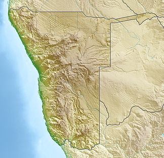
The Black Edge , rarely also the Hanam Plateau , is a break-off edge as part of the Great Edge Step in Namibia . On the high plateau of the Black edge arise numerous Riviere such. B. the Konkiep and the Gurieb , which flow endorheically towards the west .
literature
- Herbert Abel : Contributions to the morphology of the large marginal stage in southwest Africa , Trüjen 1959.
Individual evidence
- ↑ Namibia Travel Map . Kunth-Verlag, Munich 2017, ISBN 978-3-95504-578-4 .
- ↑ Hanam Plateau. GetAMap.net. Retrieved November 7, 2017.
- ^ Black border: Namibia. National Geospatial-Intelligence Agency, Bethesda, MD, USA. Retrieved November 7, 2017.
![26 ° 26'56 ″ N 017 ° 16'31 ″ E-26.44888888888917.275277777778 View from the D430 over the Schwarzrand towards Bethanie [1]](https://upload.wikimedia.org/wikipedia/commons/thumb/e/e0/Schwarzrand.jpg/324px-Schwarzrand.jpg)
