Road system in Namibia
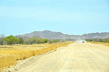
The entire Namibian road network is (as of September 2017) 48,875.27 kilometers long and largely categorized according to the road surface and the number of lanes . According to the World Economic Forum, it is (as of 2020) the best road network in Africa and ranks 21st worldwide.
Road surface types
The road pavements consist of the following types of road surface ( as of September 2017 ) :
- Bitumen pavement: 7892.8 kilometers (km)
- Gravel base: 26,046.6 km
- Salt base: 299.9 km (especially the C34 )
- Earth and sand base: 13,315.6 km
- Others: 1,320.6 km
By regions
| region | Bitumen (in km) |
Gravel (in km) |
Salt (in km) |
Earth (in km) |
Others (in km) |
Total (in km) |
Road kilometers (per 1000 km²) |
|---|---|---|---|---|---|---|---|
| Erongo | 466.9 | 1748.3 | 269.9 | 1025.7 | 14.2 | 3524.98 | 55.5 |
| Hardap | 654.7 | 4566.4 | 0.0 | 1358.9 | 0.0 | 6597.95 | 59.9 |
| ǁKaras | 1314.7 | 4989.0 | 5.0 | 1347.9 | 2.1 | 7658.62 | 47.6 |
| Kavango East | 344.4 | 465.9 | 0.0 | 673.2 | 82.5 | 1656.95 | 64.7 |
| Kavango West | 428.0 | 218.8 | 0.0 | 629.3 | 24.3 | 1300.41 | 56.0 |
| Khomas | 361.8 | 1729.0 | 0.0 | 666.2 | 70.9 | 2827.85 | 76.8 |
| Kunene | 515.5 | 2644.1 | 25.0 | 1524.5 | 186.6 | 4895.68 | 33.9 |
| Ohangwena | 359.2 | 316.9 | 0.0 | 350.2 | 303.5 | 1329.71 | 125.4 |
| Grandmaheke | 445.4 | 2974.1 | 0.0 | 2055.0 | 33.6 | 5508.09 | 73.8 |
| Omusati | 726.4 | 486.8 | 0.0 | 750.6 | 261.8 | 2225.58 | 163.2 |
| Oshana | 129.2 | 261.7 | 0.0 | 178.2 | 182.6 | 751.78 | 141.8 |
| Oshikoto | 513.3 | 934.2 | 0.0 | 328.9 | 12.6 | 1789.06 | 67.3 |
| Otjozondjupa | 1137.6 | 4454.0 | 0.0 | 1702.6 | 66.1 | 7360.35 | 69.9 |
| Zambezi | 504.7 | 257.4 | 0.0 | 697.4 | 79.8 | 1539.26 | 78.8 |
Street types and numbering
General:
- A roads are motorways with at least two lanes in each direction and are always paved. These were first introduced in January 2017.
- B-roads are national roads , at least two lanes and paved.
- C-roads (now also MR-roads ) are main roads and are partly asphalted, otherwise with a gravel base layer.
- D-roads (new DR-roads for English District Roads ) are gravel roads with varying degrees of maintenance; in a few exceptional cases (DR3608, D1526, D826 between C19 and Sesriem) also paved.
- M-streets (new MR-streets for English Main Roads ) replace or partially supplement the names of C- and D-streets and are laid out across borders, similar to a European street.
- P-roads (now F-roads ) are narrow and not regularly maintained private access roads to farms that are not directly accessible via one of the other road numbers.
A, B, C and D and M public roads are operated by the Roads Authority .
The dirt roads can be made of gravel, sand or salt.
The term pad ( Afrikaans for road ) in Namibia describes any type of road regardless of the surface. So there are z. B. "tar pads", but also "sand" and "salt pads".
Highways
Motorways ( English Freeway ) have existed in Namibia since 2017 with the completion of the first section between Windhoek and Okahandja . A motorway in Namibia always has at least two lanes in each direction.
| National road | End point 1 | End point 2 | length | map | image |
|---|---|---|---|---|---|
| A1 motorway | Windhoek | Okahandja (planned destination) | 50 km completed (as of July 2019) |

|

|
| A2 motorway | Swakopmund | Walvis Bay (planned destination) | under development | ||
| Autobahn A? | Windhoek | Hosea Kutako International Airport (planned destination) | under development (50 km) since November 18, 2019 |
National roads
National roads ( English National road ) are in Namibia's major roads for long distance service. They are paved , mostly two-lane main roads. They are the main traffic axes of the country and there are currently eight national roads, which are designated with a B and a number. The street symbols are pentagonal and green with a yellow border, the writing on them is also in yellow.
| National road | End point 1 | End point 2 | length | map | image |
|---|---|---|---|---|---|
|
National road B1, partly motorway A1 |
Noordoewer - border to South Africa - connection to the N7 |
Oshikango - border to Angola - connection to EN120 |
1600 km |

|
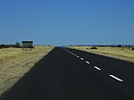 at Mariental |
| National road B2 |
Walvis Bay - end point of the TCH - end point of the TKH |
Okahandja - following the |
327 km |

|

|
| National road B3 |
Grünau - connection to the |
Ariamsvlei - border to South Africa - connection to the N11 |
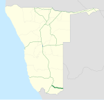
160 km |
|
 Course of the road near Ariamsvlei |
| National road B4 | Luderitz |
Keetmanshoop - following the |
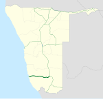
330 km |
|
 near Lüderitz |
| National road B6 |
Windhoek - connection to the |
Buitepos - Botswana border |
290 km |

|
 at Witvlei |
| National road B8 |
Otavi - connection to the |
Katima Mulilo - border to Zambia |
930 km |

|
 in Bwabwata National Park |
| National road B10 |
Ohangwena - connection to the - border to Angola |
Rundu - connection to the - border to Angola |
412 km |
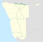
|
|
| National road B11 | between Mpoto and Silikunga - connecting to the |
Nkurenkuru - connection to the |
53 km |

|
|
| National road B14 |
Grootfontein - connection to the |
Gobabis ( planned until Aranos ) [obsolete] - connection to the |
391 km (+289 km planned) |

|
 south of Grootfontein |
| National road B15 |
Tsumeb - connection to the |
Katwitwi - border to Angola |
210 km |

|
 18 ° 17'29.8 "S 017 ° 59'57.1" E |
Main streets
Main roads in Namibia are second-order main roads and are partly paved , but mostly unpaved. The unpaved sections are usually provided with a gravel base layer. The main streets are marked with a C and a consecutive number, the street symbols are rectangular and green, the writing on them is yellow.
Examples of back roads
In Namibia, secondary roads are unpaved roads of categories D (or DR ) and M (or MR ). Category F roads (formerly P ) are also included.
| Back road | End point 1 | End point 2 | length | photo |
|---|---|---|---|---|
| D707 |
C27 25 ° 32'13 "S 016 ° 19'16" E |
C13 26 ° 15'04 "S 016 ° 35'09" E. |
122 km |
|
|
D826 (in parts also main road C27 ) |
C19 -24.449677 15.909768 |
4x2 parking lot at Sossusvlei -24.729827 15.319538 |
75 km |

|
| D1001 |
C22 23 ° 56'25 "S 019 ° 18'03" E. |
D1046 23 ° 55'24 "S 019 ° 55'43" E |
65 km |
|
| D1237 |
B1 |
C26 |
43 km |
|
| D1984 |
C28 22 ° 41'16 "S 014 ° 35'11" E |
C14 22 ° 58'59 "S 014 ° 35'47" E |
33 km |
|
| D1985 |
C28 22 ° 52'02 "S 015 ° 43'07" E. |
D1982 23 ° 03'28 "S 015 ° 43'00" E |
22 km |
|
| D2612 |
C39 |
C35 |
77 km |
|
| D3819 |
C22 (Onderombapa) 23 ° 08'57 "S 019 ° 33'22" E |
D3820 23 ° 02'27 "S 019 ° 54'55" E |
41 km |
|
| M39 |
C20 |
D1099 at Union's End |
115 km |
|
| M118 |
Oranjemund |
C13 at Rosh Pinah |
79 km |
|
Corridors of the Walvis Bay Corridor Group
according to the WBCG:
- Walvis Bay-Ndola-Lubumbashi Development Road (formerly Trans-Caprivi Highway or Trans-Caprivi Corridor )
- Trans-Cunene Corridor (also Trans-Cunene Highway )
- Trans-Kalahari Corridor (also Trans-Kalahari Highway )
- Trans-Oranje Corridor (also Trans-Oranje Highway )
Inner city streets
Important inner-city roads in Namibia are among others
- Independence Avenue (formerly Kaiserstrasse ) in Windhoek
- Robert Mugabe Avenue (formerly Leutweinstrasse and Joan Harrison Street ) in Windhoek
- Sam Nujoma Avenue (formerly Curt von François St ) in Windhoek
- Sam Nujoma Avenue (formerly Kaiser-Wilhelm-Strasse ) in Swakopmund
Remarks
- ↑ Note: This article contains characters from the alphabet of the Khoisan languages spoken in southern Africa . The display contains characters of the click letters ǀ , ǁ , ǂ and ǃ . For more information on the pronunciation of long or nasal vowels or certain clicks , see e.g. B. under Khoekhoegowab .
See also
literature
- Uwe Jäschke, Nils Bruzelius, Günter Seydack et al : History of the Namibian Road Sector. Roads Authority, Windhoek 2011, ISBN 978-99945-71-48-2 .
Web links
- Namibian Road Authority
- Klaus Dierks : Paths, pads and highways, traffic routes open up a deserted country
- Klaus Dierks: Namibian Roads in History: From the 13th Century till Today , Johann Wolfgang Goethe University Frankfurt am Main , 1992, foreword by Samuel Nujoma
- Detailed road map of Namibia
Individual evidence
- ^ Namibia's Roads still the Best on the Continent. Roads Authority, June 21, 2020 (PDF)
- ↑ Road Referencing System. Roads Authority of Namibia, September 5, 2017.
- ↑ Big mileage targets up to 2018. Allgemeine Zeitung, April 1, 2016. ( Memento from April 1, 2016 in the Internet Archive )
- ↑ B1 becomes A1, green becomes blue: New standard for "Freeways". Allgemeine Zeitung, January 6, 2017.
- ↑ Phase 2A of Hosea Kutako dual-carriageway construction launched. Namibia Press Agency, November 18, 2019.
- ↑ Namibia map north. Namibia-Forum.ch, date unknown ( memento from August 29, 2014 in the web archive archive.today ), accessed on August 29, 2014
- ↑ road to Katwitwi on track - Allgemeine Zeitung, April 2nd, 2013, page 3
- ↑ http://www.wbcg.com.na/corridors.html


