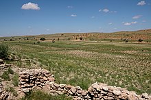
Union's End
Union's End (also Unions End ) is the geographical name for a locality in the border triangle of Namibia , South Africa and Botswana and thus for the outermost northwestern area of South Africa. The border between South Africa and Botswana ends here in its western section .
description
Union's End is located in the Kgalagadi Transfrontier National Park and in the local community of Dawid Kruiper in the ZF Mgcawu district .
The name refers to a small area of landscape in the flat sediment plain of the dry Nossob valley. It is marked by a group of trees, a sign for tourists and a sign with information on directions and distances to the capitals of the three states. There is no longer a border crossing here and passage to Namibia is prevented by a wire fence . Driving on to Botswana is prohibited by a blocking sign.
The name is derived associatively (“the end of the Union”) from the state area of the former Union of South Africa in the Kalahari region , which ends here at an acute angle , and because its outermost border crossing existed here.
A border guard was supposed to be set up here to combat poaching in 1934. However, the proposal was dropped for financial reasons. A water hole was dug nearby for travelers in 1936. The border passage between the Union of South Africa and what was then South West Africa had been blocked here since 1938. The border fence separated the Kalahari National Gemsbok Park, established in 1931, from South West Africa . Its total length was not completed until 1966.
particularities
Trees of the species Acacia erioloba E. Mey grow in the vicinity of Union's End , as well as in the entire valley of the Nossob . ( Camel thorn acacia ). According to a study by botanists at the University of Pretoria in 2008, the trees in the area may be more than 200 years old in some cases.
Transport geographic reference to Namibia
The border with Namibia runs strictly linearly in north-south direction along the 20th east longitude and is secured with a wire fence. From the direction of Gochas and from Akanous in the dry bed of the Nossob, a dirt road (M39) leads up to the border triangle, the route of which runs in South Africa to Gemsbok and further towards Upington .
Transport geographic relation to South Africa
At the informal settlement of Andriesvale , the R360 branches off from the R31, which leads west to the South African-Namibian border crossing in Rietfontein . This follows the dry valley of the Nossob upstream, passes the small settlement Twee Rivieren with the main entrance to the Kgalagadi Transfrontier National Park , where the road branches at the north exit of the group of houses. The road that crosses from the mouth of the Auob valley to the west through its dry valley and dune landscape leads to the South African-Namibian border crossing at Welverdiend . However, continuing upwards in the valley of the Nossob and touching the camp of the same name, the road marked as a lane in the underground finally reaches the locality Union's End .
Geographical traffic relation to Botswana
Union's End cannot be reached from the Botswana side by any paved road. From the north, however, a lane pulls up to this point, which runs directly parallel to the Namibian border fence.
Web link
Individual evidence
- ↑ Sign on the signpost for Union's End, spelling without an apostrophe
- ↑ Adventure Radio Club ZS1ARC: Union's End expedition. Special Event Field Station. 09-11 August 2013 . on www.qsl.net (English)
- ↑ a b Notes from Africa: Borders and Border Posts . on www.notesfromafrica.wordpress.com (English)
- ↑ Union's End . on www.tracks4africa.co.za (English)
- ↑ Carol Judith Steenkamp et al .: Age determination of Acacia erioloba trees in the Kalahari . In: Journal of arid environments, Vol. 72 (2008), No. 4, pp. 302-313. online at www.repository.up.ac.za (English)
Coordinates: 24 ° 46 ′ 4.2 ″ S , 19 ° 59 ′ 58.3 ″ E

