Witvlei
| Village Witvlei ! Khuri! Khubis ( naq )
|
|||
|---|---|---|---|
|
|||
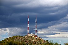
| Witvlei - View in north direction of the properties on the B6 national road | |||
| motto | - | ||
| Basic data | |||
|
Population Area Population Density |
around 2000 |
||
|
State Region Constituency |
Namibia Omaheke Okorukambe |
||
| Establishment date | |||
|
License plate phone code |
|
||
| Website | |||
|
Political data
Chief Executive Officer : Magdalena Oais (temporarily) Last election: 2015 Next election: 2020 City administration address: |
|||
|
Geographical data
Geographical coordinates : 22 ° 24′35 "S, 18 ° 29′30" E Height : 1455 |
|||
Witvlei , originally in Khoekhoegowab ! Khuri! Khubis , is a village and constituency seat of the constituency of Okorukambe in the Omaheke region in Namibia . The place is about 150 kilometers east of Windhoek on the national road B6 and about 50 kilometers west of Gobabis .
The name “Witvlei” is Afrikaans and means something like white pan , whereby “ vlei ” refers to a salt or mineral pan that is only filled with water during the rainy season. The historical name has the same meaning.
Witvlei is 1455 m above sea level and has about 2000 inhabitants.
politics
The Witvlei Village Council consists of five members, three of whom belong to SWAPO and one each from UDF and DTA.
Local government
The following official final result was determined in the 2015 local elections .
| Political party | be right | Share of votes | Seats |
|---|---|---|---|
| SWAPO | 344 | 60.2% | 3 |
| UDF | 125 | 21.9% | 1 |
| DTA | 72 | 12.6% | 1 |
| RDP | 17th | 2.9% | 0 |
| NUDO | 13 | 2.3% | 0 |
| All in all | 571 | 100% | 5 |
Culture and sights
The place is also known for its biennial carnival, the second largest in Namibia .
history
Witvlei is one of the oldest settlements in Namibia and was the scene of a battle between Herero and Nama in 1864.
As in many other places, different residential areas were created in Witvlei during apartheid for the black and white population, which are still visible today. In addition to the center on the Transkalahari Highway, a second settlement area with small parcels extends about 1 km south between D1800 and D1793. The development differs greatly in the two areas, the latter being characterized by smaller accommodations and corrugated iron buildings.
Economy and Infrastructure
Until November 2014 Witvlei Meat was the town's largest employer. However, the company ceased operations and laid off 200 local workers after the company lost a major contract with Norway . As a result, unemployment rose rapidly, which had consequences for the retail trade and the local school. The economy in Witvlei includes a taxidermist as well as smaller shops and stalls.
The Uri company premises , where the only Namibian civilian vehicle, the “Uri”, was manufactured, was also located in Witvlei .
The White Nossob flows through Witvlei , a dry river that carries water during heavy rainy seasons. Therefore, the groundwater supply in the place is usually secured.
Witvlei owns a train station, gas station, clinic, football stadium, runway for small aircraft, police station, post office and church. The Nossob Combined Primary School, a student home and a small kindergarten are also located in the village.
Remarks
- ↑ Note: This article contains characters from the alphabet of the Khoisan languages spoken in southern Africa . The display contains characters of the click letters ǀ , ǁ , ǂ and ǃ . For more information on the pronunciation of long or nasal vowels or certain clicks , see e.g. B. under Khoekhoegowab .
Web links
Individual evidence
- ↑ Witvlei battling economic hardship. Namibia Press Agency, December 5, 2018.
- ↑ Namibia Travel Map . Kunth-Verlag, Munich 2017, ISBN 978-3-95504-578-4 .
- ↑ Official election result of the regional and local elections 2015, ECN, December 4, 2015 ( Memento of the original of December 10, 2015 in the Internet Archive ) Info: The archive link was inserted automatically and has not yet been checked. Please check the original and archive link according to the instructions and then remove this notice. (PDF; 150 kB)
- ↑ Victor Tonchi, William A. Lindeke, John J. Grotpeter: Historical Dictionary of Namibia . 2nd Edition. The Scarecrow Press, Plymouth 2012, pp. 153 ff .
- ^ Deon Schlechter: Namibia: Witvlei Meat faces Closure - 200 jobs. All Africa, 2014, accessed March 26, 2016 .
- ↑ Witvlei Meat loose N $ 27m. Namibian Sun, January 29, 2015, accessed March 26, 2016 .
- ^ Greg Christelis, Wilhelm Stuckmeier: Groundwater in Namibia, an explanation to the Hydrogeological Map . Ed .: Wilhelm Stuckmeier. 2nd Edition. Ministry of Africulture, Water and Rural Development, Windhoek 2011, p. 87 .
- ^ Barbara Scharfbillig: Nossob Combined Primary School. Suni eV, January 1, 2015, accessed on March 26, 2016 (German, unknown language, English).
Coordinates: 22 ° 25 ′ S , 18 ° 30 ′ E


