Gobabis
| Municipality / city Gobabis ǂGoabes ( naq )Epako ( her ) |
|||
|---|---|---|---|
|
|||
| Gobabis (2017) | |||
| motto |
Ex oriente lux (the light comes from the east) |
||
| Basic data | |||
|
Population Area Population Density |
19,000 (2011 census) 377.4 km² 50.4 inhabitants / km² |
||
|
State Region Constituency |
Namibia Omaheke Gobabis |
||
| Establishment date | August 6, 1845 | ||
|
License plate phone code |
GO 62 |
||
| Website | gobabis.org | ||
|
Political data
Mayor : Platini Moses Katjaoha ( SWAPO ) Chief Executive Officer : Ignatius Thudinyane Last election: 2015 Next election: 2020 Township address: |
|||
|
Geographical data
|
|||
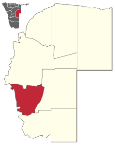
Gobabis is the capital of the Omaheke region in the east of Namibia and a district town and municipality in the constituency of the same name . Gobabis has about 19,000 inhabitants (as of 2011) and is located around 200 kilometers east of the Namibian capital Windhoek .
Gobabis is an important stopover for traffic along the Trans-Kalahari Highway to Botswana and as far as South Africa . The Buitepos border crossing to Botswana is 110 kilometers east of the city.
The Omaheke, also called "Sandveld", is located on the edge of the Kalahari and covers a vast area of more than 80,000 square kilometers. The majority of the land is used by the approximately 800 large farms that mainly raise cattle here. The landscape is characterized by savannah, acacia bushes and camel thorn trees.
geography
climate
|
Average monthly temperatures and rainfall for gobabis
Source:
|
||||||||||||||||||||||||||||||||||||||||||||||||||||||||||||||||||||||||||||||||||||||||||
history
The beginnings of Gobabis date back to 1840 when here with the consent of Kaptein Oasib ( !Na-khomab ) of the red nation in Hoachanas an immigrant from the Cape Province Orlam group which Kai|khauan , led by their Kaptein Amraal Lambert ( ǂGai- ǀnub ). The name of the place comes from him: because of the abundance of elephants, the abundant spring bubbling here was called by the Nama ǂGoabes , which means something like "elephant house". However, like many Orlam, Amraal Lambert no longer spoke a Nama, but the Afrikaans of the Boers and changed the Nama designation to “Gowabes” or “Gobabis”. The big game hunters and ivory traders who appeared here in large numbers called the place "Olifantsfontein", which, however, was not exactly a rare place name in Southwest Africa, so that the name Gobabis later became established.
The new settlers, the Lambert-Orlam , were often called " Amraalsche " after their captain Amraal Lambert .
The missionary Josef Tindall founded the first mission station on August 6, 1845 - but left it shortly afterwards. On August 23, 1856, at the request of the captain , the Rhenish Mission took over the mission station with the missionary Simon Eggert , to which a busy school belonged. Amraal was seen as a wise and understanding leader, so that the new settlement initially developed continuously and peacefully. The new church was consecrated in 1861.
However, this changed permanently with the death of the now 90-year-old Amraal on February 13, 1864: Amraal's son and thus legal successor to the captain Lambert Lambert died of smallpox with his son Willem Lambert a few days after taking office, so that the group was without a leader and it took more than a year to agree - under division - on two new chapters: Andries Lambert ( ǃNanib ) led the more peaceful part of the group and Frederik Vlermuis the so-called "war party". In view of the resulting disagreement, the place sank into chaos, which was further promoted by the fact that Gobabis was on the border between the two competing for supremacy Nama and Herero . Jan Jonker Afrikaner ( ǀHaramumab ), for example, fled Windhoek to Gobabis in order to strengthen himself for an intended campaign against the Herero through an alliance with the war party under Frederik Vlermuis. When this became known to the Herero in Okahandja , they allied themselves with the Mbanderu (Ostherero) - who lived as slaves among the Khauas - which led to the Herero uprising of Gobabis on April 11, 1865 and the expulsion of the missionaries. Gobabis fell under the rule of the Orlam Africans and the rebellious part of the Khauas allied with them; From here Jan Jonker Afrikaner forged a new alliance of Orlam Africans, Khauas, Red Nation ( Kaiǁkhaun ), Witbooi ( ǀKhowesin ) and Veldschoendrager ( ǁHawoben ) against the Herero and in September 1865 launched a failed attack on the Herero in Otjimbingwe . Samuel Maharero responded in 1867 with a counterattack on Gobabis, in the course of which a large part of the Mbanderu (Eastern Herero) who were still held here in bondage escaped to Barmen and founded a new society under Aponda. After this attack, Gobabis fell into abject poverty and its residents could only survive by robbery and highway robbery.
Maharero on the other hand strengthened his power in Okahandja and appointed the Mbanderu chief Kahimemua as governor in Gobabis. Now it was the Orlam and Nama who felt the power of the allied Herero groups so that they tried to shake off this yoke by a united attack by all Nama and Orlam groups on the Herero in Okahandja at the end of 1880. But this attack was also repulsed bloody and so Gobabis came back under the control of the Mbanderu. The Witbooi field captain Paul Visser undertook at the end of 1884, in order to emphasize his ambitions to become a captain, a successful attack on the sparsely occupied place, which was plundered and largely destroyed. After that, interest in Gobabis died out (although it continued to be a "troubled place"), as a new enemy had appeared - the German colonial power .
Colonial times
On May 28, 1895, Gobabis was also officially placed under German "protection" by stationing a district chief , but this could not prevent the place from again being the target of an attack by the Veldschoendrager and the Mbanderu allies in March 1896. The uprising was put down with the support of Samuel Maharero . The leaders of the uprising, Mbanderu chiefs Kahimemua Nguvauva and Nicodemus Kavikunua , were captured and executed after a court martial in Okahandja. At the beginning of 1897 the rinderpest spread to Gobabis, which resulted in the decline of the place and a lasting impoverishment of its residents.
apartheid
The establishment of a mission province in Namibia in 1962 by the Missionary Sisters of the Immaculate Conception of the Mother of God with a provincial office in Gobabis has strengthened social care and educational institutions through work in kindergartens, schools and adult education.
During apartheid, the white administration of Gobabis created the Epako district for the black working population. Here people according to their ethnic origin in z. B. Damara block and Herero block settled separately. Epako received only a rudimentary infrastructure and is still the socio-economically weakest district of Gobabis. In many areas of Epako, the city administration still has the right to relocate any resident within 24 hours.
Local politics
Local government
The following official final result was determined in the 2015 local elections .
| Political party | be right | Share of votes | Seats |
|---|---|---|---|
| SWAPO | 3077 | 71.1% | 5 |
| DTA | 682 | 8.8% | 1 |
| NUDO | 153 | 3.5% | 1 |
| APP | 143 | 3.3% | 0 |
| SWANU | 136 | 3.1% | 0 |
| RDP | 99 | 2.3% | 0 |
| WRP | 36 | 0.8% | 0 |
| total | 4326 | 100% | 7th |
Mayor since 1944
- AP Olivier, 1944-1945
- JO van Helsdingen, 1945-1947
- JL von Wielligh, 1947-1949
- JA van der Merwe, 1949–1951
- NJ Smit, 1951-1953
- HTA Enslin, 1953-1954
- FJ Martins, 1954-1957
- JGN Lombard, 1957-1965
- HJJL van Dyk, 1965-1967
- CRB Liebenberg, 1967-1968
- EP Kilian, 1968-1969
- PH Oosthuizen, 1969-1981
- PJ Kotze, 1981-1987
- SWP Labuschagne, 1987-1992
- IPM Nganate, 1992-1994
- AM Phemelo, 1994-1995
- IPM Nganate, 1995–?
- PM Katjaoha, since?
City structure
Gobabis is divided into the districts of Gobabis City Center, Gobabis Industrial Center, Nossobville and Epako. Nossobville is a newer part of the city that emerged after Namibia's independence and is located south of the Trans-Kalahari Corridor .
Epako
Epako is located about two kilometers east of the city center on the Trans-Kalahari Corridor and is separated from it by an unpopulated area of bush. Originally, Epako was created by the city administration before Namibia's independence as a home for black workers. About half of the residents of Gobabis live in Epako. The settlement of Epakos ranges from single-story stone houses with a front garden and fence to corrugated iron houses - the so-called shacks - to the smallest temporary accommodation made of plastic and natural materials. The informal settlement area in the north of Epakos makes up a third of Epako (as of 2013).
Public facilities and infrastructure
Educational institutions
Gobabis has primary and secondary state schools and a private educational institution. The main library of the Omaheke region is located in Epako . There are also over 10 childcare facilities in Gobabis, the largest in the entire Omaheke region is the Light for the Children Center.
The schools include:
- Ben van der Walt Primary School
- Gobabis High School
- Wennie you Plessis High School
- Gobabis Combined Project School
- Gobabis Secondary School
- Gobabis Primary School
- Rakutuka Primary School
- Khoandawas Primary School
health
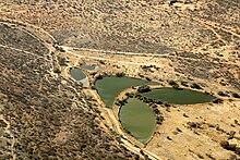
Gobabis has two pharmacies , a state clinic, a state hospital and a private health center with a total of 11 doctors. Gobabis has its own sewage treatment plant three kilometers southwest of the city.
traffic
Gobabis has a train station and an airfield that can also be approached from abroad.
Daughters and sons of the city
- Joris Harteveld (* 1968), Namibian racing cyclist
- Ottmar von Holtz (* 1961), German member of the Bundestag
annotation
- ↑ Note: This article contains characters from the alphabet of the Khoisan languages spoken in southern Africa . The display contains characters of the click letters ǀ , ǁ , ǂ and ǃ . For more information on the pronunciation of long or nasal vowels or certain clicks , see e.g. B. under Khoekhoegowab .
Web links
- Tourism website for Gobabis (English)
Individual evidence
- ↑ a b c d Namibia 2011 Population and Housing Census Preliminary Results. Namibia Statistics Agency, April 2012, accessed May 9, 2012
- ↑ Gobabis on a map from the time of German South West Africa
- ^ History Weather Underground, Gobabis, Namibia. MSN Weather, accessed September 1, 2010 .
- ^ Climate Gobabis - Namibia. Climatedata.eu, accessed September 1, 2010 .
- ^ Official website of the Mission Sisters Münster
- ↑ Barbara Scharfbillig: Homes of Hope 2012 . Ed .: Go Ahead! 2012, p. 2 .
- ↑ Official election results of the regional and local elections 2015, ECN, December 4, 2015 ( Memento of December 10, 2015 in the Internet Archive ) (PDF; 150 kB)
- ↑ Barbara Scharfbillig: Language diversity of Pre-Primary learners in Epako, Namibia . Ed .: Suni eV 2013, p. 2 .
- ↑ Home. In: Light for the Children. Retrieved March 26, 2016 .
- ↑ gobabisgymnasium.edu.na ( Memento from October 15, 2010 in the Internet Archive )
Coordinates: 22 ° 27 ′ S , 18 ° 58 ′ E


