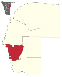
Gobabis (constituency)
 Details |
Gobabis constituency |
| Basic data | |
|---|---|
|
State region |
Namibia Omaheke |
|
Population area District administrative seat |
27,844 (2011) 41,447 km² Gobabis |
| Election information | |
|
Registered voters |
|
Gobabis is a constituency in the Omaheke region in eastern Namibia .
The district of Gobabis has 27,844 inhabitants and is located around 200 kilometers east of the capital Windhoek . The capital is the city of the same name .
The traffic with Botswana runs through Gobabis : The border post Buitepos is 110 kilometers east of Gobabis. The journey from Walvis Bay (via Swakopmund and Windhoek ) to Johannesburg (and from there on to Mozambique to the Indian Ocean) across Botswana was an adventure just a few years ago. Thanks to the asphalted Trans-Kalahari-Highway ( national road B6 ), which was completed in 1998, the almost 1300 kilometers between Windhoek and Johannesburg can now be covered in two days without any problems.
The Windhoek – Gobabis railway was built between 1921 and 1929 and is still operated by TransNamib today for freight and passenger traffic.
Coordinates: 22 ° 27 ′ S , 18 ° 58 ′ E

