Kongola
| Village Kongola
|
|||
|---|---|---|---|
|
|||
| motto | |||
| Basic data | |||
|
Population Area Population Density |
<4134 |
||
|
State Region Constituency |
Namibia Zambezi Kongola |
||
| Establishment date | |||
|
License plate phone code |
|
||
| Website | |||
|
Geographical data
|
|||
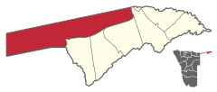
Kongola is a village and the administrative seat of the constituency of the same name in the Caprivi region in the northeast of Namibia , not far from Angola and Zambia in the north and Botswana in the south.
Geographical location
Kongola lies on a flood-proof bank terrace east of the Cuando River (also Kwando), which crosses the Caprivi Strip from north to south. To the west of the river Kongola borders the Caprivi National Park , the Mudumu National Park is around 40 km south and the regional capital Katima Mulilo is 118 km to the east.
Transport and infrastructure
Kongola is an important stop on the B8 national road , the Trans-Caprivi Highway , which crosses the Cuando with the Congolabrücke , the only bridge over hundreds of kilometers over the river. There is a gas station and a range of accommodation options. Via the M125, which branches off to the south from the B8, the place is the starting point for trips to the Mudumu National Park. To the west of the Cuando, Kongola has an airfield .
Coordinates: 17 ° 49 ′ S , 23 ° 24 ′ E


