
National road B3
| National road B3 in Namibia | ||||||||||||||||||||||||||||||||||

|
||||||||||||||||||||||||||||||||||
| map | ||||||||||||||||||||||||||||||||||
 |
||||||||||||||||||||||||||||||||||
| Basic data | ||||||||||||||||||||||||||||||||||
| Operator: | Roads Authority | |||||||||||||||||||||||||||||||||
| Overall length: | 179 km | |||||||||||||||||||||||||||||||||
| of which in operation: | 179 km | |||||||||||||||||||||||||||||||||
|
Regions : |
||||||||||||||||||||||||||||||||||
| Development condition: | Asphalt - two lanes | |||||||||||||||||||||||||||||||||
 |
||||||||||||||||||||||||||||||||||
| National road B6 on the border with South Africa at Ariamsvlei. |
||||||||||||||||||||||||||||||||||
|
Course of the road
|
||||||||||||||||||||||||||||||||||
The national road B3 is a national road in Namibia .
It begins in Grünau , departing from the B1 national road , and continues east to Karasburg, 50 km away, and from there another 130 km to the settlement of Ariamsvlei , which also marks the Namibian border crossing to South Africa . Here the B3 merges into National Route 10 .
The entire length of the B3 national road has been developed as a two-lane asphalt trunk road.
Special occurrences
On an approximately 12.8 km long section between Karasburg and Ariamsvlei, on the night of February 4, 2011, as a result of a storm with heavy rain , the carriageway was undermined and completely destroyed. On this section of the route, the B3 national road had to be completely renewed. The construction work to restore the carriageway lasted over four months. The reopening of the B3 on the affected section took place on July 10, 2011.
gallery

Course of the road near Ariamsvlei
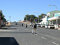
Passage through Karasburg


Web links
- Namibian Road Authority (English)
- Detailed street map Namibia (English)