National road B10
| National road B10 in Namibia | |

|
|
| map | |
| Basic data | |
| Operator: | Roads Authority |
| Overall length: | 412 km |
|
Regions : |
|
| Development condition: |
Asphalt - two lanes partially gravel |
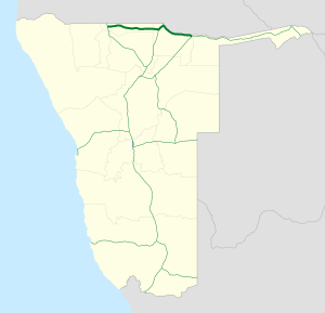
The national road B10 ( English National Road B10 ) is a national road in Namibia and connects the Ohangwena region with Rundu in the Kavango-East region in northern Namibia . Until July 2010 it had the status of a C-street with the street number C45.
The road is around 412 kilometers long and runs parallel to the border between Namibia and Angola at an average distance of 50 km , in its eastern section directly along the south bank of the Okavango .
The B10 forms the backbone of road traffic for the entire Ohangwena region and the Kavango-West region . It has been completely asphalted since the end of 2011.
