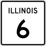
Illinois State Route 6

|
|
|---|---|
| Basic data | |
| Overall length: | 10.11 mi / 16.27 km |
| Starting point: |
|
| End point: |
|
| County: | Peoria County |
The Illinois State Route 6 (short- IL 6 is) a State Route in the State of Illinois , the north-south direction is in.
The State Route begins on Interstates 74 and 474 in Peoria and ends 10 miles in Mossville on Illinois State Route 29 .
course
Illinois State Route 6 continues the route of Interstate 474, which ended west of Peoria. At War Memorial Drive she meets US Highway 150 , which runs parallel to I-74. The IL 6 begins to run east before Allen Road and meets Illinois State Route 40 north of Mount Hawley Auxiliary Airport at Exit 6 . After ten miles ends at State Route 29 in Mossville.
See also
Web links
- Illinois Highway Ends (English)
- Illinois Highways (English)