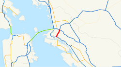
Interstate 980
| Basic data | |
|---|---|
| Length: | 2.02 mi / 3.25 km |
| State: |
California |
| map | |

|
|
The Interstate 980 (abbreviated I-980 ) is an interstate highway in the US state of California . It connects Interstate 580 and Interstate 880 and runs the full length in the city of Oakland in Alameda County . At the intersection with Interstate 580, there is also a transition to California State Route 24 . I-980 is nicknamed the Grove Shafter Freeway .
history
The route of today's Interstate 980 was added in 1947 under the designation Legislative Route 226 in the State Highway System of California. When the numbers were reassigned in 1964, the road became part of California State Route 24. In 1976, a 0.8 mile section west of San Pablo Avenue was upgraded by the Federal Highway Administration to the Interstate. The remaining 1.1 miles to I-580 followed by 1985.
Web links
- Interstate Guide (English)
