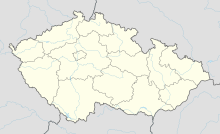
Jewish cemetery (Dlouhý Újezd)
Coordinates: 49 ° 45 ′ 51.3 " N , 12 ° 36 ′ 49.3" E
The Jewish cemetery in Dlouhý Újezd (German Langendörflas ), a municipality in Okres Tachov in the Czech Republic , was established in the 18th century. There are still around 250 gravestones ( Mazevot ) on the 1623 m² Jewish cemetery .
literature
- Klaus-Dieter Alicke: Lexicon of the Jewish communities in the German-speaking area. Volume 3: Ochtrup - Zwittau. Gütersloher Verlagshaus, Gütersloh 2008, ISBN 978-3-579-08079-6 ( online edition ).
Web links
Commons : Jewish Cemetery (Dlouhý Újezd) - collection of pictures, videos and audio files
- Description (accessed January 24, 2015, in Czech)


