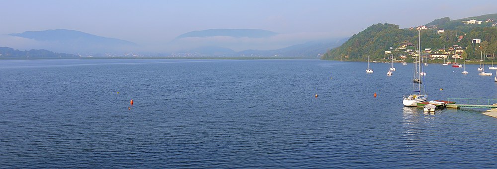
Jezioro Rożnowskie
| Jezioro Rożnowskie | |||||||||||
|---|---|---|---|---|---|---|---|---|---|---|---|
| View from Tabaszowa | |||||||||||
|
|||||||||||
|
|
|||||||||||
| Coordinates | 49 ° 43 '56 " N , 20 ° 42' 52" E | ||||||||||
| Data on the structure | |||||||||||
| Construction time: | 1935-1941 | ||||||||||
| Height of the barrier structure : | 49 m | ||||||||||
| Data on the reservoir | |||||||||||
| Water surface | 16 km² | ||||||||||
| Reservoir length | 22 km | ||||||||||
| Storage space | 193 million m³ | ||||||||||
| Catchment area | Dunajec | ||||||||||
The Jezioro Rożnowskie is a reservoir on the Dunajec in the Polish Malopolska province . Downstream is the Jezioro Czchowskie reservoir . It is located in the Sandets Beskids .
description
Behind the 49 meter high dam the water of is Dunajec and smaller tributaries dammed. With full back which includes reservoir 193 million cubic meters of water. The water area is then 1600 hectares.
history
The decision to build the dam in Niedzica was taken in 1935 and construction began in 1938. The reservoir was finally flooded in 1941. It is used both as a bathing lake and as a protective storage against flooding and a hydropower plant.
tourism
On the banks of the lake are the places Tęgoborze , Znamirowice , Zbyszyce , Bartkowa , Gródek nad Dunajcem , Tabaszowa and Rożnów and the ruins of the castle Gródek nad Dunajcem on the "Monkey Island" and several beaches and marinas where sailing boats, pedal boats and kayaks available become.
Web links
bibliography
- Chełmicki Wojciech, Blaski i cienie zapór wodnych | czasopismo = Poznaj Świat, R. XXXIV, no 2 (397), 1986-02, s = 21-22
- Kruczek Zygmunt, Jeziora Rożnowskie i Czchowskie - Przewodnik turystyczny, Warszawa - Kraków, 1986 ISBN 83-7005-059-X
panorama


