Karimata Islands
| Karimata Islands | ||
|---|---|---|
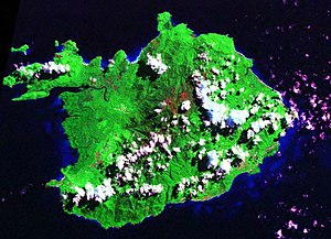
| Satellite image of Karimata | ||
| Waters | Karimata Street | |
| Geographical location | 1 ° 37 ′ S , 108 ° 53 ′ E | |
|
|
||
| Main island | Karimata | |
| Total land area | 222 km² | |
The Karimata Islands ( Indonesian Kepulauean Karimata ) are a group of islands not far from the west coast of the Indonesian part of Borneo and from Billiton separated by the Karimata Strait . Administratively, they belong to the Bangka-Belitung Province .
The group consists of a larger ( Karimata , 179 km²) and many smaller islands with a total area of 222 km².
On the island of Karimata, there are two mountain peaks, the so-called blunt and the sharp peak, 1022 and 1034 m high.

