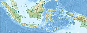
Karimata Street
| Karimata Street | ||
|---|---|---|
| Connects waters | Java lake | |
| with water | South China Sea | |
| Separates land mass | Sumatra | |
| of land mass | Borneo | |
| Data | ||
| Geographical location | 2 ° 19 ′ S , 108 ° 52 ′ E | |
|
|
||
| Smallest width | 150 km | |
| Islands | Bangka , Belitung , Karimata Islands | |
The Karimata Strait is a strait between the islands of Sumatra and Borneo that connects the Java Sea with the South China Sea . In it are the islands of Bangka , Belitung and the Karimata Islands . The equator runs along the 150 km wide sea road . Gaspar Street runs as a side path between Bangka and Belitung .
