Kasserine Dam
| Kasserine Dam | |||||
|---|---|---|---|---|---|
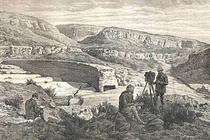
| Dam near Kasserine (1886) | |||||
|
|||||
|
|
|||||
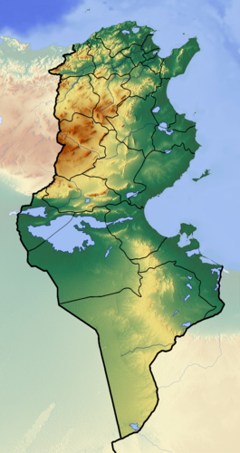
| Coordinates | 35 ° 9 '57 " N , 8 ° 48' 2" E | ||||
| Data on the structure | |||||
| Lock type: | Arch weight wall | ||||
| Construction time: | 2nd century AD | ||||
| Height of the barrier structure : | 10 m | ||||
| Crown length: | 150 m | ||||
| Base width: | 7.3 m | ||||
The Kasserine dam was a Roman dam on the edge of the Roman city of Cillium, west of today's city of Kasserine in Tunisia, designed to store drinking water and irrigate fields .
construction
The arched dam from the 2nd century AD is variously classified as an arched weight dam or weight dam . It was placed in such a way that the water flowing from the wadis to the south could be collected in a reservoir framed by rocks immediately in front of the city; when the water level was high enough, water could be drained onto the fields by means of irrigation ditches.
Today's dam
The ancient complex was probably only destroyed in the Middle Ages; just above it, a modern, but modest-looking concrete dam was built for the site as an irrigation project.
See also
literature
- Patrick James, Hubert Chanson: Historical Development of Arch Dams. From Roman Arch Dams to Modern Concrete Designs . In: Australian Civil Engineering Transactions , Vol. CE43 (2002), pp. 39-56.
- Niklaus Schnitter: Roman dams . In: Antike Welt , Vol. 8, No. 2 (1978), pp. 25-32.
- Norman Smith: A History of Dams . Peter Davies Verlag, London 1971, ISBN 0-432-15090-0 .

