Kaya (South Sudan)
Coordinates: 3 ° 33 ' N , 30 ° 53' E
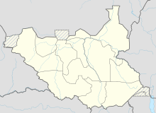
Kaya is a small town in the state of Yei River (in Central Equatoria until 2015 ) in South Sudan .
location
The city is on the border with Uganda . Oraba is on the other side of the border .
population
There are no exact figures about the current population of Kaya, as due to the unrest in the region a large number of displaced persons remain in Kaya or displaced persons from Kaya are still missing.
history
Kaya was in the contested area of the Civil War in South Sudan and was captured on March 10, 1997 by the SPLA rebel army .
economy
Due to the war of secession, infrastructure, trade and commerce are only very poorly developed. Since the peace agreement between the government in Khartoum and the SPLA in January 2005, there have been the first signs of a small economic upturn.
In 2003 the road between Kaya and Yei , financed by HABITAT and the World Food Program WFP, was improved. A large part of the goods from Uganda destined for Juba and the western part of South Sudan cross the border at Kaya.
There are several small, local style hotels and inns in Kaya.
religion
In Kaya there is a church building of the Presbyterian Church , which was built in 2003.
