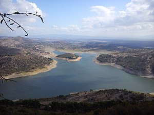
Kestel dam
| Kestel dam | |||||||||
|---|---|---|---|---|---|---|---|---|---|
| View from Pergamon Castle Hill to the reservoir | |||||||||
|
|||||||||
|
|
|||||||||
| Coordinates | 39 ° 7 '54 " N , 27 ° 11' 28" E | ||||||||
| Data on the structure | |||||||||
| Lock type: | Earthfill dam | ||||||||
| Construction time: | 1976-1990 | ||||||||
| Height above valley floor: | 65 m | ||||||||
| Building volume: | 1 040 000 m³ | ||||||||
| Data on the reservoir | |||||||||
| Water surface | 50 ha | ||||||||
| Storage space | 37.4 million m³ | ||||||||
The Kestel Dam ( Turkish Kestel Barajı ) is located on the northeastern outskirts of Bergama , which was built on the site of ancient Pergamon , in the Turkish province of İzmir on the course of the Kestel Çayı.
The Kestel Dam was built in 1976–1990 as an earth embankment dam . It is used to irrigate an area of 3716 ha as well as flood protection . The dam is 65 m high and has a volume of 1.04 million m³. The associated reservoir covers an area of 50 ha and has a storage volume of 37.4 million m³. The city of Bergama begins below the dam. To the west of the dam and reservoir is the castle hill ( acropolis ) of old Pergamon.
Web links
Commons : Kestel Dam - collection of images, videos and audio files

