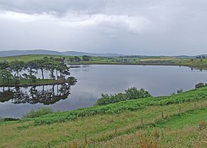
Killington Reservoir
| Killington Reservoir | |||||||
|---|---|---|---|---|---|---|---|
| The Killington Reservoir | |||||||
|
|||||||
|
|
|||||||
| Coordinates | 54 ° 18 '41 " N , 2 ° 38' 6" W | ||||||
| Data on the structure | |||||||
| Construction time: | 1818-1819 | ||||||
| Height above the river bed : | 200.55 m | ||||||
The Killington Reservoir is a reservoir in Cumbria , England . The reservoir was built between 1818 and 1819 under the direction of William Crosley . The lake was used to supply water to the Lancaster Canal . The reservoir is located west of the M6 motorway south of junction 37 and can be overlooked from the rest area on the south side of the motorway. The lake has several unnamed tributaries from the north and is also connected to the Lily Mere . The lake has two dams. A three meter high and 110 m long dam is located in the west of the lake near the motorway and the main dam with a length of 253 m and a height of 15.8 m to the east of it.
In 1822 and 1825, leaks were found in the dam walls. In 1830 the western dam broke in a storm. In 1853 an overflow was built on the eastern dam wall. Further modifications were made in 1930 and 1975.
Web links
swell
Killington Reservoir on Engineering Timelines, accessed July 27, 2016

