Kiyu-Ordeig
| Kiyu-Ordeig | ||
|---|---|---|
|
Coordinates: 34 ° 42 ′ S , 56 ° 45 ′ W Kiyu-Ordeig on the map of Uruguay
|
||
| Basic data | ||
| Country | Uruguay | |
| Department | San Jose | |
| Residents | 423 (2011) | |
| Detailed data | ||
| Post Code | 80102 | |
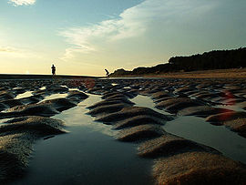
| Beach at Kiyú | ||
| Forest near Kiyú | ||
Kiyú-Ordeig is a town in Uruguay .
Geography and location
Kiyú-Ordeig is located in the territory of the Department of San José in its sector 6 on the coast of the Río de la Plata . The closest settlement is Libertad in the northeast. At the eastern edge of the village is the mouth of the Arroyo Mauricio , while a few kilometers west of the de los Ceibos and the Arroyo San Gregorio end their course in the Río de la Plata. The cliffs, which are up to 50 meters high and form a steep coast, shape the area around the town, which is around 70 kilometers from the capital, Montevideo. The on-site soil erosion , partly caused by human hands, represents a problem in the landscape , which is criss-crossed by erosion channels and has a fragile geological composition.
history
The name Kiyú comes from the Guaraní and translated means cricket . The indigenous people of Uruguay settled here. Kiyú is also located in one of the most archaeologically important regions in the country. In October 2002, during excavations started the previous month under the direction of archaeologist Laura Beovide , a pottery and wood workshop of indigenous origin was uncovered, the age of which is dated around 2,500 years and is assigned to previously unknown indigenous tribes. Various finds such as arrowheads, mortar and ceramic remains were found at a depth of between 25 cm and one meter. In the more recent history of the place, the area belonged to an estancia dedicated to cattle breeding , which was first owned by Juan María Pérez and then passed on by way of inheritance to the Ordeig family , whose name now forms the second part of the name of the place. In 1955 the land was bought by the Banco Industrial y Comercial of San José. Subsequently, Julio César Moreno , Julio Altieri and Mario Urdagaría were commissioned to undertake a first parceling out here. Two years later, the building lots began to be sold, one of which was given to the Colombian Miss Universum Luz Marina Zuluaga , who took over the inauguration of the seaside resort in 1959.
Infrastructure
economy
Kiyú, whose center extends around seven kilometers, is located in the middle of an agricultural zone in which lemon and potato cultivation dominates. Tourism also plays a not insignificant role for the seaside resort, which has recently seen increased new building activity. The tourist infrastructure awaits with the campsites Las Acasias , El Grillo and the municipal campground , and there are also various dining options.
traffic
The place can be reached via a connection to the now two-lane Ruta 1 , which runs around 15 kilometers away, at kilometer points 52 and 61. The main street Kiyús, which has not yet been completely asphalted and provided with street lighting, is currently being expanded in this regard.
Residents
The population of Kiyú-Ordeig is 423 (as of 2011), of which 223 are male and 200 are female.
| year | Residents |
|---|---|
| 1963 | - |
| 1975 | 357 |
| 1985 | 312 |
| 1996 | 414 |
| 2004 | 332 |
| 2011 | 423 |
Source: Instituto Nacional de Estadística de Uruguay
Web links
- City map of Kiyú-Ordeig (PDF; 116 kB)
Individual evidence
- ↑ Uruguayan postal code directory , accessed on March 23, 2012
- ↑ Hallan taller indígena en barrancas de Kiyú (Spanish) in El País of October 22, 2002, accessed on December 9, 2012
- ↑ Kiyú, la perla del Oeste (Spanish) at www.lr21.com.uy of February 8, 2011, accessed on December 8, 2012
- ↑ Statistical data from the Instituto Nacional de Estadística de Uruguay , accessed on September 28, 2012
- ↑ Statistical data of the Instituto Nacional de Estadística de Uruguay 1963–1996 (DOC; 25 kB)
- ↑ Statistical data from the Instituto Nacional de Estadística de Uruguay 2004 as XLS file


