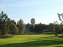
Kleppischberg

The Kleppischberg or Kleppschberg is an elevation of the Lusatian two- mica granodiorite massif in the West Lusatian Loesshügelland sloping down on three sides . The basement consists of the West Lusatian granodiorite and the Lusatian two-mica granite and is covered by young deck sediments ( loess loam layers from the Vistula glaciation ).
The 344 meter high mountain is located about four hundred meters south of Oberrammenau and, like the neighboring 343 meter high Hubertsberg or Hubrichtberg, offers a comprehensive view to the southeast and south. On the top of the hill there are five linden trees arranged in a circle six meters in diameter. They were planted in 1817 by order of the wife of the then Rammenau castle owner, the Rittmeister von Kleist, and a family crypt was laid out underneath. This illustrates how mysticism and a feeling for nature mixed in romanticism . The crypt was only used temporarily and is now in ruins. The Linden are like the parishioners Linde on the adjacent Pfarrberg (335 m) as a natural monument under special protection.
In the valley between the Kleppischberg, the Hubrichtberg and the Tanneberg (370 m) lies the upper village of Rammenaus with the castle . This baroque complex is located on a dam overgrown with pedunculate oaks , which stretches across a valley at the eastern foot of the mountain, on the immediate outskirts of Rammenau. Until 1721 the water of the Kleppsch or Tiefen Teich was dammed here. Ever since Ernst Ferdinand von Knoch had the palace completely rebuilt on its edge by Johann Christoph Knöffel and a baroque garden laid out behind it, meadows have spread behind it.
Kleppischberg and Kleppischteich probably got their name from a former hammer mill settlement, which is said to have been near Kleppischberg before the medieval colonization of the east. Alfred Meiche derived the name from the Sorbian klepač (hammer).
In 1783 an initially wooden water pipe was completed from a spring on the slope of the Kleppischberg to the Rammenau district of Schaudorf , a pipe foreman monitored the condition of the pipes.
literature
- Kleppischberg. In: Lausitzer Bergland around Pulsnitz and Bischofswerda (= values of our homeland . Volume 40). 1st edition. Akademie Verlag, Berlin 1983, p. 102.
Individual evidence
- ↑ a b Helmut Petzold: Memories of my green village , 1988, Museum Barockschloss Rammenau in cooperation with the Fichte-Freundeskreis
- ↑ Land use plan with integrated landscape plan: explanatory report. (PDF: 1.26 MB) In: www.bischofswerda.de. Large district town of Bischofswerda, municipality of Rammenau, June 8, 2006, p. 102 , accessed on June 23, 2010 : "3.13.11.1 Registered natural monuments: No. 235 / type of object: Linden group on the Kleppischberg / district: Rammenau"
- ^ Kleppisch in the Digital Historical Directory of Saxony
- ^ Alfred Meiche : The Upper Lusatian border document from 1241 and the Burgwarde Ostrusna, Trebista and Godobi . In: New Lusatian Magazine . Volume 84, 1908, pp. 145-251
Coordinates: 51 ° 9 ′ 20.4 ″ N , 14 ° 7 ′ 0.3 ″ E