Laguna de la Leche
| Laguna de la Leche | ||
|---|---|---|

|
||
| South bank of the Laguna de la Leche | ||
| Geographical location | Cuba | |
| Data | ||
| Coordinates | 22 ° 12 '0 " N , 78 ° 37' 0" W | |
|
|
||
| surface | 67.2 km² | |
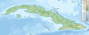
The Laguna de La Leche ( Milk Lake ) is a lake in the north of the central Cuban province of Ciego de Ávila .
There are several lakes between Morón and the north coast of Cuba, of which the Laguna de la Leche is the largest with 67.2 km². It is the largest natural freshwater reservoir in Cuba. The water depth is just over 2 m. The peculiar white color of the water comes from limestone deposits.
The lake is surrounded by inaccessible swamps and can only be reached by a 4 km long road from Morón. The Júcaro Canal runs along this road . A connection from the northwest bank to the Bahía de Buena Vista on the Atlantic coast was closed in 1988.
The south bank is attractive to tourists and locals alike, with restaurants and nightclubs. There are also opportunities for boat trips, fishing, water sports and regattas. Traditionally in September the 'Carnaval acuático' is celebrated with decorated boats.
Web links
- Laguna de la Leche in the Cuban state online encyclopedia EcuRed (Spanish)
