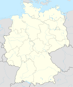
Laierhöhle
| Laierhöhle
|
||
|---|---|---|
| Location: | Geislingen an der Steige | |
| Height : | 685 m | |
|
Geographic location: |
48 ° 36 '54 " N , 9 ° 51' 41" E | |
|
|
||
| Cadastral number: | 7325/75 | |
| Geology: | White Jurassic δ - ζ | |
| Type: | Shaft cave | |
| Discovery: | 1996 | |
| Overall length: | 2618 m | |
| Level difference: | 127 m | |
The Laier cave is one of the deepest shaft caves in the Swabian Alb. It is located near Weiler ob Helfenstein, a district of Geislingen an der Steige . Only a little to the east of the cave is the Battenau , the largest karst depression in the Alb, which lies directly on the main European watershed.
The Laier cave was cut into in 1996 when a garage was being built and has since been explored by members of the Kahlensteiner Höhlenverein Bad Überkingen. The cave is currently explored to a depth of 127 meters. The cave extends over several floors and includes several halls, such as the "Wagrain Hall" or the "Amphitheater", the largest room in the cave at 42 × 20 meters. The Laierhöhle was created in phases. The oldest phase, represented by the top floor, could be 14 million years old. This would make the Laier cave the oldest cave in the Swabian Alb.
literature
- Dieter Domke, Hannes Köble, R. Rösch: The Laierhöhle . In: Weiler ob Helfenstein and Hofstett am Steig. Publications from the Geislingen City Archives 27, Geislingen 2010, pp. 24–45.
- M. Strasser, A. Strasser: Geology around hamlets . In: Weiler ob Helfenstein and Hofstett am Steig. Publications from the Geislingen City Archives 27, Geislingen 2010, pp. 16–23.
- Hans Binder , Herbert Jantschke: Cave guide Swabian Alb. Caves - springs - waterfalls . 7th completely revised edition. DRW-Verlag, Leinfelden-Echterdingen 2003, ISBN 3-87181-485-7 , p. 65 .
Web links
- Laierhöhle , Kahlensteiner Höhlenverein Bad Überkingen
